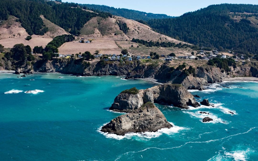
by CoastView | Jul 11, 2026 | 2026, California, Coastal Features, Communities, Developments, Historical, Islands, July 2026, Land Use, Natural History
Listen to the article here https://coastview.org/wp-content/uploads/2026/03/CasketRock.mp3 Casket Rock is the outermost of three large rocks west of Elk, a community about 22 miles (35 km) south-southeast of Fort Bragg and 13 miles (21 km) north of Point Arena,...
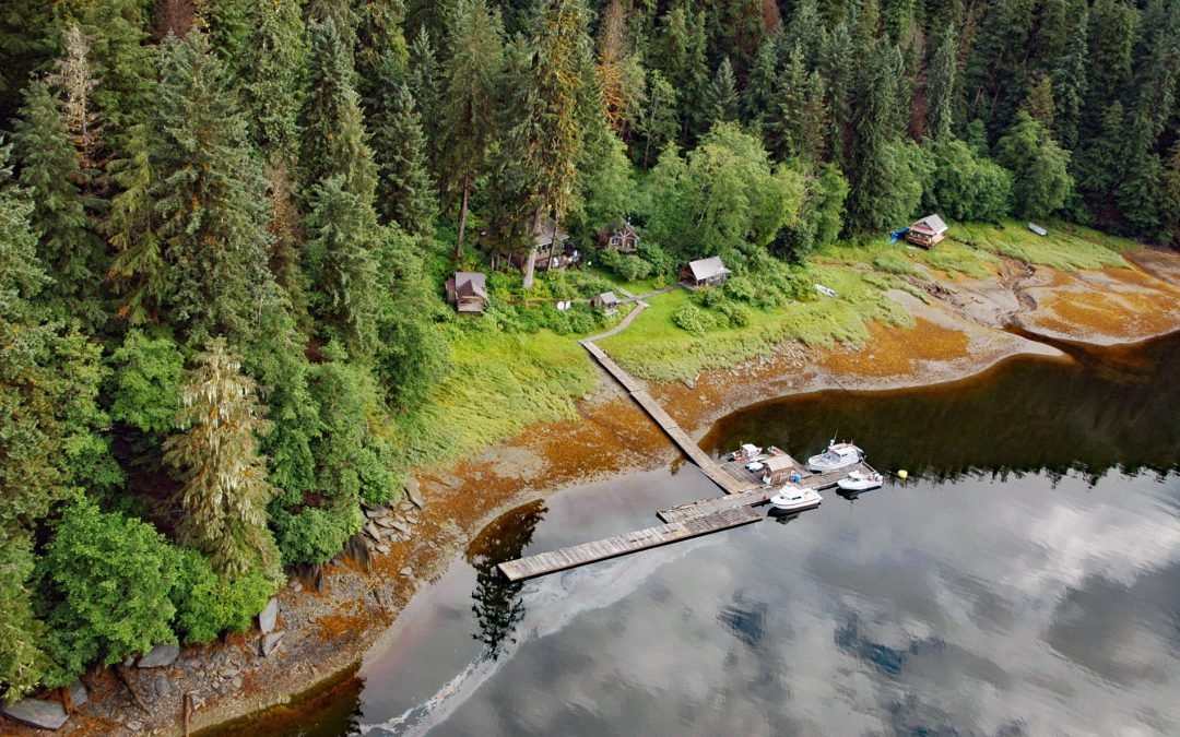
by CoastView | Jun 28, 2026 | 2026, Alaska, Communities, Developments, Embayments, Historical, June 2026, Land Use, Mines, Natural History
Listen to the article here https://coastview.org/wp-content/uploads/2026/03/WindhamBay.mp3 Windham is a settlement that historically supported mining operations along Spruce Creek at the head of Windham Bay, about 63 miles (102 km) southeast of Juneau and 57 miles (92...

by CoastView | Jun 25, 2026 | 2026, Coastal Features, Developments, Embayments, Historical, June 2026, Oregon, Rivers, Shipwrecks
Listen to the article here https://coastview.org/wp-content/uploads/2026/02/MaryDHume.mp3 Mary D. Hume sank on November 13, 1985, on the south bank of the Rogue River during a restoration effort to convert her to a museum ship for the Curry County Historical Society;...
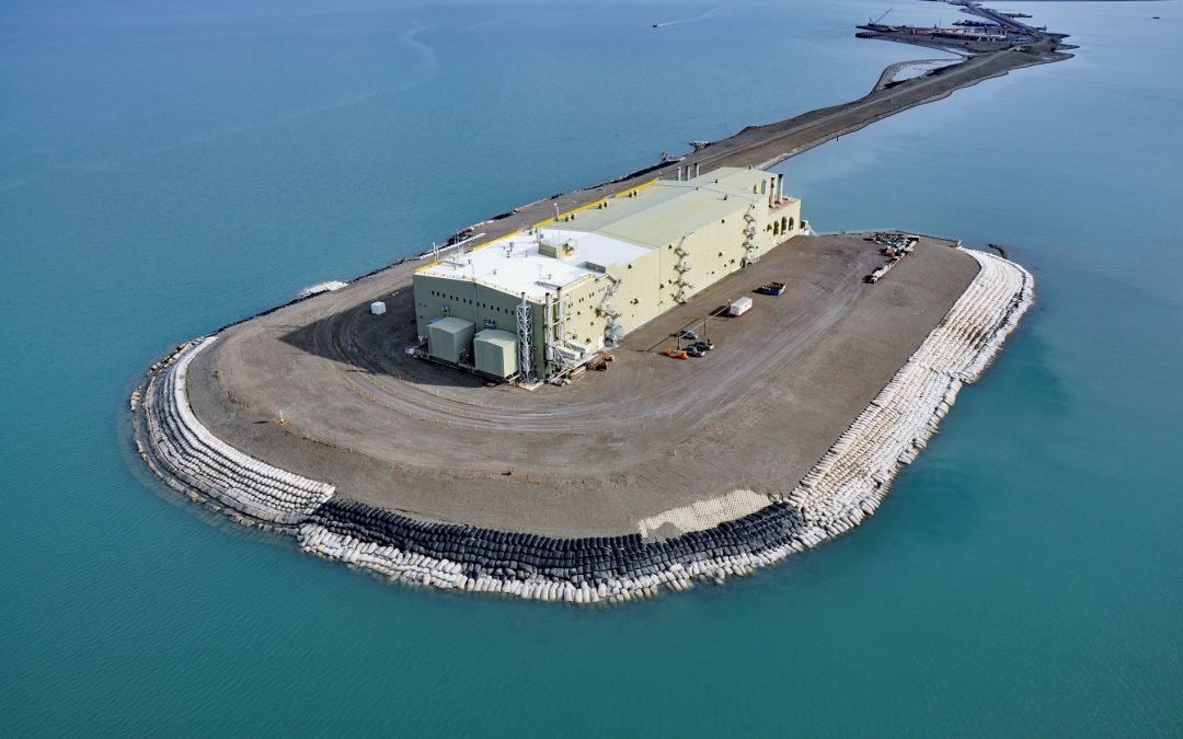
by CoastView | Jun 23, 2026 | 2026, Alaska, Developments, Embayments, June 2026, Land Use, Natural History
Listen to the article here https://coastview.org/wp-content/uploads/2026/02/WestDock.mp3 West Dock Causeway was constructed in the Beaufort Sea, between Gwydyr Bay to the west and Prudhoe Bay to the east, to support oil exploration and to access a seawater treatment...
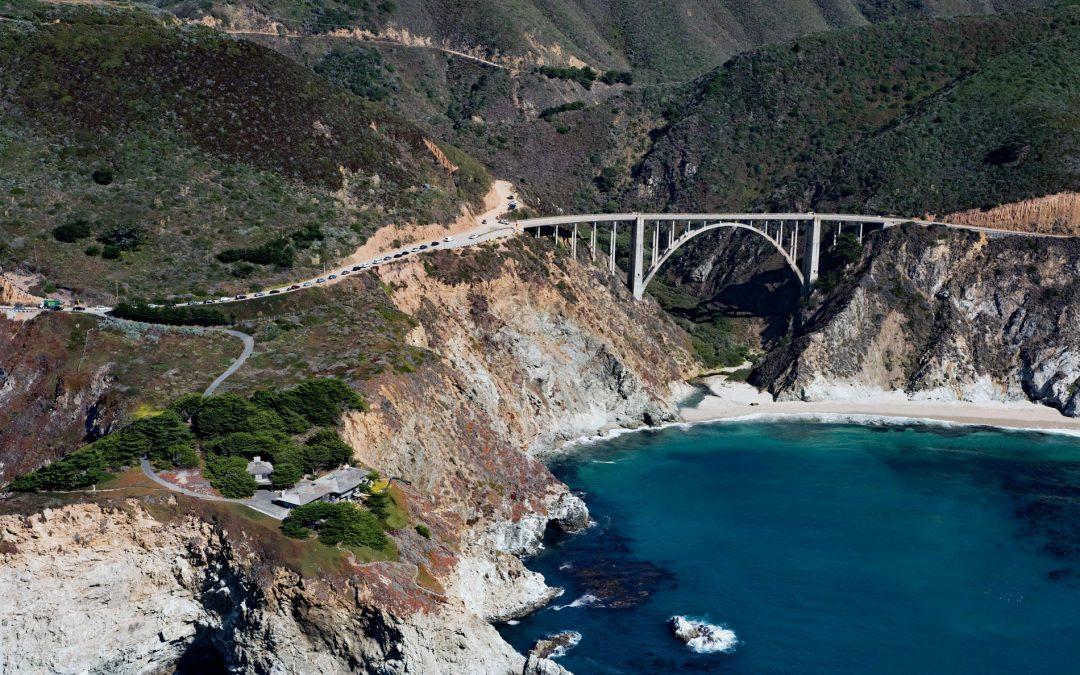
by CoastView | Jun 14, 2026 | 2026, California, Coastal Features, Developments, Historical, June 2026, Land Use, Natural History, Rivers
Listen to the article here https://coastview.org/wp-content/uploads/2026/02/BixbyBridge.mp3 Bixby Creek starts at the confluence of Mill Creek and Turner Creek, which flow from an elevation of 2,500 feet (762 m) on the west flank of Skinner Ridge, for a total run of...
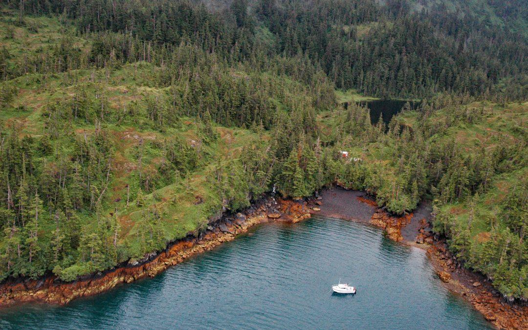
by CoastView | Jun 13, 2026 | 2026, Alaska, Biodiversity, Developments, Embayments, Hatcheries, June 2026, Land Use, Natural History
Listen to the article here https://coastview.org/wp-content/uploads/2026/02/MainBay.mp3 Main Bay is an estuary on the Kenai Peninsula in Prince William Sound, between Port Nellie Juan to the west and Knight Island Passage to the east, about 81 miles (131 km) west of...