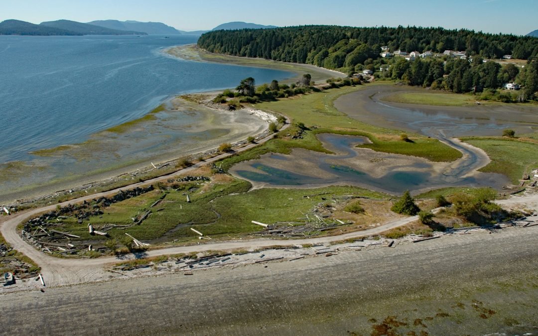
by CoastView | Jul 14, 2026 | 2026, British Columbia, Communities, Embayments, Historical, Islands, July 2026, Land Use, Natural History
Listen to the article here https://coastview.org/wp-content/uploads/2026/03/Penelakut.mp3 Penelakut Island lies between Stuart Channel to the west and Trincomali Channel to the east in the southern Gulf Islands, about 40 miles (65 km) north-northwest of Victoria and...
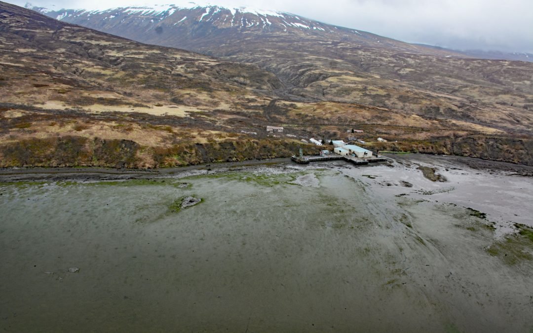
by CoastView | Jul 13, 2026 | 2026, Alaska, Canneries, Communities, Historical, July 2026, Natural History
Listen to the article here https://coastview.org/wp-content/uploads/2026/03/ChignikFisheries.mp3 Chignik Fisheries is a historic salmon canning facility on the northwest shore of Chignik Lagoon, southwest of Dago Point, about 44 miles (71 km) south of Port Heiden and...
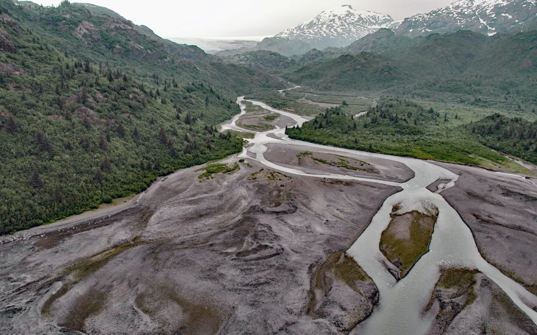
by CoastView | Jul 12, 2026 | 2026, Alaska, Coastal Features, Embayments, Glaciers, July 2026, Natural History, Rivers
Listen to the article here https://coastview.org/wp-content/uploads/2026/03/PrincetonGlacier.mp3 Princeton Glacier drains into Nassau Fjord in Prince William Sound on the east side of the Kenai Peninsula, about 37 miles (60 km) south-southeast of Whittier and 38 miles...
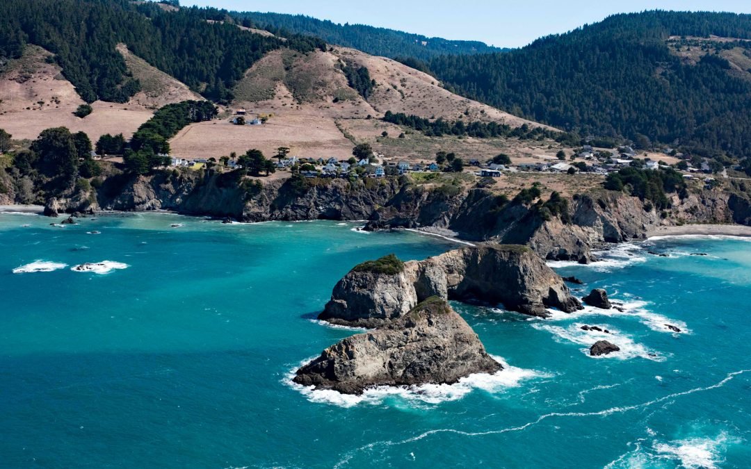
by CoastView | Jul 11, 2026 | 2026, California, Coastal Features, Communities, Developments, Historical, Islands, July 2026, Land Use, Natural History
Listen to the article here https://coastview.org/wp-content/uploads/2026/03/CasketRock.mp3 Casket Rock is the outermost of three large rocks west of Elk, a community about 22 miles (35 km) south-southeast of Fort Bragg and 13 miles (21 km) north of Point Arena,...
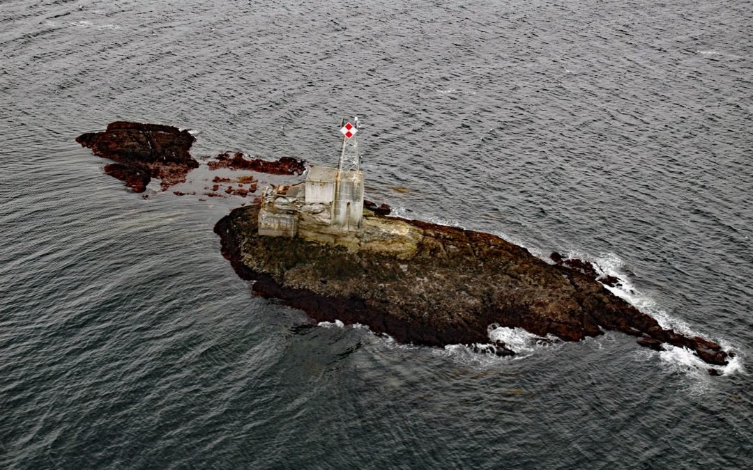
by CoastView | Jul 10, 2026 | 2026, Alaska, Coastal Features, Historical, Islands, July 2026, Lighthouses, Natural History
Listen to the article here https://coastview.org/wp-content/uploads/2026/03/LincolnRockLight.mp3 Lincoln Rock and Lincoln Island are small islets in Clarence Strait, part of the Abraham Islands just off the west coast of Etolin Island, about 63 miles (102 km)...
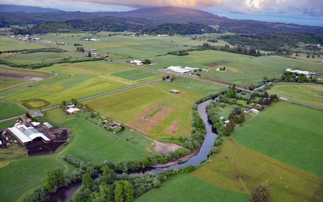
by CoastView | Jul 9, 2026 | 2026, Embayments, July 2026, Land Use, Natural History, Oregon, Rivers
Listen to the article here https://coastview.org/wp-content/uploads/2026/03/TraskRiver.mp3 Trask River drains a mountainous, timber-producing area of the Coast Range into Tillamook Bay, about 57 miles (92 km) west of Portland and 52 miles (84 km) south of Astoria,...