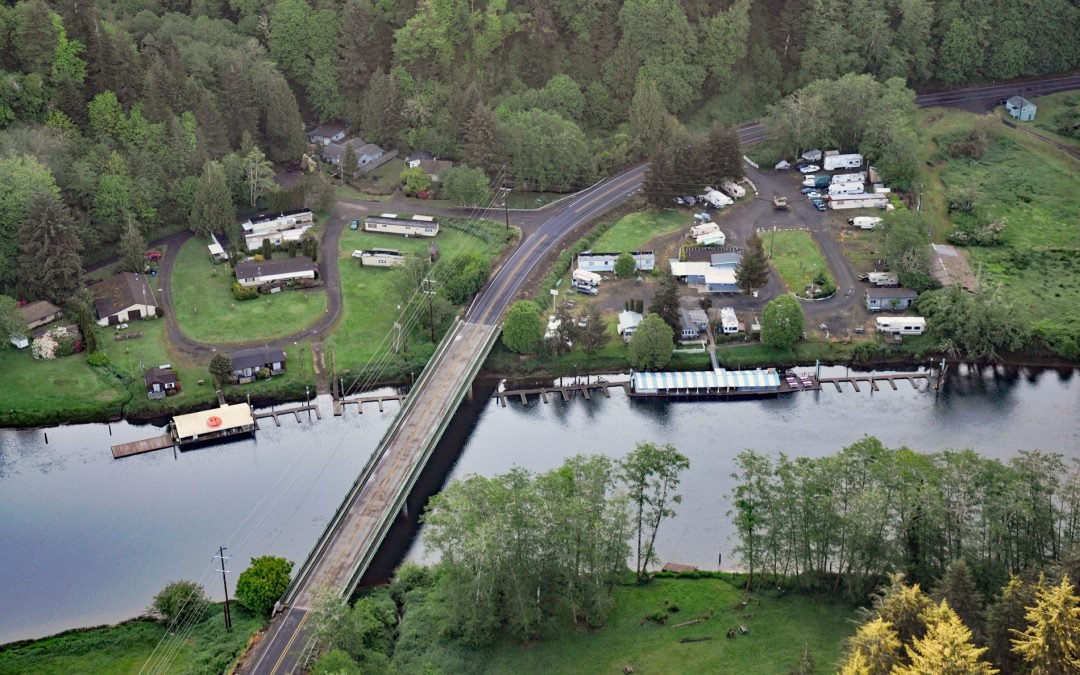
by CoastView | Jul 30, 2026 | 2026, Communities, July 2026, Oregon, Rivers
Listen to the article here https://coastview.org/wp-content/uploads/2026/03/TaylorsLanding.mp3 Taylors Landing is a boat landing and small community near the head of the tide on the Alsea River, in the Coast Range, about 17.4 miles (28 km) west of Alsea and 6.4 miles...
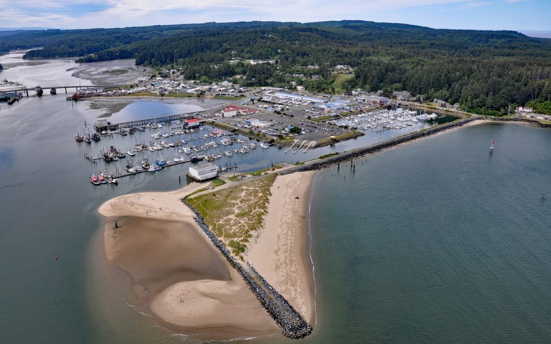
by CoastView | Jul 16, 2026 | 2026, Communities, Embayments, July 2026, Land Use, Natural History, Oregon
Listen to the article here https://coastview.org/wp-content/uploads/2026/03/OregonInstitute-1.mp3 Oregon Institute of Marine Biology is the marine research field station of the University of Oregon, situated on South Slough adjacent to Coos Bay about 7 miles southwest...
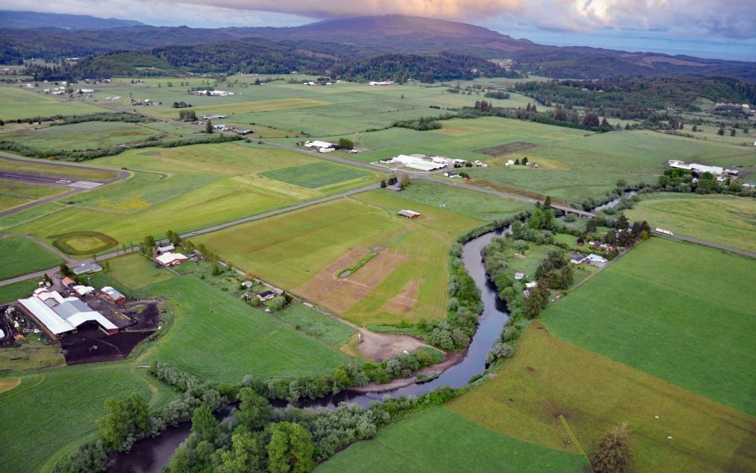
by CoastView | Jul 9, 2026 | 2026, Embayments, July 2026, Land Use, Natural History, Oregon, Rivers
Listen to the article here https://coastview.org/wp-content/uploads/2026/03/TraskRiver.mp3 Trask River drains a mountainous, timber-producing area of the Coast Range into Tillamook Bay, about 57 miles (92 km) west of Portland and 52 miles (84 km) south of Astoria,...
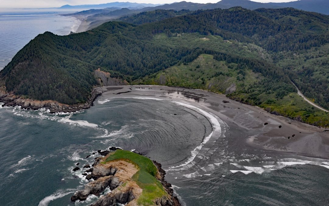
by CoastView | Jul 2, 2026 | 2026, Beaches, Coastal Features, Embayments, Headlands, July 2026, Land Use, Natural History, Oregon
Listen to the article here https://coastview.org/wp-content/uploads/2026/03/HuntersCove.mp3 Hunters Cove lies on the south side of Cape Sebastian, a prominent headland in Cape Sebastian State Scenic Corridor, about 20 miles (32 km) north-northwest of Brookings and 6.3...

by CoastView | Jun 25, 2026 | 2026, Coastal Features, Developments, Embayments, Historical, June 2026, Oregon, Rivers, Shipwrecks
Listen to the article here https://coastview.org/wp-content/uploads/2026/02/MaryDHume.mp3 Mary D. Hume sank on November 13, 1985, on the south bank of the Rogue River during a restoration effort to convert her to a museum ship for the Curry County Historical Society;...
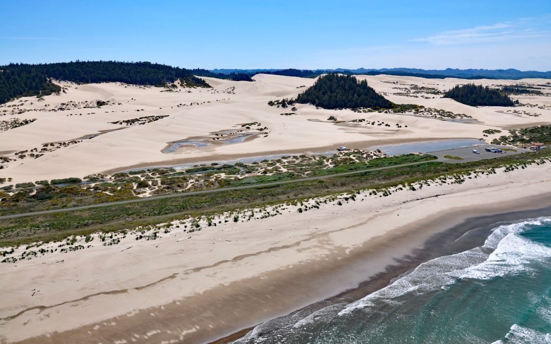
by CoastView | Jun 19, 2026 | 2026, Beaches, Best of 2024, Coastal Features, June 2026, Land Use, Natural History, Oregon, Parks
Listen to the article here https://coastview.org/wp-content/uploads/2026/02/OregonDunes.mp3 Umpqua Beach is in the Oregon Dunes National Recreation Area that extends for about 35 miles (56 km) along the coast from the Siuslaw River at Florence in the north to the Coos...