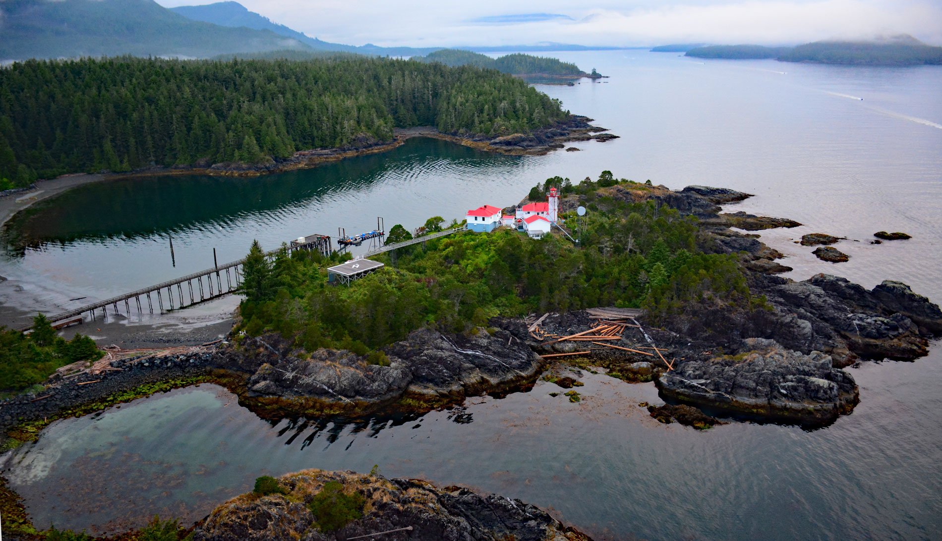
Friendly Cove is an embayment on Nootka Island situated at the northern entrance to Nootka Sound, and is the site of a historic lighthouse and the Yuquot National Historic Site of Canada, about 72 miles (116 km) south-southeast of Port McNeill and 45 miles (72 km) northwest of Tofino, British Columbia. The name was given by early European explorers, who were attracted to the embayment as a safe harbor. Nootka Island lies on the western coast of Vancouver Island on the continental shelf, with a convergent plate boundary to its west. The Nootka Fault Zone extends from the Vancouver Island margin to the Juan de Fuca Ridge, where a triple junction marks the intersection of the Juan de Fuca, Explorer, and Pacific tectonic plates. Nootka Island is considered a metamorphosed portion of Wrangellia, an exotic accretionary terrane that formed part of the Insular Belt after accreting to the North American continent during the Jurassic. Friendly Cove is formed mostly by amphibolite, a rock that most frequently forms by metamorphism of igneous rocks, such as basalt.
Friendly Cove is the ancestral home of the Mowachaht, one of the Nuu-chah-nulth-aht peoples that inhabit Nootka Sound, and the village of Yuquot, that once lined the shore of Friendly Cove, has been continuously occupied for over 4,300 years, and was the social, political and economic center for all 17 Nuu-chah-nulth-aht tribes of the Nootka Sound region. The Spanish explorer Perez Hernandez was the first European on record to visit Nootka Sound in 1774. Captain James Cook followed in 1778 during his third Pacific voyage. The log books of Cook’s exploration, prompted British traders to use the harbor at Friendly Cove as a base for a promising trade with China in sea-otter pelts, but this became embroiled with the Spanish claims of sovereignty over the Pacific Ocean. In 1789, Spain took possession and established Fort San Miguel at Yuquot to protect the settlement called Santa Cruz de Nuca, the first European colony in British Columbia. The capture of British vessels in 1789, and the ensuing Nootka Incident, nearly led to war between Britain and Spain. The Nootka Conventions of the 1790s, hosted by the Mowachaht chief Maquinna, and carried out in part by Captain George Vancouver and his Spanish counterpart Juan Francisco de la Bodega y Quadra, prevented the dispute from escalating to war.
In the early 20th century, local demand for a navigational aid at the entrance to Nootka Sound resulted in funding for a lighthouse at the summit of San Rafael Island, the largest island in Friendly Cove, as part of a more general expansion of the lighthouse system in British Columbia. The first Nootka lighthouse was a square, wooden dwelling surmounted by a lantern, and it was put into service in 1911. At the time of its construction, the lighthouse played a vital role in safeguarding water routes for the many regional industries that were dependent on marine shipping, including canneries, logging, and mining. The pulp and paper and mining industries would continue to grow throughout the 20th century. In 1958, a new steel skeleton tower surrounding a central column was constructed around a staircase that provides access to the lantern room. The light keepers’ dwellings, engine room and fog alarm building, and boathouse were also added. The current lighthouse primarily serves international vessels exporting lumber, as well as recreational boaters, many of whom are involved in developing tourism and outdoor recreational initiatives to supplement the region’s primary industries. Read more here and here. Explore more of Friendly Cove and Nootka Island here:

