Waterfalls
Recent Articles
More Articles
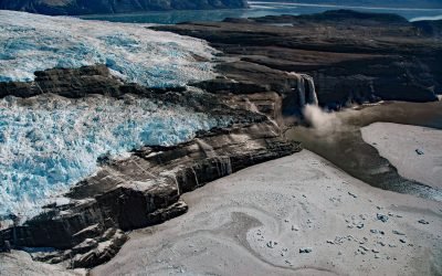
Kashteen Peninsula, Tsaa Fjord
Kashteen Peninsula is located in Wrangell-Saint Elias National Park and Preserve on the eastern shore of Icy Bay, between Tsaa Fjord to the south and Guyot Fjord to the north, and is emerging from under the retreating Guyot Glacier, about 149 miles (240 km) east-southeast of Cordova and 73 miles (118 km) northwest of Yakutat, Alaska.
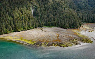
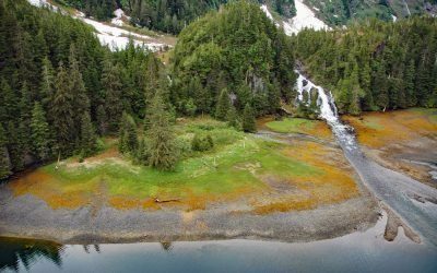
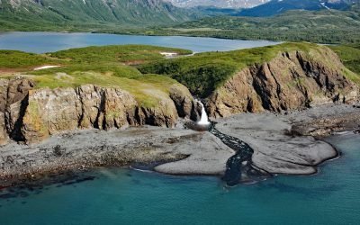
Salt Lagoon, Porcher Inlet
Salt Lagoon is situated at the southwestern base of the Spiller Range on Porcher Island and is connected by a tidal channel 1.8 miles (2.9 km) long to Porcher Inlet that extends 11 miles (81 km) from the south and nearly bisects the island, about 15 miles (24 km) north-northeast of Kitkatla and 5 miles (8 km) northwest of Oona River, British Columbia.
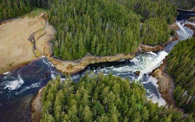
Tutka Bay, Kachemak Bay State Park
Tutka Bay is a deglaciated fjord that extends 8.5 miles (14 km) in Kachemak Bay State Park from Eldred Passage to the mouth of an unnamed river that flows generally west-northwest for 7 miles (11 km) from small remnants of the Southern Glacier, about 18 miles (29 km) southeast of Homer and 15 miles (24 km) east of Seldovia, Alaska.
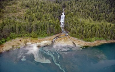
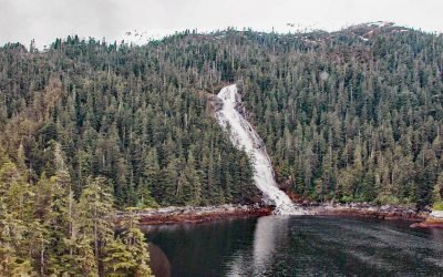
Sahlin Falls, Sheep Bay
Sahlin Falls is located at the base of Sahlin Creek on the northern shore of Sheep Bay, approximately 33 miles (53 km) southeast of Valdez and 13 miles (21 km) northwest of Cordova, Alaska.
Cliff Falls, Deep Cove
Cliff Falls is the outlet for Cliff Lake, located at the head of Deep Cove, approximately 1.1 miles (1.8 km) west of Patterson Point, about 41 miles (66 km) south-southeast of Sitka, and 17.5 miles (28 km) north-northwest of Port Armstrong, Alaska.

Beaver Falls Creek, George Inlet
Beaver Falls Creek is on Revillagigedo Island, on the western shore of George Inlet, 5.3 miles (8.5 km) northeast of Ketchikan, Alaska.
Kasnyku Falls, Waterfall Cove
Kasnyku Falls is a waterfall located on Kasnyku Creek that drains Kasnyku Lake from an elevation of 650 feet (198 m) on the northeast coast of Baranof Island and flows about 1 mile (1.6 km) to Waterfall Cove on Chatham Strait, about 23 miles (37 km) south-southwest of Angoon and 21 miles (34 km) northeast of Sitka, Alaska.
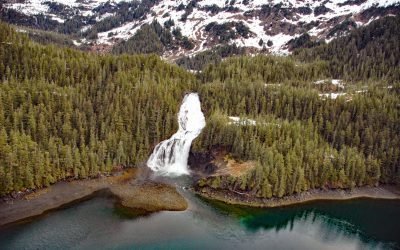
Cascade Falls, Eaglek Bay
Cascade Falls descends to Cascade Bay, an estuary extending 1.5 miles (2.4 km) northwest from Eaglek Bay in northern Prince William Sound, about 52 miles (84 km) west-southwest of Valdez and 32 miles (51.5 km) east-northeast of Whittier, Alaska.
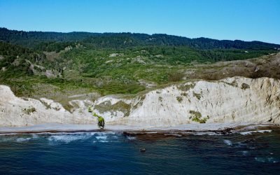
Alamere Falls, Point Reyes National Seashore
Alamere Falls is located in the Phillip Burton Wilderness of Point Reyes National Seashore, about 6 miles (10 km) south of Olema and 6.4 miles (10.3 km) northwest of Bolinas, California.
Kirschner Lake, Kamishak Bay
Kirschner Lake is located on the northern shore of Kamishak Bay and the western coast of lower Cook Inlet at an elevation of approximately 80 feet (24 m), about 110 miles (177 km) northeast of King Salmon and 86 miles (138 km) west-southwest of Homer, Alaska.
About the background graphic
This ‘warming stripe’ graphic is a visual representation of the change in global temperature from 1850 (top) to 2019 (bottom). Each stripe represents the average global temperature for one year. The average temperature from 1971-2000 is set as the boundary between blue and red. The colour scale goes from -0.7°C to +0.7°C. The data are from the UK Met Office HadCRUT4.6 dataset.
Click here for more information about the #warmingstripes.