THIS MONTH
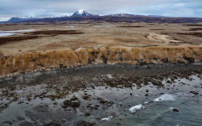
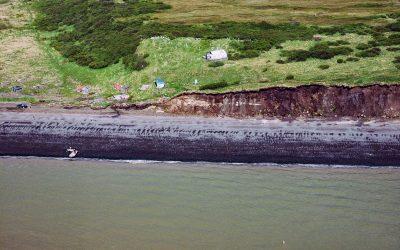
Unga Island Petrified Forest, Shumagin Islands
Unga Island is part of the Shumagin Islands situated south of the Alaska Peninsula in the Gulf of Alaska, and the site of a petrified forest exposed along the eroding northern shore, about 64 miles (103 km) northeast of King Cove and 11 miles (18 km) northwest of Sand Point, Alaska.
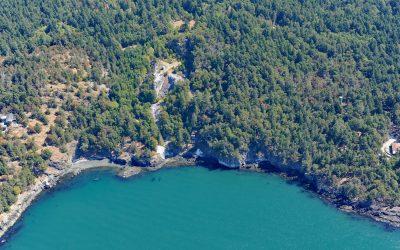
Lime Kiln Point, San Juan Island
Lime Kiln Point is a state park of 42 acres (17 ha) and the site of a historic limestone quarry and kiln on the western shore of San Juan Island, about 6 miles (10 km) south of Roche Harbor and 6 miles (10 km) west of Friday Harbor, Washington.
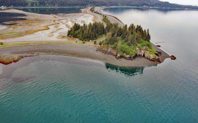
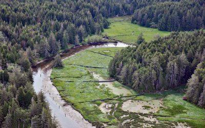
Nubble Point, Kasitsna Bay
Nubble Point is a bedrock outcrop connected to the Kenai Peninsula mainland by MacDonald Spit which forms and separates Kasitsna Bay from Kachemak Bay, about 11 miles (18 km) south of Homer and 6.5 miles (10.5 km) northeast of Seldovia, Alaska.

False Narrows, Gabriola Island
False Narrows is a waterway between 10 and 30 feet (3-9 m) deep, navigable only by small boats and with local knowledge, and about 1.3 miles (2 km) long that separates Gabriola Island to the north from Mudge Island to the south, about 37 miles (60 km) northwest of Sidney and 8 miles (13 km) southeast of Nanaimo, British Columbia.
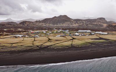
Perryville, Alaska Peninsula
Perryville is an Alutiiq Sugpiaq community established on the south coast of the Alaska Peninsula between Three Star Point to the west and Coal Cape to the east, about 66 miles (106 km) northeast of Sand Point and 41 miles (66 km) southwest of Chignik, Alaska.
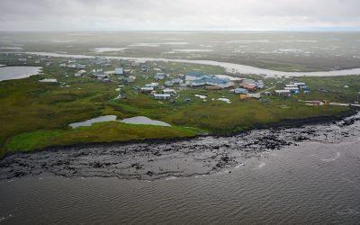
Newtok, Yukon-Kuskokwim Delta
Newtok is a Central Yup’ik community located between the Ningaluk River to the south and a tidal slough to the north, 19 miles (31 km) upstream from the Bering Sea in the Yukon-Kuskokwim Delta, about 125 miles (202 km) south of Emmonak and 96 miles (155 km) west of Bethel, Alaska.
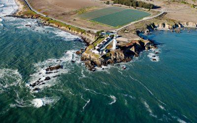
Pigeon Point Lighthouse, Pigeon Point
Pigeon Point is a prominent headland and the site of a historic lighthouse, situated between Bolsa Point to the north and Franklin Point to the south, about 25 miles (40 km) northwest of Santa Cruz and 5 miles (8 km) south of Pescadero, California.

Tyndall Glacier, Taan Fjord
Tyndall Glacier starts at an elevation of about 10,000 feet (3,050 m) in the Saint Elias Mountains near the Canadian border, between Mount Huxley to the west and Mount Saint Elias to the east, and flows generally south-southwest for 13 miles (21 km) to the head of Taan Fjord in Icy Bay, about 160 miles (258 km) east-southeast of Cordova and 68 miles (110 km) northwest of Yakutat, Alaska.
South Slough, Coos Bay
South Slough is a tidal embayment designated as a National Estuarine Research Reserve that extends 6 miles (10 km) south from Coos Bay, which is an estuary of the Coos River, about 13 miles (21 km) north-northeast of Bandon and 4 miles (6.5 km) south of Charleston, Oregon.
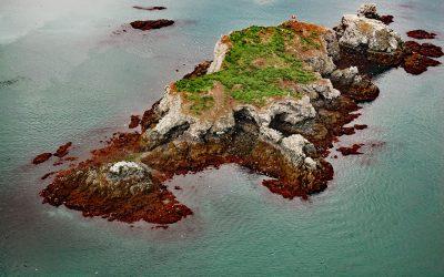
Gull Island, Kachemak Bay
Gull Island is about 633 feet (193 m) long and 93 feet (28 m) high and is situated about 0.6 miles (1 km) northwest of Moosehead Point near the entrance to Peterson Bay on the southeast shore of Kachemak Bay, and about 17 miles (27 km) northeast of Seldovia and 8 miles (13 km) southeast of Homer, Alaska.
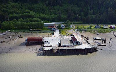
Cassiar Cannery, Skeena River
Cassiar is a historic salmon cannery situated on the northern shoreline of Inverness Passage at the mouth of the Skeena River, about 67 miles (18 km) southwest of Terrace and 11 miles (18 km) southeast of Prince Rupert, British Columbia.
Saint Nicholas Chapel, Ekuk
Saint Nicholas Chapel is a historic Russian Orthodox church situated on a bluff overlooking Ekuk Spit and the summer set-net community of Ekuk, on the eastern shore of Nushagak Bay, about 16 miles (26 km) south-southwest of Dillingham and 2 miles (3.2 km) south-southwest of Clarks Point, Alaska.