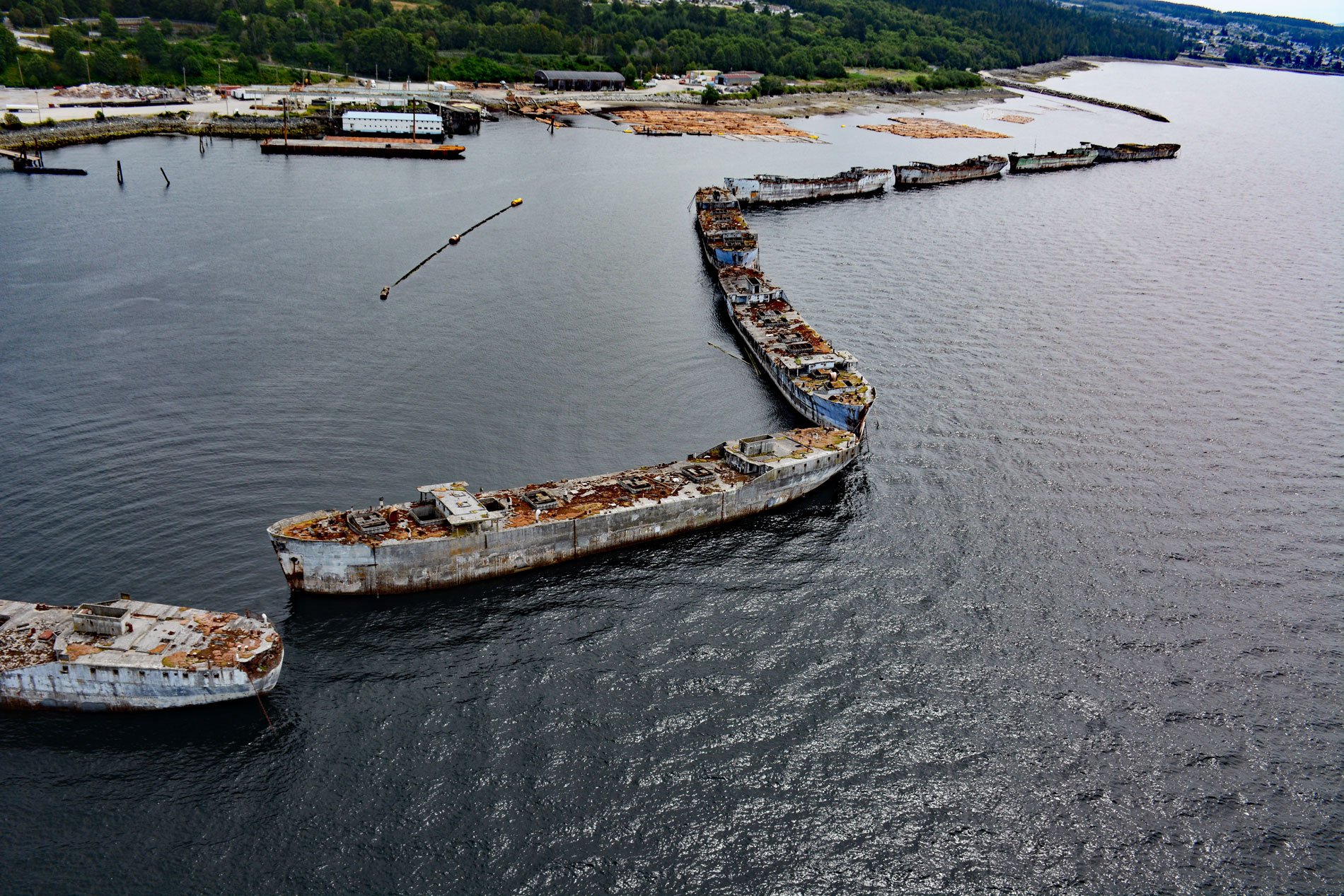
The Hulks is a floating breakwater consisting of ship hulls anchored off the mouth of Powell River originally to protect a log pond for a pulp and paper mill, about 28 miles (45 km) southeast of Campbell River and 2 miles (3.2 km) north-northwest of the community of Powell River, British Columbia. Powell River was named for Israel W. Powell, the first superintendent of Indian Affairs in British Columbia, and served from 1872 to 1889. The river is about 1,640 feet (500 m) long and connects Powell Lake to Malaspina Strait in the Strait of Georgia. The lake is 31 miles (50 km) long and 1.2 miles (2 km) wide and was once a fjord with steep slopes and sills separating six basins, two of which are permanently stratified and contain relatively warmer relic seawater at depth. The fjord became isolated from the adjacent Strait of Georgia about 10,000 to 13,000 years ago by isostatic rebound. It serves as a reservoir for a small hydroelectric generating station, which was built to provide water and power for a historical paper mill and for the community of Powell River.
Powell River is part of the traditional territory of the Tla’amin First Nation who are a part of the greater Northern Coast Salish peoples which also include the Klahoose, Homalco, and Kʼómoks. The Tla’amin people had a village called ’tiskʷat’ at the mouth of Powell River that was abandoned as European settlers encroached. Starting in 1908, the Brooks-Scanlon Lumber Company began developing the hydroelectric potential of Powell Lake and Lois Lake, and in 1910 also built a pulp mill at the mouth of Powell River. By 1912, newsprint was being shipped from a deep water dock at the river mouth. Demand for newsprint was so high that soon Powell River was the largest newsprint mill in the world. The company needed to provide suitable housing for hundreds of construction and mill workers, and a town site was planned to last for decades. Early in 1911, the first two houses were built, and within a year 21 homes were finished. Following a large plant expansion in 1925, house construction increased, and 114 buildings were erected to bring the total to 500 houses. In 1955, the population of Powell River was over 10,000. In 2021, the mill was permanently shuttered and the current owner, Paper Excellence, began exporting electricity from the two dams to the United States.
During World War II, the United States Maritime Commission ordered 24 ships and 58 barges to be constructed with lightweight concrete in response to the shortage of steel. The ships were typically about 336 feet (110 m) long with a beam of 54 feet (16.5 m) and a displacement of about 11,000 tons (10,000 t). The ships performed various military services, but the useful service of these vessels was measured in months, mostly because the war ended shortly after they were delivered. The fate of these ships varied, some were used as docks, such as the SS Palo Alto in Santa Cruz. Only ten are known to still be floating, and these form a massive breakwater at the mouth of Powell River, constructed to protect a logging pond. The ships were acquired between 1948 and 1966, stripped of machinery, and anchored in a semicircle. The ships were re-arranged in 2002 and in 2018 one, YOGN-82, was sunk to create an artificial reef. The current configuration from north to south is: SS Armand Considere, built in 1944 and used as a store ship; SS L.J. Vicat, built in 1944 and used as a store ship; SS Thadeus Merriman, built in 1944 and used as a store ship in the South Pacific; SS John Smeaton, built in 1943 and used in the sugar trade; SS P.M. Anderson, built in 1944 was laid up after being used for only one trip from Manila to San Francisco; SS Henri Le Chatelier, built in 1944 and was used in the sugar trade; SS Emile N. Vidal, built in 1944 and used as a store ship in the South Pacific before being towed back to the U.S. after losing a propeller; USS Quartz, built in 1943 and was initially used as a barge and later participated in an atomic bomb test called Operation Crossroads; and SS Peralta, built in 1921 as an oil tanker and is the oldest American built concrete vessel still afloat. Read more here and here. Explore more of The Hulks and Powell River here:

