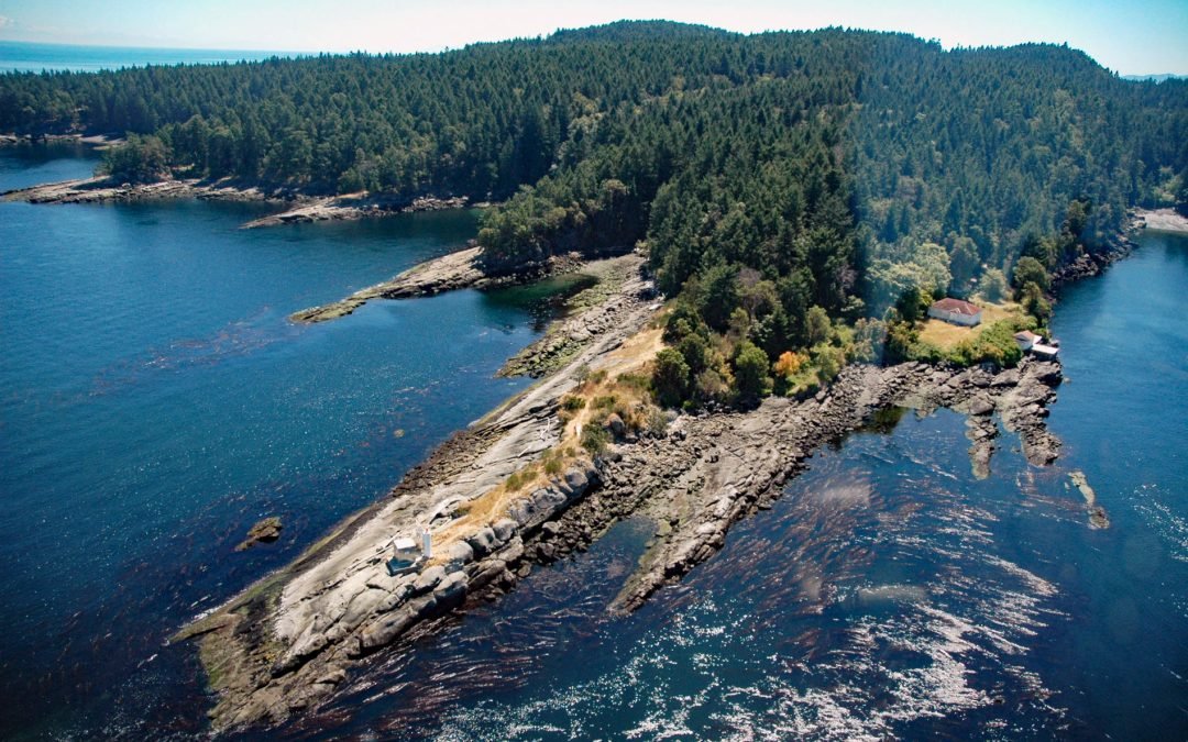
by CoastView | Jul 28, 2026 | 2026, British Columbia, Embayments, Historical, Islands, July 2026, Land Use, Lighthouses, Natural History
Listen to the article here https://coastview.org/wp-content/uploads/2026/03/PorlierPass.mp3 Porlier Pass separates Valdes Island to the north from Galiano Island to the south in the Southern Gulf Islands of Georgia Strait, about 28 miles (45 km) southwest of Vancouver...
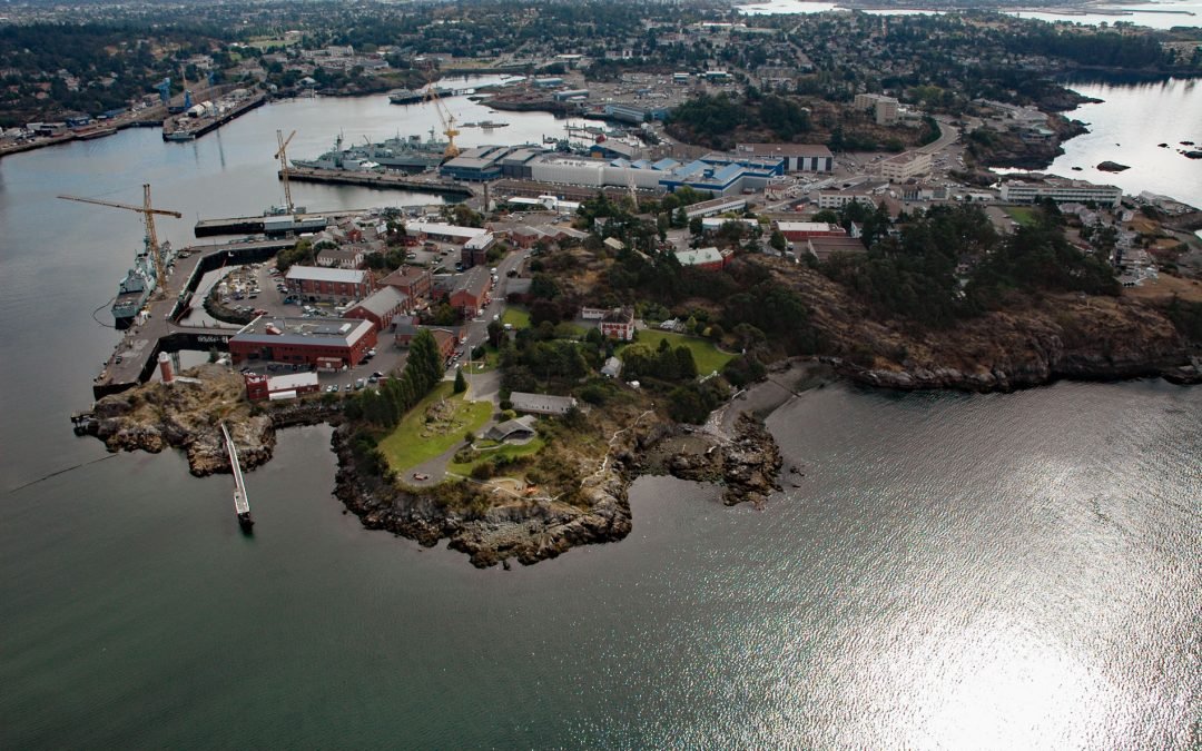
by CoastView | Jul 21, 2026 | 2026, British Columbia, Developments, Embayments, Historical, July 2026, Land Use
Listen to the article here https://coastview.org/wp-content/uploads/2026/03/EsquimaltHarbour-1.mp3 Esquimalt Harbour is a sheltered embayment on the southern tip of Vancouver Island, about 21 miles (34 km) north of Port Angeles, Washington, and 3 miles (4.8 km)...
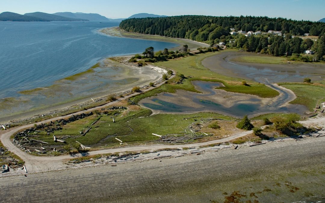
by CoastView | Jul 14, 2026 | 2026, British Columbia, Communities, Embayments, Historical, Islands, July 2026, Land Use, Natural History
Listen to the article here https://coastview.org/wp-content/uploads/2026/03/Penelakut.mp3 Penelakut Island lies between Stuart Channel to the west and Trincomali Channel to the east in the southern Gulf Islands, about 40 miles (65 km) north-northwest of Victoria and...
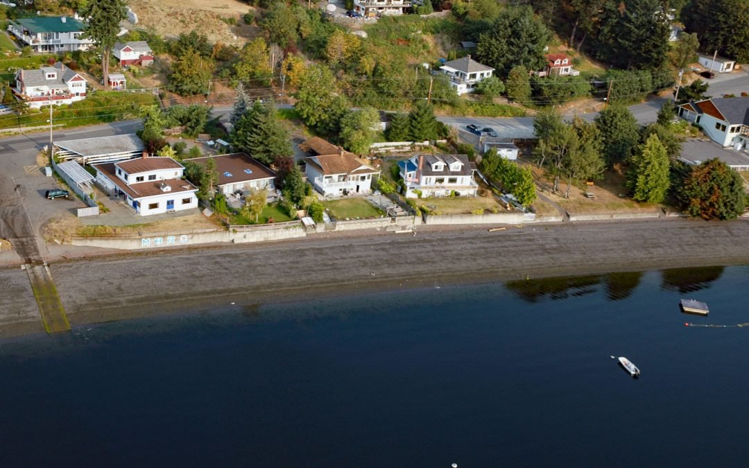
by CoastView | Jul 7, 2026 | 2026, Beaches, British Columbia, Communities, Embayments, Historical, July 2026, Land Use, Natural History
Listen to the article here https://coastview.org/wp-content/uploads/2026/03/MapleBay.mp3 Maple Bay is a community located on Sansum Narrows, an inlet in the Salish Sea that separates Vancouver Island from Salt Spring Island, about 29 miles (47 km) northwest of...
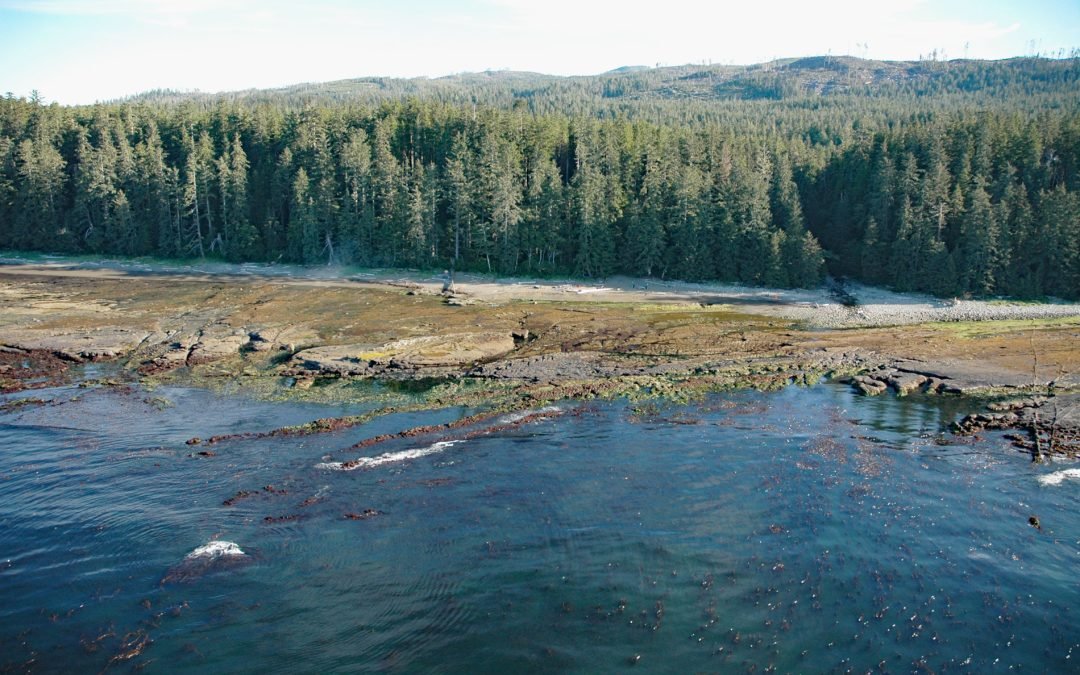
by CoastView | Jun 30, 2026 | 2026, British Columbia, Coastal Features, Historical, July 2026, Land Use, Natural History, Parks, Rivers, Shipwrecks
Listen to the article here https://coastview.org/wp-content/uploads/2026/03/MichiganCreek.mp3 Michigan Creek starts at an elevation of 1,400 feet (427 m) and flows generally south for 4 miles (6.4 km) through the Coast Mountains on Vancouver Island, entering the...

by CoastView | Jun 24, 2026 | 2026, Biodiversity, British Columbia, Coastal Features, Embayments, Islands, June 2026, Natural History, Waterfalls
Listen to the article here https://coastview.org/wp-content/uploads/2026/02/SaltLagoon.mp3 Salt Lagoon sits at the southwestern base of the Spiller Range on Porcher Island, connected by a tidal channel 1.8 miles (2.9 km) long to Porcher Inlet, which extends 11 miles...