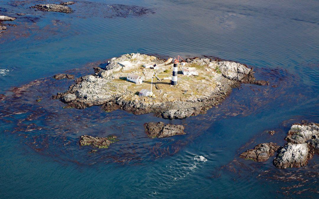
by CoastView | Jun 17, 2026 | 2026, Biodiversity, British Columbia, Coastal Features, Historical, Islands, June 2026, Land Use, Lighthouses, Natural History
Listen to the article here https://coastview.org/wp-content/uploads/2026/02/RaceRocks.mp3 Race Rocks is a group of nine islets, including North Rock, West Race, Great Race, and Rosedale Rock, located about 1 mile (1.6 km) off Cape Calver on the southern tip of...
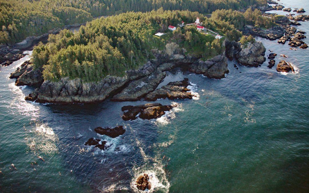
by CoastView | Jun 10, 2026 | 2026, British Columbia, Coastal Features, Historical, June 2026, Land Use, Lighthouses, Natural History, Parks, Shipwrecks
Listen to the article here https://coastview.org/wp-content/uploads/2026/02/CapeBeale.mp3 Cape Beale is the site of a historic lighthouse marking the southern entrance to Barkley Sound on the west coast of Vancouver Island in Pacific Rim National Park Reserve, about...
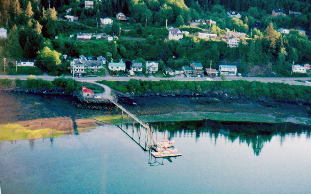
by CoastView | Jun 3, 2026 | 2026, British Columbia, Coastal Features, Communities, Developments, Embayments, Historical, Islands, June 2026, Land Use, Natural History
Listen to the article here https://coastview.org/wp-content/uploads/2026/02/QueenCharlotte.mp3 The community of Daajing Giids, historically known as Queen Charlotte, is situated on the northern shore of Skidegate Inlet on Graham Island in the Haida Gwaii archipelago,...
by CoastView | May 27, 2026 | 2026, British Columbia, Coastal Features, Communities, Islands, Land Use, May 2026, Natural History
Listen to the article here https://coastview.org/wp-content/uploads/2026/02/FalseNarrows.mp3 False Narrows is a waterway 10 to 30 feet (3-9 m) deep, navigable only by small boats with local knowledge, and about 1.3 miles (2 km) long, separating Gabriola Island to the...
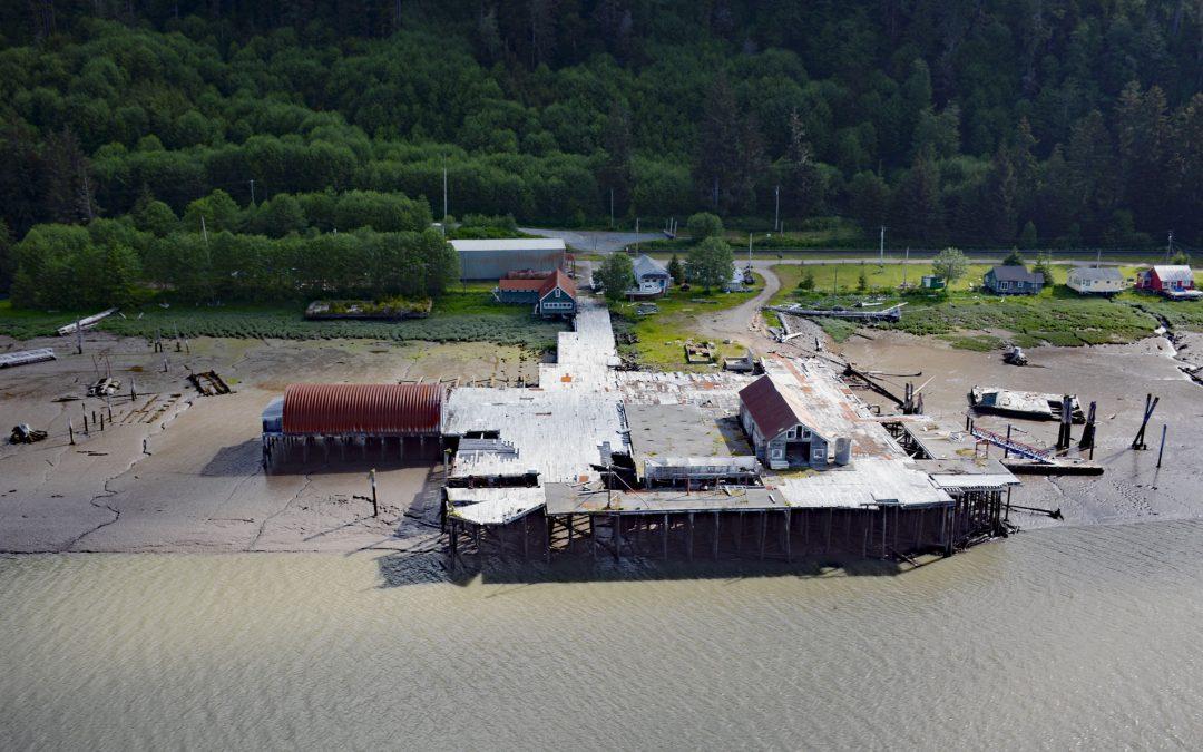
by CoastView | May 20, 2026 | 2026, Biodiversity, British Columbia, Canneries, Communities, Developments, Historical, Land Use, May 2026, Natural History, Rivers
Listen to the article here https://coastview.org/wp-content/uploads/2026/02/CassiarCannery.mp3 Cassiar is a historic salmon cannery on the northern shore of Inverness Passage at the mouth of the Skeena River, about 67 miles (108 km) southwest of Terrace and 11 miles...
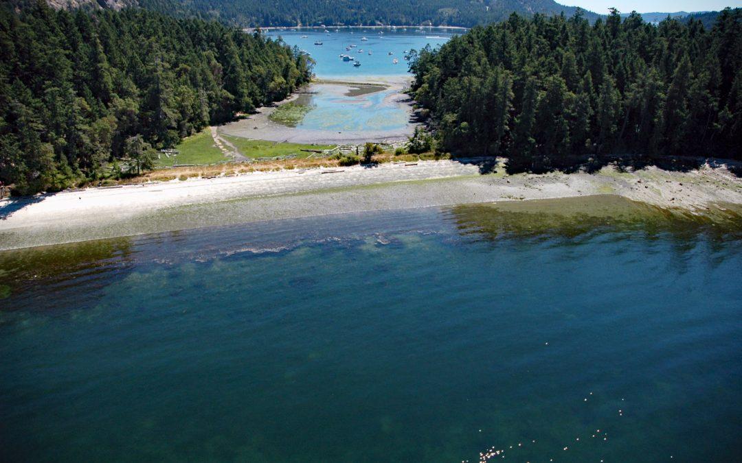
by CoastView | May 14, 2026 | 2026, Biodiversity, British Columbia, Coastal Features, Embayments, Islands, Land Use, May 2026, Natural History
Listen to the article here https://coastview.org/wp-content/uploads/2026/01/MontagueHarbour.mp3 Montague Harbour is a provincial marine park on Trincomali Channel on the southern coast of Galiano Island, one of the Gulf Islands in the Strait of Georgia, about 32 miles...