BEST OF 2022
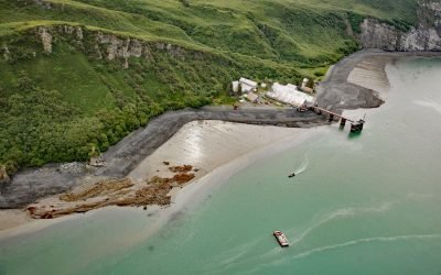
Snug Harbor, Chisik Island
Snug Harbor is a historical cannery located along a bight on the west coast of Chisik Island, at the southern end of Tuxedni Channel, on the western shore of Cook Inlet, about 51 miles (82 km) northwest of Homer and 56 miles (90 km) southwest of Kenai, Alaska.
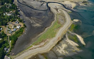
Minter, Henderson Bay
Minter is a community on the northwestern shore of Henderson Bay, at the head of Carr Inlet in South Puget Sound, about 24 miles (39 km) southwest of Seattle and 5.5 miles (9 km) northwest of Gig Harbor, Washington.
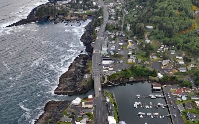
Depoe Bay, Depoe Creek
Depoe Bay is a community located on a small natural embayment with the same name, 11 miles (18 km) south-southwest of Lincoln City and 12 miles (19 km) north of Newport, Oregon.
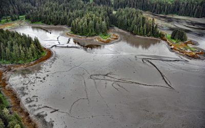
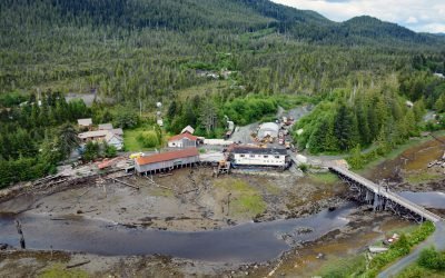
Port Camden, Kuiu Island
Port Camden is an embayment on the northeast coast of Kuiu Island, about 36 miles (58 km) south-southwest of Petersburg, and 61 miles (98 km) northwest of Wrangell, Alaska.
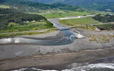
Pistol River, Pistol River State Scenic Viewpoint
Pistol River starts at an elevation of 3,179 feet (970 m) on the southern flank of Sugarloaf Mountain and drains a watershed of 67,200 acres (27,195 ha) in the Siskiyou National Forest while flowing generally southwest for 21 miles (34 km) to the Pacific Ocean near the community of Pistol River, about 17 miles (27 km) north-northwest of Brookings and 10 miles (16 km) south of Gold Beach, Oregon.
Portlock Cannery, Port Chatham
Portlock is a historical salmon cannery in Port Chatham, an embayment on the southern coast of the Kenai Peninsula, about 102 miles (164 km) north-northeast of Kodiak and 10 miles (16 km) south-southeast of Port Graham, Alaska.
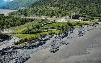
Bird Point, Turnagain Arm
Bird Point is on the north shore of Turnagain Arm in Cook Inlet, 4 miles (6.5 km) southwest of the community of Bird Creek, and 7.5 miles (13 km) west of Girdwood, Alaska.
Oona River, Porcher Island
Oona River starts from an elevation of about 2,000 feet (610 m) and flows north-northeast for 2 miles (3.2 km) and then southeast for 2 miles (3.2 km) to the community of Oona River on the eastern shore of Porcher Island at the mouth of the Skeena River, about 25 miles (40 km) south of Prince Rupert and 13 miles (21 km) north-northeast of Kitkatla, British Columbia.
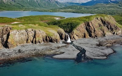
Kirschner Lake, Kamishak Bay
Kirschner Lake is on the western coast of lower Cook Inlet at an elevation of about 80 feet (24 m) and isolated by a waterfall that cascades 40 feet (12 m) to the northern shore of Kamishak Bay, about 110 miles (177 km) northeast of King Salmon and 86 miles (138 km) west-southwest of Homer, Alaska.
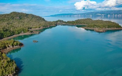
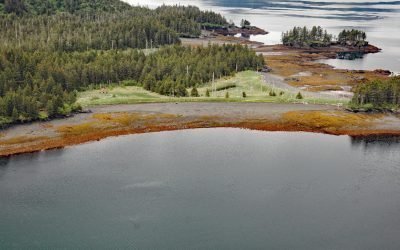
Bear Cove, Kachemak Bay
Bear Cove is a small embayment on the Kenai Peninsula that extends southeast for 1.5 miles (2.4 km) from the southeastern coast of Kachemak Bay between Bear Island to the south and Chugachik Island to the north, about 57 miles (92 km) south of Kenai and 18 miles (29 km) northeast of Homer, Alaska.
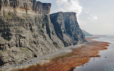
Fortification Bluff, Kamishak Bay
Fortification Bluff is a sea cliff over 3 miles (4.8 km) long that rises almost vertically to 1,200 feet (366 m), on the south face of Step Mountain in Kamishak Bay, about 125 miles (201 km) northwest of Kodiak and 82 miles (132 km) west-southwest of Homer, Alaska.
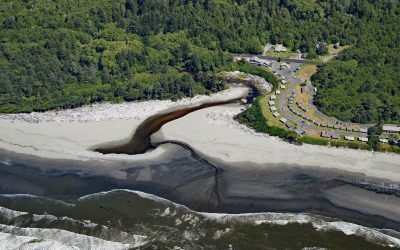
Kalaloch, Olympic National Park
Kalaloch is a resort area and ranger station on the west coast of the Olympic Peninsula at the mouth of Kalaloch Creek in Olympic National Park, about 24 miles (39 km) southeast of La Push and 19 miles (31 km) north-northwest of Taholah, Washington.