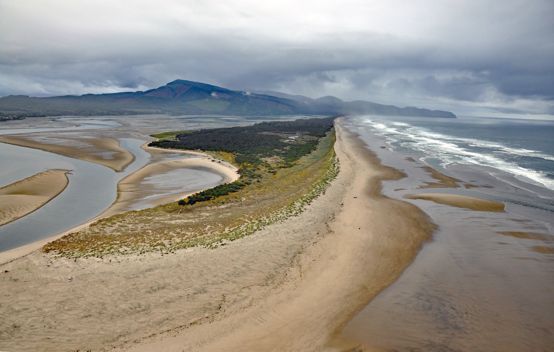
Netarts Spit is in Cape Lookout State Park and extends north for 6 miles (10 km) from Cape Lookout, forming Netarts Bay, an estuary of 2,179 acres (883 ha) for several minor streams draining the western flank of an unnamed peninsula separating Tillamook Bay from the Pacific Ocean, about 53 miles (85 km) south of Astoria and 5.7 miles (9 km) west-southwest of Tillamook, Oregon. The name first appeared in the 4th edition of the Directory of the Pacific Coast in 1889, later known as the Coast Pilot, written by George Davidson, a geodesist and hydrographer with the U.S. Coast Survey. As early as 1867, schooners had entered the bay called Na-ta-ats meaning ‘oyster’, but the name was published as Netarts for the village on the northeastern shore. The spit represents a foredune with elevations reaching 49 feet (15 m) in some places. The underlying bedrock is the Astoria Formation, composed of sediments derived from erosion of the Coast Range and deposited in a shallow coastal area during the early Miocene. Netarts Bay occupies a shallow eroded basin in this sandstone formation between basaltic intrusions to the north represented by Cape Meares and to the south by Cape Lookout.
The area surrounding Netarts Bay represents the traditional lands of the Tillamook people and there were several settlements around the bay including one on the spit. They subsisted primarily on shellfish and salmon, and also hunted seals, sea lions, deer, bears, and elk. A settlement on the spit consisting of traditional plank houses was occupied from 1300 AD until the mid to late 1700s. The total population of the Tillamook settlements was originally about 2,000, but they were subsequently ravaged by introduced diseases shortly after first contact with Europeans, and by 1851 the total population had declined to about 88. In 1856, the lands in the Netarts Bay area were surveyed, and the Homestead Act of 1862 allowed the first settlers to stake claims in 1865. The eastern shore of the bay was settled first, probably because the tide lands provided access to oysters and the marshes could be grazed by livestock. Dikes and tide gates were constructed in some of the marshes to increase their agricultural value. Netarts Spit was first settled in 1880, and virtually all the shoreline was claimed and occupied by 1903. In 1951, European beach grass was planted to stabilize the foredune sand. Access to the spit was by trail across Cape Lookout or by ferry across the bay to the mainland. Native oysters were so plentiful that a small industry developed to ship oysters to San Francisco; however, the accidental introduction of Japanese oyster drill in 1957 effectively ended the oyster export industry until commercial oyster farming started.
The original acquisition for a state park at Cape Lookout was a gift in 1935 of 975 acres (395 ha) from the U.S. Lighthouse Service. Land was purchased from various owners of the beach area north of the cape and the entire Netarts Spit. The spit property was partially a gift and partially an exchange involving lands on the spit for lands at Cascadia State Park. Additional lands were acquired until 1988, including a tract of 40 acres (16 ha) on the south side of the cape. Originally, the park was left undeveloped as a natural preserve. In 1930, a picnic area was developed by the Civilian Conservation Corps. In 1954, Cape Lookout State Park opened a campground which grew quickly and now consists of 38 recreational vehicle sites, 170 tent sites, 13 yurts, 6 cabins, and a hiker-biker camp. Coastal erosion has become an issue since the El Niño storms of 1982 to 1983 that caused northward movement of beach sand, creating a sand deficit fronting the campgrounds and the near elimination of the foredunes. The El Niño of 1997 to 1998 caused more erosion and the foredune was breached, flooding the campground and causing significant damage to park facilities. A project is now underway to relocate the campground and all electrical, water, and sewage infrastructure. Read more here and here. Explore more of Netarts Spit and Cape Lookout State Park here:

