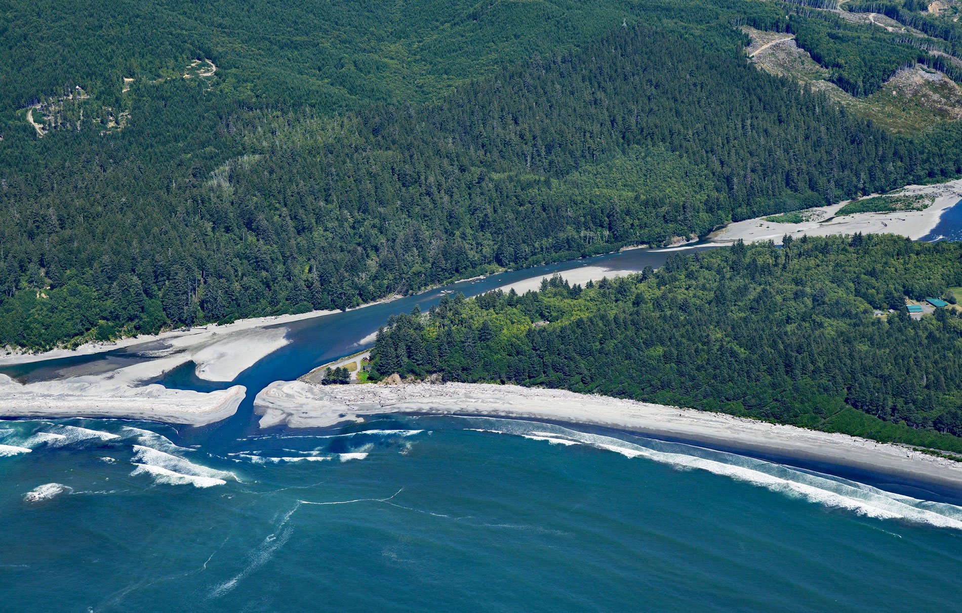
Hoh River starts from the terminus of the Hoh Glacier at an elevation of roughly 4,200 feet (1,280 m) on the northeast flank of Mount Olympus in Olympic National Park and flows generally west-southwest for 56 miles (90 km) draining a watershed of 191,360 acres (77,441 ha) to the Pacific Ocean, about 99 miles (159 km) west of Seattle and 15 miles (24 km) south of Forks, Washington. The river name is from the language of the Quinault people who live to the south, but the meaning of the word has been lost. The river watershed is the traditional territory of a people who speak the Quileute language and call themselves Cha’lák, but today are referred to as the Hoh people. The watershed is formed by sedimentary rocks and oceanic basalts. During the early and middle Eocene, fissures on the Farallon tectonic plate under the proto-Pacific Ocean emitted lava, creating underwater seamounts. About 35 million years ago, the Farallon plate was subducted beneath the North America plate and some of the seamount material was scraped off creating a horseshoe-shaped arc of basalt along the Strait of Juan de Fuca to the north, Hood Canal to the east, and Lake Quinault to the south. Other obducted crustal rocks, primarily Eocene sandstones and turbidites, formed the core of the Olympic Mountains and are highly fractured resembling a mélange. The mountains were uplifted around 10 to 20 million years ago, and the present-day landscape was shaped during the Pleistocene by repeated glaciations.
The Hoh people were formerly considered a band of the Quileute tribe, who are also of Chimakuan linguistic stock. Their name for the Hoh River is Cha’lak’at’sit, which means the ‘southern river’ and refers to the river being the southernmost salmon stream in Quileute speaking territory. The Quileute origin story is that they were created from wolves by the mythological Dokibatt the Changer, or Transformer. The Hoh people were isolated from contact with Europeans until 1787 when the British fur trader Charles W. Barkley, on the Imperial Eagle, dispatched a boat up the Hoh River to trade with the natives but never returned to the ship. In 1808, the Russian-American Company schooner Saint Nikolai ran aground at Rialto Beach, adjacent to the main Quileute village, and many of the crew were enslaved. In 1855, Indian Agent Michael T. Simmons, representing Washington territorial governor and superintendent of Indian affairs Isaac Stevens, and the Quinault, Queets, Hoh, and Quileute tribes agreed to the Quinault River Treaty and the Hoh moved onto the Hoh Indian Reservation of 477 acres (193 ha) at the mouth of the Hoh River. In the late 19th and early 20th centuries, the mouth of the river was the site of petroleum exploration and extraction with a large community planned, but the discovered oil reserves were not profitable.
The headwaters of the Hoh River are within Olympic National Park, and the river mouth is protected from development by a narrow coastal strip of the park. Beginning in 2001, the Western Rivers Conservancy acquired nearly 7,000 acres (2,833 ha) of corporate-owned timber lands along the lower 30 miles (48 km) of the Hoh River. In September 2009, this land was conveyed to the Hoh River Trust, created to act as owner and steward of the Hoh River Recreation and Conservation Area. They subsequently reopened every blocked salmon spawning stream within the conservancy, largely by replacing impassible culverts with bridges that allow for miles of additional fish passage. Coho and steelhead returned to these streams and spawned for the first time since the 1940s. Over 10 miles (16 km) of logging roads were decommissioned and 3,500 acres (1416 ha) of former timberland were thinned because tree density was inhibiting the return to old-growth habitat conditions. In 2017, the Hoh River Recreation and Conservation Area was expanded to 10,315 acres (4,174 ha) by combining lands within the Hoh River basin owned by The Nature Conservancy that included important tributaries for all five Pacific salmon species as well as steelhead, cutthroat, and bull trout. The conservation area is now owned and managed by The Nature Conservancy in partnership with Hoh River Trust. Read more here and here. Explore more of the Hoh River and Olympic Peninsula here:

