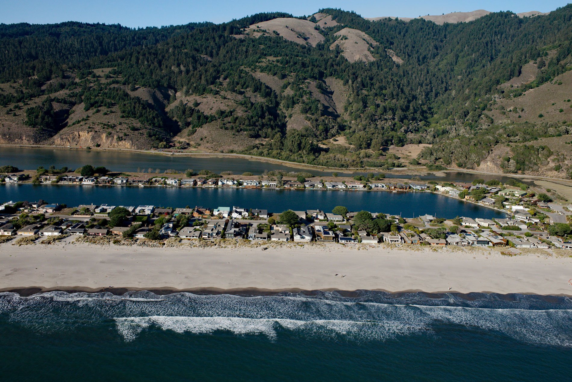
Stinson Beach is a community on Bolinas Bay developed on a crescent-shaped sand spit partially enclosing Bolinas Lagoon between Duxbury Point to the northwest and Rocky Point to the south, about 15 miles (24 km) northwest of San Francisco and 14 miles (23 km) south-southeast of Point Reyes Station, California. The beach is named after Nathan H. Stinson who came to California in the 1850s, and with his brother, leased a dairy ranch at Point Reyes in 1866, and later bought property on Bolinas Lagoon. The spit extends from the Marin Peninsula which represents rocks of the Franciscan Complex consisting mostly of highly fractured greywacke sandstones, shales and conglomerates which have experienced low-grade metamorphism. The beach is composed of medium to coarse-grained sand that overlies a highly cohesive clay that is moderately resistant to wave scour but was exposed during the El Niño storms of 1982-83 and 1997-1998. The beach and foredune sand deposits have also been extensively damaged or destroyed by significant residential development of the Stinson Beach community that is now subject to long-term erosion, wave run-up, coastal flooding, septic failure, and water distribution pipe failure.
The Pacific Coast of the Marin Peninsula is the traditional territory of the Coast Miwok who occupied a large region extending north to Bodega Bay and east to San Francisco Bay. The first Coast Miwok encounter with Europeans was in 1595 when Sebastião R. Soromenho, sailing from the Philippines on the San Agustin anchored in present-day Drakes Bay. In 1783, records from the Mission San Francisco de Asis show that several Coast Miwok had been baptized. Mission San Rafael Arcángel was founded in 1817 and within a year 850 Coast Miwok had been converted. Following the Mexican War of Independence in 1821, all mission lands were secularized and in 1833 turned over to the Mexican government. In 1846, Mexican Governor Pio Pico granted Gregorio Briones a land grant of 8,911 acres (3606 ha) called Rancho Las Baulines that extended around Bolinas Lagoon and encompassed present-day Stinson Beach and Bolinas. The 1849 California Gold Rush brought an influx of fortune seekers to the San Francisco Bay area, and as land was sold to the new immigrants, the land titles usually became ensnared in litigation. One of the first land disputes concerned the title to various properties on the Point Reyes Peninsula, and during a five-year period ending in 1857, the disputes led to the Shafter brothers owning over 50,000 acres (20,234 ha) with the intent of creating a dairy farming district. They utilized the letters of the alphabet to name their individual ranches, and the Stinson brothers leased H Ranch and their families settled in the Olema Valley and Stinson Beach.
A principal access road to the Stinson Beach neighborhoods of Calles, Patios, and Seadrift are subjected to increased flooding and eventual permanent inundation, severely limiting access to portions of the community. Stinson Beach has a density of homes on the immediate Bolinas Bay beach front where a rock revetment was constructed to mitigate erosion; however, flooding from Bolinas Lagoon also occurs and will likely worsen with future rising sea levels. In the past Marin County has generally allowed redevelopment of damaged beach homes if they comply with flood elevation rules developed by the Federal Emergency Management Agency, but this has resulted in some elevated structures that potentially raise concerns about visual impairment and community character, as well as beach access and recreation. In the long-term, there may be a concern that the mean high tide, and thus public trust lands, will eventually migrate under the elevated homes. This demonstrates the looming need to more comprehensively address the potential conflict between coastal hazard mitigation and coastal resource protection, including protection of the public trust interest in tidelands. Read more here and here. Explore more of Stinson Beach and Bolinas Bay here:

