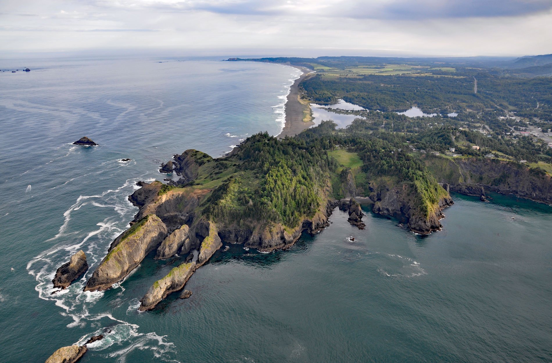
Nellies Cove is situated on the south side of a rocky headland known as The Heads, between Agate Beach to the north and Port Orford to the south, and is the site of a historic lifeboat station in Port Orford Heads State Park, about 23 miles (37 km) north of Gold Beach and 1 mile (1.6 km) southwest of Port Orford, Oregon. The cove was named in the late 19th century for Sarah Ellen Tichenor, known as Nellie, the youngest daughter of Captain William Tichenor, the founder of Port Orford and owner of the headland property through a Dominion Land Claim. The southern Oregon coast lies at the western margin of the Klamath Mountains province, a region composed of sedimentary and volcanic material on the sea floor and are some of the oldest rocks in Oregon. Metamorphic recrystallization and intense folding, faulting, and shearing have severely altered these rocks to varying degrees. The Heads and Nellies Cove are formed by rocks representing the Otter Point Formation that developed during the Late Jurassic and Early Cretaceous, and consists mostly of sandstone and mudstone. The top of the headland consists of sediments representing Pleistocene marine terrace deposits, with the Pioneer terrace to the north and the Indian Creek terrace sediments to the south.
The Heads is the site of a prehistoric human settlement that was excavated by archaeologists in the 1970s. The project concluded that the area had been used as a village site for approximately 3,000 years and that distinct activities were discernible such as tool manufacture; woodworking; plant food processing; and butchering of animals including mammals, birds, and fish. The mammals were identified as Steller sea lions, elk, deer, harbor seals, seal otters, black bears, whales, and small mammals. In the historical period, Port Orford was the traditional territory and village site of the Kwatami, part of the Sixes band of the Tututni tribe that inhabited the coast between the Coquille River to the north and Chetco River to the south. The boundaries of the Southern Oregon tribes were identified by, and associated with, certain prominent headlands, rocks and streams, and extended to Coast Range summits. These boundaries were strictly recognized and adhered to by the tribes, and were passed down from one generation to the next. The first contact between the Tututni people and Europeans was in the late 1700s when British, Spanish and American ships explored Oregon’s coastal region. In the 1840s, the first immigrant wagon trains started arriving and within ten years the traditional Tututni game trails and hunting grounds were destroyed by pioneer settlers clearing land for farms. After the Rogue River Wars in 1856, the Tututni and other Rogue River Indians were removed from this area and forced to settle on the Coast Indian Reservation and later became the Confederated Tribes of Siletz.
The increase in shipping traffic and the establishment of shipping ports along the Oregon coast resulted in increasing numbers of shipwrecks. In 1891, an act of Congress authorized the establishment of a life-saving station at Port Orford, but the station was not constructed until 1934. The main complex including former housing for U.S. Lifesaving Service personnel is on a knoll at the top of the headland that, at the time of construction, had relatively unobstructed views. Today, mature trees, as well as other natural vegetation, make clear views to the Pacific Ocean difficult. The boathouse was located at sea level on Nellies Cove 280 feet (85 m) below the station buildings, and access was provided by a steep staircase of wood and concrete. The structure was used to house and launch two motor lifeboats that were 34 feet (10 m) long. Launching was done using a ramp called a slipway or ‘ways‘ that was over 60 feet (18 m) long. The Port Orford Station was decommissioned in 1970, and shortly afterward, the boathouse was destroyed by arson, and all that remains are concrete foundation pilings. Oregon State University used the buildings as a teaching facility until 1976 when the site was deeded to Oregon State Parks and was opened to the public as the Port Orford Heads State Park. Read more here and here. Explore more of Nellies Cove and The Heads here:

