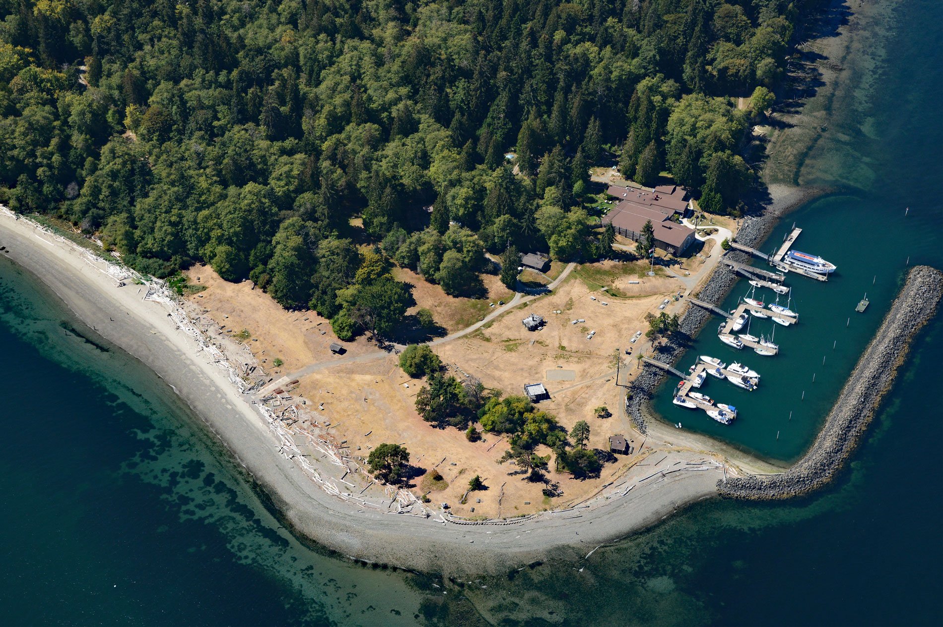
Blake Island is a Washington State Marine Park in Puget Sound situated between Bainbridge Island to the north and Vashon Island to the south, about 8 miles (13 km) southwest of downtown Seattle and 7 miles (11 km) east of Port Orchard, Washington. The island was named in 1841 by Lieutenant Charles Wilkes during the U.S. Exploring Expedition to honor George S. Blake who was commodore of the United States Navy at that time. Blake Island lies within the southern part of the Salish Lowland that was last glaciated during the Vashon stade of the Fraser Glaciation. The Cordilleran ice sheet advanced south from the Coast Mountains of British Columbia and overrode all the Salish Lowland to a maximum extent south of present-day Olympia around 17,000 years ago, and then retreated rapidly, leaving extensive sediment deposits that exceed 300 feet (100 m) in thickness. Landscape surfaces in the Salish Lowland including Blake Island were formed in three phases: ice-sheet glaciation; deglaciation, including large changes in relative sea level due to isostatic rebound. Locally, significant uplift associated with earthquakes on the Seattle Fault and Tacoma Fault and ongoing erosion and deposition continue to shape the landscape.
In 1792, Captain George Vancouver was the first recorded European to enter Puget Sound with the HMS Discovery and HMS Chatham. The ships anchored in the channel between Blake Island and Bainbridge Island, and Vancouver dispatched crews to survey Puget Sound in small boats led by Lieutenants Peter Puget, Joseph Baker, and Joseph Whidbey. Blake Island was an ancestral seasonal campsite for the Suquamish people and reputedly the birthplace of Chief Seattle, or Sealth, in the late 18th century. Sealth later became the head of six tribes and was present at Point Elliott in 1855 for the signing of the treaty between the United States government and the tribes of the greater Puget Sound region in the recently formed Washington Territory. In the mid-1800s, the island was logged and after the timber supply was exhausted, a Seattle bank foreclosed on the owners and took possession. In the late 1800s, William P. Trimble purchased Blake Island, but he lost his fortune in the Great Depression and traded the island to the United National Corporation. In 1959, the island was traded to Washington State in exchange for timber property and the Board of Natural Resources set aside all of Blake Island for a park.
The Century 21 Exposition, or world’s fair, in 1961 prompted entrepreneur and caterer William Hewitt to propose a tourist attraction for the island called Tillicum Village consisting of a traditional cedar plank longhouse to showcase Coast Salish peoples art, culture, and food. Hewitt built a restaurant, performance area, and gift shop on the northeast side of the island with a public pier for boats, and operated the concession for 40 years. Approximately 100,000 people visited Blake Island State Park every year, arriving mostly on the tour boats from Seattle waterfront piers 55 and 56, just eight miles (about 45 minutes) away. Hewitt sold the concession to Argosy Cruises in 2009, and in 2021 the business ended due to the COVID-19 pandemic and the property languished until reverting to state ownership. Read more here and here. Explore more of Blake Island and Puget Sound here:

