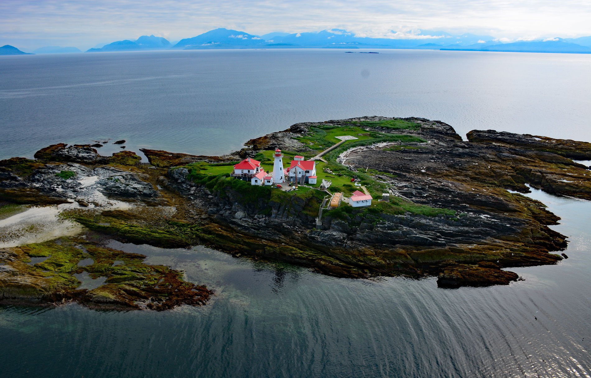
Green Island is part of the Dundas Island Archipelago situated on the west side of Chatham Sound and is the site of a historic lighthouse, about 65 miles (105 km) south-southeast of Ketchikan and 24 miles (39 km) northwest of Prince Rupert, British Columbia. The archipelago is named after the largest island, which in turn was named in 1793 by Captain George Vancouver to honor Henry Dundas, Treasurer of the Royal Navy. Chatham Sound is a semi-enclosed inland sea with a width of 10 to 15 miles (15-25 km) between Dixon Entrance to the west and the Skeena River delta to the east, and an important waterway for the Port of Prince Rupert spanning a total distance of approximately 44 miles (70 km) from south to north. The sound was likely named in 1788 by Captain Charles Duncan for John Pitt, the 2nd Earl of Chatham, and First Lord of the Admiralty from 1788 to 1794. The Dundas Islands represent the eastern margin of the southern Alexander terrane, a tectonic wedge that amalgamated with North America during the late Silurian or early Devonian. Green Island is formed by an igneous intrusion called gabbro from the Ordovician to Triassic that was exposed by subsequent Pleistocene glaciations.
The Dundas Island Archipelago is the traditional territory of the Northern Tsimshian people who have oral histories that reference the occupation and use of the offshore islands for thousands of years. The archaeological record indicates that the islands were inhabited by seafaring peoples exploiting marine resources such as mammals, fish, and shellfish as early as 11,000 years ago. These islands were a major population center by at least the second half of the Holocene, with at least 6 villages situated along the major waterways and level shorelines. Occupation shifted away from the large villages between 1900 and 1300 years ago, after which time occupation of the islands appears to be characterized by seasonal foraging sites. Traditional histories include stories of Tlingit invaders moving in from the north and establishing villages in Northern Tsimshian territory, including on the Dundas Islands. This eventually led to a large-scale war in which the Northern Tsimshian were forced to flee up the Skeena River, where they regrouped and later returned to reclaim their territories. The islands are now part of the Lax Kwaxl/Dundas and Melville Islands Conservancy and are uninhabited except for a few seasonal sport fishing camps and cabins used by contemporary Northern Tsimshian from Lax Kw’alaams and Metlakatla.
Maritime traffic along the Inside Passage increased dramatically with the discovery of gold in the late 19th century in Alaska and the Klondike. In 1897, the steamer Portland arrived in Seattle with a large amount of gold from the Klondike, and this set off a stampede of people wanting to go north to the gold fields. A week later, the steamer Mexico left Seattle loaded with people and supplies, but wrecked near Green Island. The need for a lighthouse marking Chatham Sound became more urgent in 1902 by the wreck of collier Bristol under the command of Captain James McIntyre. The steamer was carrying 2,500 tons of coal from Vancouver Island to the Treadwell Mine in Alaska when it ran aground on Green Island during a southeast gale. Twenty-one of the vessel’s crew escaped in lifeboats and were picked up by the steamer Cottage City, but the captain, pilot, chief engineer, and four other men drowned. In 1906, a light station was built on Green Island consisting of a wood frame dwelling with a square tower 44 feet tall housing a 3rd-order Fresnel lens manufactured by Barbier, Benard & Turenne of Paris. The original structure was replaced in 1956 by a concrete tower and is now flanked by related buildings including a storage shed and workshop, tractor shed, garage, senior keeper’s residence, junior keeper’s residence, winch house, and generator room. Read more here and here. Explore more of Green Island and Chatham Sound here:

