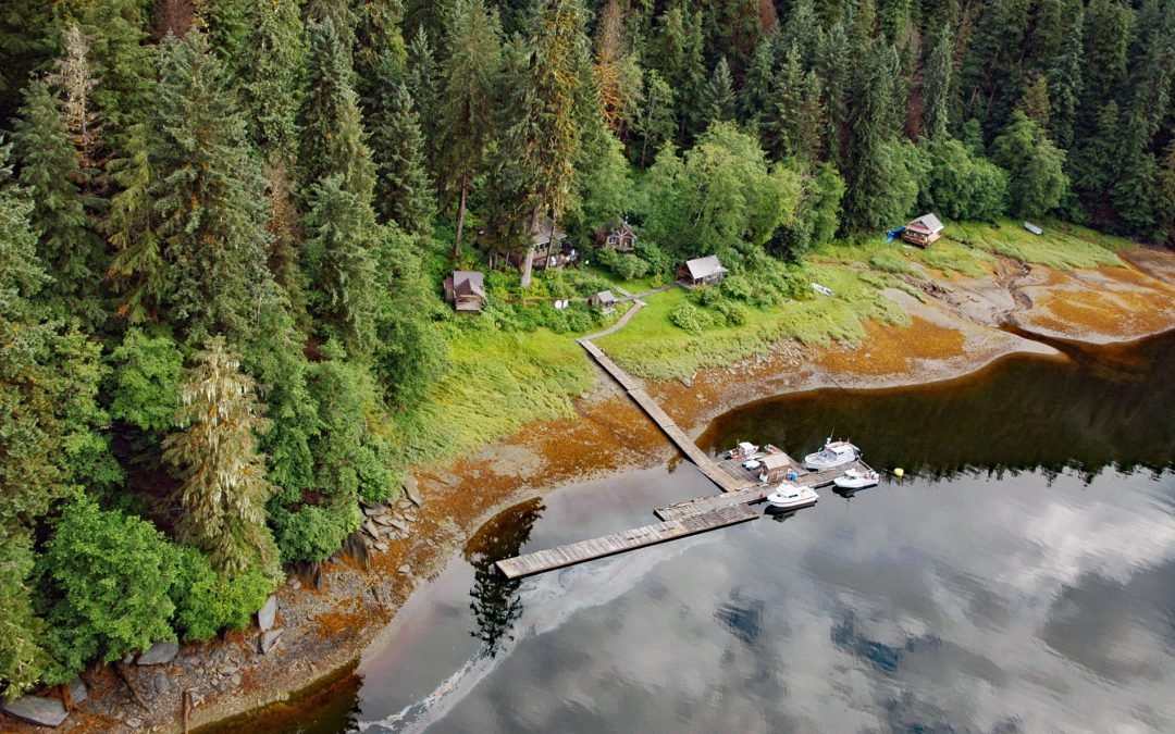
by CoastView | Jun 28, 2026 | 2026, Alaska, Communities, Developments, Embayments, Historical, June 2026, Land Use, Mines, Natural History
Listen to the article here https://coastview.org/wp-content/uploads/2026/03/WindhamBay.mp3 Windham is a settlement that historically supported mining operations along Spruce Creek at the head of Windham Bay, about 63 miles (102 km) southeast of Juneau and 57 miles (92...
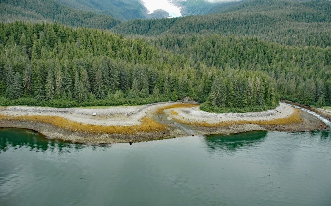
by CoastView | Jun 20, 2026 | 2026, Alaska, Climate Change, Embayments, Glaciers, June 2026, Land Use, Mines, Natural History, Parks
Listen to the article here https://coastview.org/wp-content/uploads/2026/02/SumdumGlacier.mp3 Sumdum Glacier begins on the south flank of Mount Sumdum, whose summit reaches 6,666 feet (2,032 m), and flows southwest to a hanging terminus at 2,100 feet (640 m), where...

by CoastView | Jun 2, 2026 | 2026, Alaska, Chemical Pollution, Communities, Developments, Embayments, Historical, Islands, June 2026, Land Use, Mines, Natural History
Listen to the article here https://coastview.org/wp-content/uploads/2026/02/LaToucheIsland.mp3 The Beatson Copper Mine and the abandoned mining community of Latouche sit at the base of Mount Beatson, near Powder Point at the northwest tip of Latouche Island in Prince...
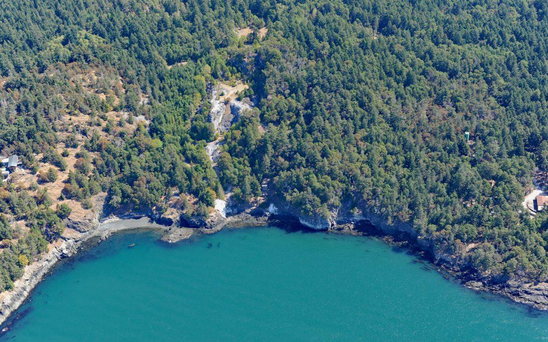
by CoastView | May 29, 2026 | 2026, Developments, Headlands, Historical, Land Use, May 2026, Mines, Natural History, Parks, Washington
Listen to the article here https://coastview.org/wp-content/uploads/2026/02/LimeKilnPoint.mp3 Lime Kiln Point is a 42-acre (17 ha) state park and the site of a historic limestone quarry and kiln on the western shore of San Juan Island, about 6 miles (10 km) south of...

by CoastView | Apr 2, 2026 | 2026, Alaska, April 2026, Beaches, Developments, Embayments, Historical, Kachemak, Land Use, Mines
Listen to the article here https://coastview.org/wp-content/uploads/2026/01/CoalCove.mp3 Coal Cove is the site of a historic Russian coal mine at Dangerous Cape on the north shore entrance to Port Graham, near the southern end of the Kenai Peninsula, about 7 miles (11...

by CoastView | Mar 23, 2026 | 2026, Alaska, Beaches, Developments, Embayments, Historical, Kachemak, Land Use, March 2026, Mines, Natural History
Listen to the article here https://coastview.org/wp-content/uploads/2026/01/ClaimPoint.mp3 Claim Point forms the western shore of Chrome Bay at the northern entrance to Port Chatham on the Kenai Peninsula, about 100 miles (162 km) north-northwest of Kodiak and 33...