
Washington
Recent Articles
More Articles
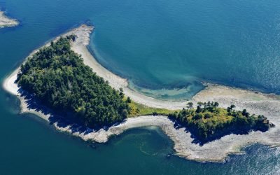
Little Sucia Island, San Juan Islands
Little Sucia Island is part of an archipelago of ten islands including Sucia Island, Ewing, Justice, Herndon, Cluster Islands, and several smaller unnamed islands, about 20 miles (32 km) west of Bellingham and 3.5 miles (5.6 km) north of Eastsound, Washington.
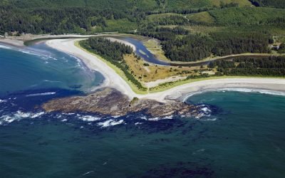
Sooes River, Makah Bay
Sooes River, also known as the Tsoo-Yess River, originates in the northwest foothills of the Olympic Mountains and flows for 16 miles (26 km) through private timberlands and the Makah Reservation until it reaches Makah Bay, about 120 miles (194 km) northwest of Seattle and 4 miles (6.5 km) southwest of Neah Bay, Washington.
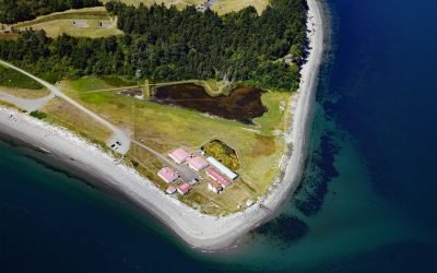
Marrowstone Point, Admiralty Inlet
Marrowstone Point is a low broad spit on Marrowstone Island that marks the entrance to Port Townsend Bay from the Admiralty Inlet, about 38 miles (61 km) north-northwest of Seattle and 3 miles (4.8 km) southeast of Port Townsend, Washington.
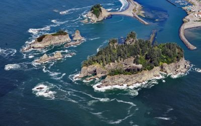
James Island, Quillayute River
James Island has an elevation of over 160 feet (50 m) and is located at the mouth of the Quillayute River, about 32 miles (52 km) south of Neah Bay and 0.6 miles (1 km) west of La Push, Washington.
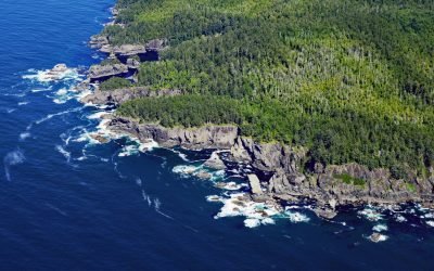
Fuca Pillar, Cape Flattery
Fuca Pillar is a prominent rectangular sea stack on the west side of Cape Flattery, about 18 miles (29 km) southwest of Port Renfrew and 6 miles (10 km) west-northwest of Neah Bay, Washington.
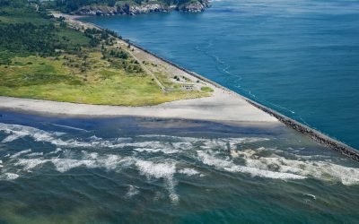
Peacock Spit, Columbia River Bar
Peacock Spit is the northern portion of a mostly submerged sand bar at the mouth of the Columbia River, about 12 miles (19 km) northwest of Astoria and 2.5 miles (4 km) south of Ilwaco, Washington.
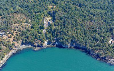
Lime Kiln Point, San Juan Island
Lime Kiln Point is a state park of 42 acres (17 ha) and the site of a historic limestone quarry and kiln on the western shore of San Juan Island, about 6 miles (10 km) south of Roche Harbor and 6 miles (10 km) west of Friday Harbor, Washington.

North Head, Ilwaco
North Head is a rocky promontory with a summit elevation of 300 feet (91 m) and the site of a historic lighthouse situated on Cape Disappointment at the mouth of the Columbia River between Baker Bay to the east and the Pacific Ocean to the west, about 14 miles (23 km) northwest of Astoria and 2 miles (3.2 km) southwest of Ilwaco, Washington.
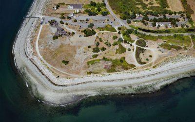
Point Roberts, Strait of Georgia
Point Roberts is a community situated on 3,136 acres (1,269 ha) of the southern tip of the Tsawwassen Peninsula and represents an exclave of the United States in the Strait of Georgia, about 32 miles (52 km) northwest of Bellingham and 15 miles (24 km) west of Blaine, Washington.
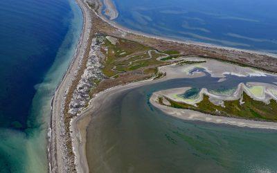
Dungeness Bay, Strait of Juan de Fuca
Dungeness Bay is formed by a complex of depositional features that partially enclose the embayment including Dungeness Spit, Graveyard Spit, Cline Spit, and the Dungeness River delta located on the southern shore of the Strait of Juan de Fuca and the northern coast of the Olympic Peninsula, about 19 miles (31 km) west-northwest of Port Townsend and 14 miles (23 km) east-northeast of Port Angeles, Washington.
About the background graphic
This ‘warming stripe’ graphic is a visual representation of the change in global temperature from 1850 (top) to 2019 (bottom). Each stripe represents the average global temperature for one year. The average temperature from 1971-2000 is set as the boundary between blue and red. The colour scale goes from -0.7°C to +0.7°C. The data are from the UK Met Office HadCRUT4.6 dataset.
Click here for more information about the #warmingstripes.