
Rivers
Recent Articles
More Articles
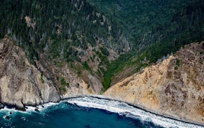
Anderson Gulch, Lost Coast
Anderson Gulch is a small watershed on the Lost Coast of Northern California, between Northport Gulch and Dark Gulch, about 9 miles (15 km) west of Leggett and 2.6 miles (4 km) south-southeast of Wheeler, California.
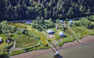
Prosper, Coquille River
Prosper is a historical community on the Coquille River, about 10 miles (16 km) west-southwest of Coquille and 3 miles (5 km) northeast and upstream of Bandon, Oregon.
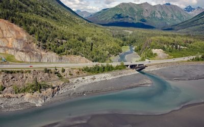
Bird Creek, Turnagain Arm
Bird Creek starts in the Chugach Mountains and flows southwest for 16 miles (26 km) to Turnagain Arm, about 22 miles (35 km) southeast of Anchorage and 12 miles (19 km) west of Girdwood, Alaska.
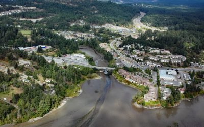
Millstream Creek, Esquimalt Harbour
Millstream Creek is a salmon-bearing stream that drains a watershed with an area of 6,424 acres (2,600 ha) of lakes and wetlands over a distance of 8 miles (12.5 km) before it flows into a tidal estuary in Esquimalt Harbour, about 4.8 miles (7.7 km) northwest of Victoria and 1.8 miles (3 km) east of Langford, British Columbia.
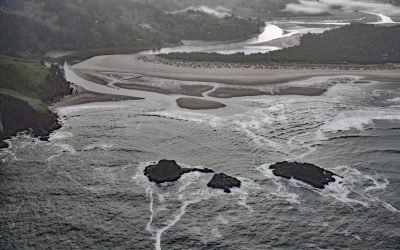
Salmon River Estuary, Cascade Head
Salmon River flows for about 24 miles from the Central Oregon Coast Range, through the Siuslaw National Forest, to the Pacific Ocean south of Cascade Head, about 73 miles (118 km) southwest of Portland and 6 miles (10 km) north of Lincoln City, Oregon.
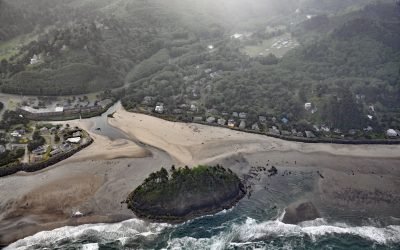
Proposal Rock, Neskowin Creek
Proposal Rock is at the mouth of the Neskowin Creek, about 10 miles (16 km) north-northeast of Lincoln City and 0.5 miles (0.8 km) south-southwest of the community of Neskowin, Oregon.
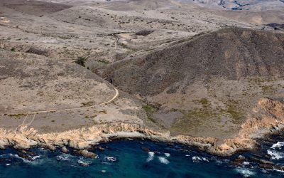
Harmony Headlands, Point Estero
Harmony Headlands State Park preserves an undeveloped parcel of Pacific coastline between Point Estero to the south and Natalie’s Cove to the north, about 7 miles (11 km) west-northwest of Cayucos and 3 miles (5 km) south-southeast of Harmony, California.
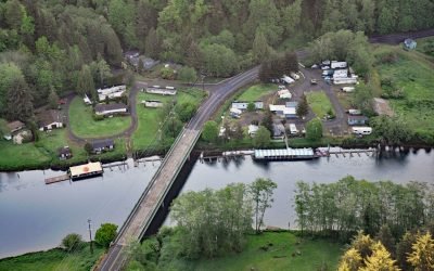
Taylors Landing, Alsea River
Taylors Landing is a small community near the head of the tide on the Alsea River in the Coast Range, about 17.4 miles (28 km) west of Alsea and 6.4 miles (10 km) east-southeast of Waldport, Oregon.
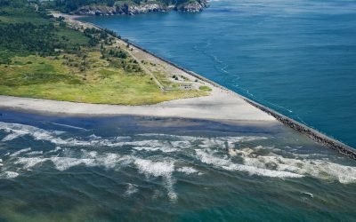
Peacock Spit, Columbia River Bar
Peacock Spit is the northern portion of a mostly submerged sand bar at the mouth of the Columbia River, about 12 miles (19 km) northwest of Astoria and 2.5 miles (4 km) south of Ilwaco, Washington.

Princeton Glacier, Nassau Fjord
Princeton Glacier is on the east side of the Kenai Peninsula, about 37 miles (60 km) south-southeast of Whittier and 38 miles (61 km) east-northeast of Seward, Alaska.
About the background graphic
This ‘warming stripe’ graphic is a visual representation of the change in global temperature from 1850 (top) to 2019 (bottom). Each stripe represents the average global temperature for one year. The average temperature from 1971-2000 is set as the boundary between blue and red. The colour scale goes from -0.7°C to +0.7°C. The data are from the UK Met Office HadCRUT4.6 dataset.
Click here for more information about the #warmingstripes.