
Communities
Recent Articles
More Articles
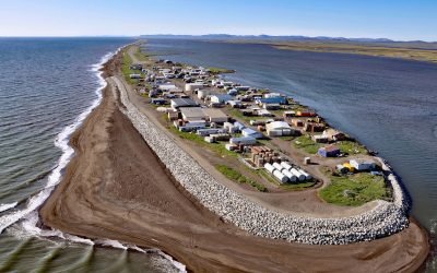
Kivalina, Singauk Entrance
Kivalina is a community located on a barrier island between the Chukchi Sea and Kivalina Lagoon, about 79 miles (127 km) northwest of Kotzebue and 72 miles (116 km) southeast of Point Hope, Alaska.
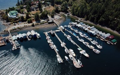
Genoa Bay, Cowichan Bay
Genoa Bay is located between Separation Point and Mount Tzouhalem on the north shore of Cowichan Bay on Vancouver Island, about 33 miles (53 km) southeast of Nanaimo and 5 miles (8 km) east-southeast of Duncan, British Columbia.
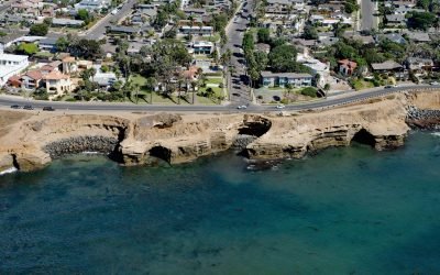
Sunset Cliffs, Point Loma
Sunset Cliffs is a neighborhood adjacent to the Pacific Ocean on the western edge of Point Loma, about 7.5 miles (12 km) south of La Jolla and 5 miles (8 km) west of San Diego, California.
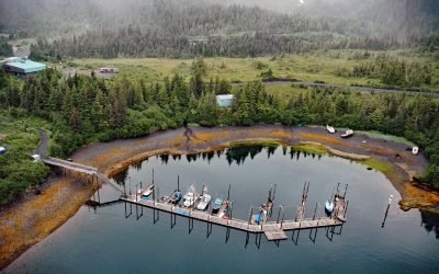
Chenega, Evans Island
Chenega is a village located on the western shore of Crab Bay, on the southeastern coast of Evans Island in Prince William Sound, about 84 miles (135 km) southwest of Cordova and 49 miles (79 km) east of Seward, Alaska.
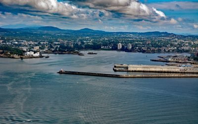
Ogden Point, Victoria
Ogden Point is a deepwater port facility and cruise ship terminal located 21 miles (34 km) north of Port Angeles and 1 mile (1.6 km) southwest of downtown Victoria, British Columbia.
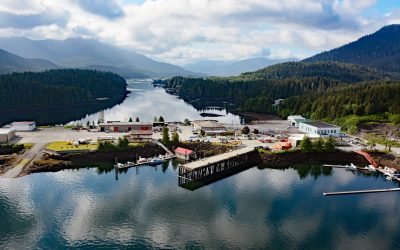
Aero Point, Seal Cove
Aero Point is on the eastern shore of Seal Cove, a small embayment in Prince Rupert Harbour on the north coast of Kaien Island, at the entrance to Fern Passage, about 90 miles (145 km) southeast of Ketchikan and 2 miles (3.2 km) northeast of downtown Prince Rupert, British Columbia.
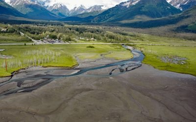
Glacier Creek, Girdwood
Glacier Creek starts from an unnamed glacier on the south flank of Goat Mountain in the Chugach Mountains and flows southwest for 10 miles (16 km) to Turnagain Arm near Girdwood, about 31 miles (50 km) southeast of Anchorage and 20 miles (32 km) northwest of Whittier, Alaska.
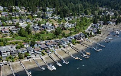
Pleasantside, Port Moody
Pleasantside is a residential neighbourhood located on the northern shore of Port Moody, which is the eastern extension of Burrard Inlet, about 12 miles (19 km) east of Vancouver and 1.5 miles (2.4 km) northwest of the community of Port Moody, British Columbia.
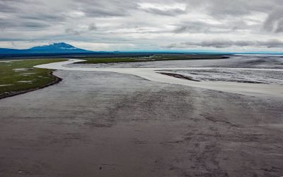
Beluga River, Cook Inlet
Beluga River starts at Beluga Lake and flows southeast for about 30 miles (48 km) to Cook Inlet, about 46 miles (74 km) north-northeast of Kenai and 35 miles (57 km) west of Anchorage, Alaska.
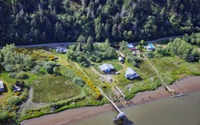
Prosper, Coquille River
Prosper is a historical community on the Coquille River, about 10 miles (16 km) west-southwest of Coquille and 3 miles (5 km) northeast and upstream of Bandon, Oregon.
About the background graphic
This ‘warming stripe’ graphic is a visual representation of the change in global temperature from 1850 (top) to 2019 (bottom). Each stripe represents the average global temperature for one year. The average temperature from 1971-2000 is set as the boundary between blue and red. The colour scale goes from -0.7°C to +0.7°C. The data are from the UK Met Office HadCRUT4.6 dataset.
Click here for more information about the #warmingstripes.