
Parks
Recent Articles
More Articles
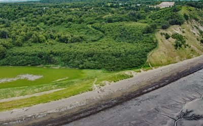
Kincaid Park, Point Campbell
Kincaid Park is 1,517 acres (614 ha) located on Point Campbell between Knik and Turnagain Arms of Cook Inlet, 5.2 miles (8 km) southwest of downtown Anchorage, Alaska.
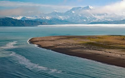
Mount Saint Elias, Icy Bay
Mount Saint Elias is situated at the head of Icy Bay on the Alaska-Canada boundary in the Saint Elias Range, about 165 miles (266 km) east-southeast of Cordova and 67 miles (108 km) northwest of Yakutat, Alaska.

Mount Douglas, Katmai National Park and Preserve
Mount Douglas is a stratovolcano with an elevation of 7,000 feet (2134 m) located on Kamishak Bay, near the northern part of the Alaska Peninsula and within Katmai National Park and Preserve, about 113 miles (182 km) east of King Salmon and 91 miles (147 km) southwest of Homer, Alaska.
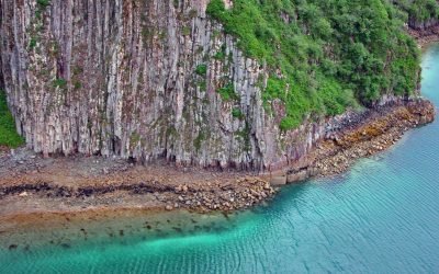
Geographic Harbor, Katmai National Park and Preserve
Geographic Harbor is in Katmai National Park and Preserve and is formed by two large bays that extend 3 miles (5 km) off Amalik Bay on Shelikof Strait, about 86 miles (139 km) southwest of King Salmon and 83 miles (134 km) northwest of Kodiak, Alaska.
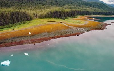
Tracy Arm, Tracy Arm-Fords Terror Wilderness
Tracy Arm is a fjord in the Coast Mountains of Southeast Alaska about 85 miles (137 km) northeast of Sitka and 42 miles (67.7 km) southeast of Juneau, Alaska.
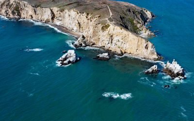
Chimney Rock, Point Reyes
Chimney Rock is an islet that lies off the eastern headland of the Point Reyes Peninsula, connected only at low tide, about 3 miles (4.8 km) east of the Point Reyes Light and 10 miles (16 km) southwest of Inverness, California.
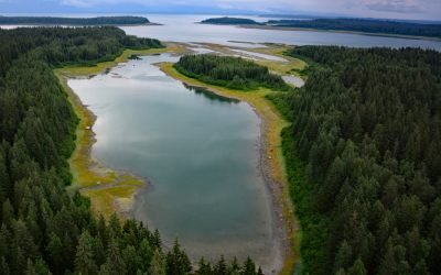
Berg Bay, Glacier Bay National Park and Preserve
Berg Bay is in Glacier Bay National Park and Preserve, and extends west for 4 miles (6.5 km) off Sitakaday Narrows near the mouth of Glacier Bay, about 38 miles (61 km) northwest of Hoonah, and 18 miles (29 km) northwest of Gustavus, Alaska.
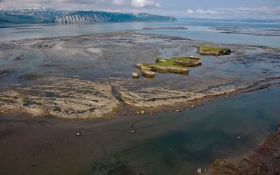
Douglas River Tidal Flats, Kamishak Bay
Douglas River starts at the terminus of an unnamed glacier on the northwest flank of Fourpeaked Mountain in the Aleutian Range on the Alaska Peninsula, and flows north for 28 miles (45 km) to Kamishak Bay, about 108 miles (174 km) northeast of King Salmon and 89 miles (144 km) southwest of Homer, Alaska.
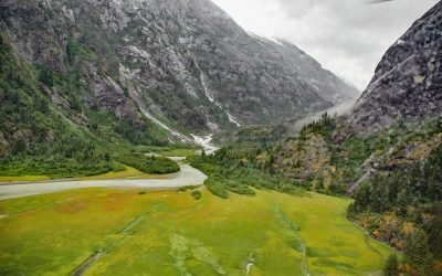
North Dawes Glacier, Endicott Arm
North Dawes Glacier starts from the Stikine Icefield at an elevation of about 5,200 feet (1,585 m) on the western flank of Sheppard Peak and flows generally southwest for 15 miles (24 km) to a proglacial lake at an elevation of 1000 feet (305 m) which is 2 miles (3.2 km) long and drained by a stream 1.3 miles (2.1 km) long at the head of an inlet extending north from Endicott Arm, about 74 miles (119 km) southeast of Juneau and 51 miles (82 km) north of Petersburg, Alaska.

Salmon Creek, Sonoma Coast State Park
Salmon Creek starts at an elevation of 570 feet (174 m) and flows generally southwest for 19 miles (31 km) draining a watershed of 22,487 acres (9,100 ha) between the Northern Coast Ranges and the Pacific Ocean at Salmon Creek Beach in Sonoma Coast State Park, about 20 miles (32 km) southwest of Santa Rosa and 2 miles (3.2 km) northwest of Bodega Bay, California.
About the background graphic
This ‘warming stripe’ graphic is a visual representation of the change in global temperature from 1850 (top) to 2019 (bottom). Each stripe represents the average global temperature for one year. The average temperature from 1971-2000 is set as the boundary between blue and red. The colour scale goes from -0.7°C to +0.7°C. The data are from the UK Met Office HadCRUT4.6 dataset.
Click here for more information about the #warmingstripes.