
Alaska
Recent Articles
More Articles
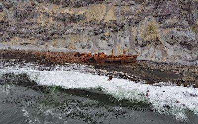
Cape Pankof, Ikatan Peninsula
Cape Pankof is a point of land situated at the eastern tip of the lkatan Peninsula on Unimak Island and the site of the shipwrecked SS Oduna, about 148 miles (239 km) northeast of Dutch Harbor and 18 miles (29 km) southeast of False Pass, Alaska.
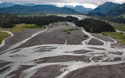
McKeon Flats, Wosnesenski River
McKeon Flats is formed by the Wosnesenski River that flows into Neptune Bay on the south shore of Kachemak Bay on the Kenai Peninsula, about 14 miles (23 km) northeast of Seldovia and 9 miles (14.5 km) southeast of Homer, Alaska.
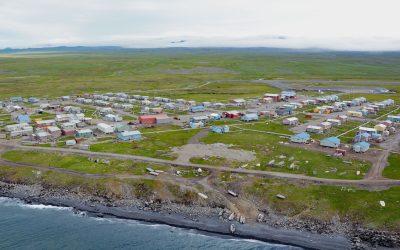
Savoonga, Saint Lawrence Island
Savoonga is a Siberian Yupik community situated on the north flank of the Kookooligit Mountains at Savoonga Point on the north coast of Saint Lawrence Island in the Bering Sea, about 164 miles (265 km) southwest of Nome and 39 miles (63 km) east of Gambell, Alaska.
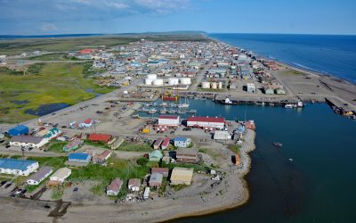
Nome, Norton Sound
Nome is a community at the mouth of the Snake River on the south coast of the Seward Peninsula on Norton Sound, about 289 miles (466 km) northwest of Bethel and 185 miles (298 km) southwest of Kotzebue, Alaska.
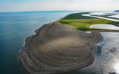
Safety Sound, Nome-Council Highway
Safety Sound is a lagoon along the Nome-Council Highway, formed by barrier beaches with elevations up to 14 feet (4.2 m), which extends 15 miles (24 km) along the north coast of Norton Sound between Cape Nome to the west and the Solomon River to the east, about 52 miles (84 km) west-southwest of Golovin and 20 miles (32 km) east of Nome, Alaska.
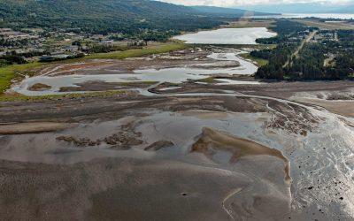
Beluga Slough, Bishops Beach
Beluga Slough is formed by Bishops Beach and is the tidal estuary of a historical stream called Palmer Creek that drained a watershed on the southern flank of Diamond Ridge on the northern shore of Kachemak Bay in the community of Homer, about 121 miles (195 km) southwest of Anchorage and 15 miles (24 km) north-northeast of Seldovia, Alaska.
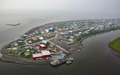
Unalakleet, Norton Sound
Unalakleet is an Iñupiaq-Yup’ik community built on an ancient beach ridge with an elevation of 7 feet (2 m) at the mouth of the Unalakleet River on the eastern coast of Norton Sound, about 145 miles (234 km) southeast of Nome, and 36 miles (58 km) south-southeast of Shaktoolik, Alaska.
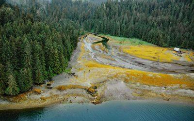
Chomly, Cholmondeley Sound
Chomly is the site of a historic cannery and settlement situated on the south shore of West Arm Cholmondeley Sound on Prince of Wales Island, 28 miles (45 km) west-southwest of Ketchikan and 20 miles (32 km) east-northeast of Hydaburg, Alaska.
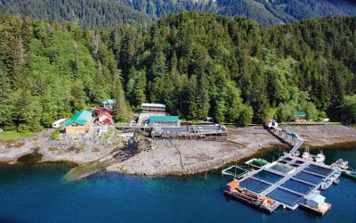
Port Armstrong, Baranof Island
Port Armstrong is an embayment on the southeast coast of Baranof Island, that extends west-southwest for 1.6 miles (2.6 km) from Point Eliza on Chatham Strait, and the site of a historical whaling station and present-day salmon hatchery, about 59 miles (95 km) south-southeast of Sitka and 4 miles (6.5 km) north of Port Alexander, Alaska.
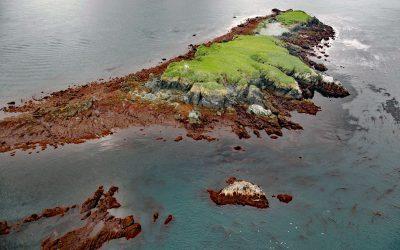
Flat Islands, Kachemak Bay
Flat Islands are situated about 0.8 miles (1.3 km) offshore and 1 mile (1.6 km) north of Point Bede on the Kenai Peninsula along the southern shore of Kachemak Bay in southern Cook Inlet, about 31 miles (50 km) south of Anchor Point and 3 miles (5 km) southwest of Nanwalek, Alaska.
About the background graphic
This ‘warming stripe’ graphic is a visual representation of the change in global temperature from 1850 (top) to 2019 (bottom). Each stripe represents the average global temperature for one year. The average temperature from 1971-2000 is set as the boundary between blue and red. The colour scale goes from -0.7°C to +0.7°C. The data are from the UK Met Office HadCRUT4.6 dataset.
Click here for more information about the #warmingstripes.