
Alaska
Recent Articles
More Articles
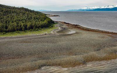
Point Sherman, Lynn Canal
Point Sherman is the site of a historic lighthouse and now a navigational aid marking a shallow ledge that extends 1,600 feet (488 m) from the eastern shore of Lynn Canal and a reef called Sherman Rock situated 2,640 feet (805 m) to the southwest, about 46 miles (74 km) northwest of Juneau and 30 miles (48 km) south-southeast of Haines, Alaska.
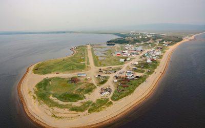
Golovin, Norton Sound
Golovin is a community on the northern shore of Norton Sound in the Bering Sea and situated on a sand spit between Golovnin Lagoon to the north and Golovnin Bay to the south, about 71 miles (114 km) east of Nome and 24 miles (38 km) west-southwest of Elim, Alaska.
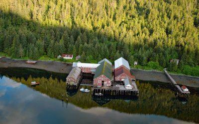
Steamboat Bay, Noyes Island
Steamboat Bay is the site of a historic salmon cannery on the north coast of Noyes Island, part of the Prince of Wales Archipelago in the Gulf of Esquibel of Southeast Alaska, about 122 miles (197 km) southeast of Sitka and 77 miles (124 km) west-northwest of Ketchikan, Alaska.
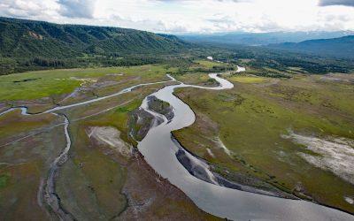
Fox River, Kenai Mountains
Fox River starts at the terminus of the Chernof Glacier in the Kenai Mountains at an elevation of 1,100 feet (335 m) and flows northwest for 11 miles (18 km) and then southwest for 16 miles (26 km) to the Fox River Flats at the head of Kachemak Bay, about 52 miles (84 km) south-southeast of Kenai and 22 miles (35 km) northeast of Homer, Alaska.
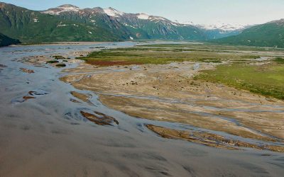
Aguchik River, Kukak Bay
Aguchik River starts at the terminus of Aguchik Glacier at an elevation of about 1,060 feet (323 m) and flows generally southeast for 8 miles (13 km) to the head of Kukak Bay in Katmai National Park and Preserve, about 138 miles (222 km) southwest of Homer and 80 miles (129 km) northwest of Kodiak, Alaska.

Five Fingers, Stephens Passage
Five Fingers is a group of islets and the site of a historic lighthouse situated at the southern entrance to Stephens Passage, about 67 miles (108 km) east-northeast of Sitka and 41 miles (66 km) northwest of Petersburg, Alaska.
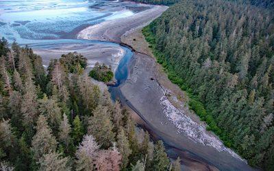
Roller Bay, Noyes Island
Roller Bay is located on the west coast of Noyes Island near a prehistoric rock shelter on Cape Addington to the south, and Cape Ulitka to the north, about 122 miles (196 km) southeast of Sitka and 24 miles (39 km) west of Craig, Alaska.
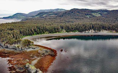
Coal Cove, Port Graham
Coal Cove is the site of a historic Russian coal mine at Dangerous Cape on the north shore entrance to Port Graham near the southern end of the Kenai Peninsula, about 7 miles (11 km) southwest of Seldovia and 3 miles (5 km) north-northeast of Nanwalek, Alaska.
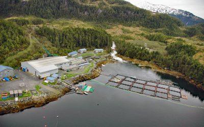
Lake Bay, Esther Island
Lake Bay is the site of a salmon hatchery on the southern coast of Esther Island in northwestern Prince William Sound, and the deglaciated fjord extends 1.5 miles (2.4 km) northwest from Wells Passage, about 63 miles (101 km) west-southwest of Valdez and 20 miles (32 km) east of Whittier, Alaska.
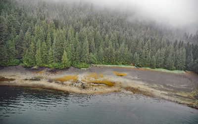
Admiralty Trading Company, Gambier Bay
Gambier Bay is the site of an infamous shipwreck and a historical salmon cannery operated by Admiralty Trading Company near Stephens Passage on the east coast of Admiralty Island, about 61 miles ( km) northwest of Petersburg and 59 miles (km) south-southeast of Juneau, Alaska.
About the background graphic
This ‘warming stripe’ graphic is a visual representation of the change in global temperature from 1850 (top) to 2019 (bottom). Each stripe represents the average global temperature for one year. The average temperature from 1971-2000 is set as the boundary between blue and red. The colour scale goes from -0.7°C to +0.7°C. The data are from the UK Met Office HadCRUT4.6 dataset.
Click here for more information about the #warmingstripes.