
Alaska
Recent Articles
More Articles
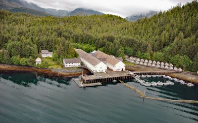
Waterfall Cannery, Ulloa Channel
Waterfall is a historic cannery situated on the west coast of Prince of Wales Island on Ulloa Channel, adjacent to Port Refugio on Suemez Island, approximately 145 miles (234 km) southeast of Sitka and 60 miles (97 km) west of Ketchikan, Alaska.
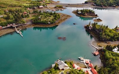
Halibut Cove, Ismailof Island
Halibut Cove is a small community lining the shores of The Narrows, a protected waterway separating Ismailof Island to the north from the Kenai Peninsula to the south, on the southeastern shore of Kachemak Bay, about 20 miles (32 km) northeast of Seldovia and 11 miles (18 km) east-southeast of Homer, Alaska.

Cape Hinchinbrook, Hinchinbrook Island
Cape Hinchinbrook is a headland with a light station on the southwestern point of Hinchinbrook Island in Prince William Sound, about 79 miles (127 km) southeast of Whittier and 37 miles (60 km) southwest of Cordova, Alaska.
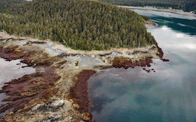
Claim Point, Chrome Bay
Claim Point forms the western shore of Chrome Bay at the northern entrance to Port Chatham on the Kenai Peninsula, the site of a historical chromite mine, about 100 miles (162 km) north-northwest of Kodiak and 33 miles (53 km) south-southwest of Homer, Alaska.
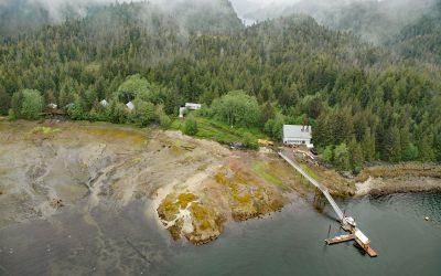
Gwent Cove, Pearse Canal
Gwent Cove is a small community at the site of the historical Hidden Inlet fishing village and cannery located adjacent to and west of the entrance to Hidden Inlet, an estuary that trends generally north for 6 miles (9.7 km) from the western shore of Pearse Canal, 45 miles (72 km) north of Prince Rupert and 61 miles (98 km) southeast of Ketchikan, Alaska.

Guard Islands, Tongass Narrows
Guard Islands are separated from Vallenar Point at the northern tip of Gravina Island by Inside Passage, a channel that connects the northern entrance of Tongass Narrows to the east from Clarence Strait to the west, and are part of an island chain that includes Vallenar Rocks, about 73 miles (118 km) south-southeast of Wrangell and 10 miles (16 km) northwest of Ketchikan, Alaska.
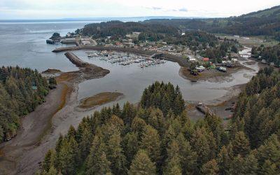
Seldovia, Kachemak Bay
Seldovia is a community situated on the eastern shore of Seldovia Bay and on the southern shore of Kachemak Bay in Cook Inlet, about 136 miles (219 km) southwest of Anchorage and 15 miles (24 km) southwest of Homer, Alaska.
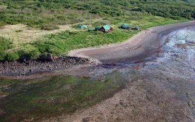
Old Kukak Village, Devils Cove
Old Kukak was a historical Sugpiaq Alutiiq village located on Kukak Point that forms the northern shore of Devils Cove on the Alaska Peninsula in Katmai National Park and Preserve, about 94 miles (152 km) southwest of King Salmon and 74 miles (119 km) northwest of Kodiak, Alaska.
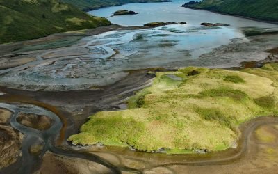
Viekoda Bay, Kodiak National Wildlife Refuge
Viekoda Bay is a deglaciated fjord that extends southeast for 18 miles (29 km) from Shelikof Strait on the northwestern coast of Kodiak Island, with the southern shore in the Kodiak National Wildlife Refuge, about 134 miles (216 km) southwest of Homer and 26 miles (42 km) west-northwest of Kodiak, Alaska.

Cordova Rose, Odiak Slough
Cordova Rose is a landlocked barge that was converted to a guest lodge on the southern shore of Odiak Slough, a tidal embayment on Orca Inlet in Prince William Sound and adjacent to Eyak Lake, about 46 miles (74 km) south-southeast of Valdez and 0.5 miles (0.8 km) south of Cordova, Alaska.
About the background graphic
This ‘warming stripe’ graphic is a visual representation of the change in global temperature from 1850 (top) to 2019 (bottom). Each stripe represents the average global temperature for one year. The average temperature from 1971-2000 is set as the boundary between blue and red. The colour scale goes from -0.7°C to +0.7°C. The data are from the UK Met Office HadCRUT4.6 dataset.
Click here for more information about the #warmingstripes.