
Alaska
Recent Articles
More Articles
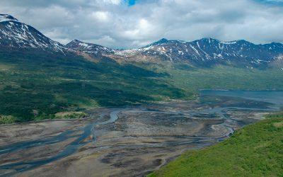
Terror Bay, Kodiak National Wildlife Refuge
Terror Bay is on the northern coast of Kodiak Island and extends about 7 miles (11 km) south from Uganik Passage to the mouth of Terror River in Kodiak National Wildlife Refuge, about 32 miles (52 km) east-northeast of Larsen Bay and 30 miles (48 km) west-southwest of Kodiak, Alaska.

Elfin Cove, Chichagof Island
Elfin Cove is an embayment that extends south from Cross Sound for 1 mile (1.6 km) and narrows to just over 100 feet (30 m) on the western shore of the Inian Peninsula at the northern end of Chichagof Island in Tongass National Forest, about 80 miles (129 km) west of Juneau and 34 miles (55 km) northwest of Hoonah, Alaska.

Dangerous Cape, Port Graham
Dangerous Cape is a headland with an elevation of 66 feet (20 m) on the southern Kenai Peninsula, at the northern entrance of Port Graham near the mouth of Kachemak Bay, about 22 miles (35 km) southwest of Homer and 4 miles (6.5 km) northwest of the community of Port Graham, Alaska.
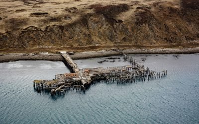
Mutton Cove, Chernofski Harbor
Mutton Cove is an embayment on Unalaska Island about 0.3 miles (0.5 km) across situated on the northern shore of Chernofski Harbor and protected by Observatory Point to the west, about 64 miles (103 km) northeast of Nikolski and 53 miles (85 km) southwest of Dutch Harbor, Alaska.
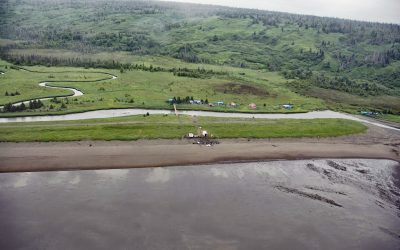
Polly Creek, Cook Inlet
Polly Creek and Little Polly Creek drain a combined watershed of 16,113 acres (6,521 ha), on the southern flank of an unnamed ridge that extends southeast from the summit of Mount Redoubt, and flow generally south for 9 miles (14.5 km) and 8 miles (12.8 km) respectively to the western shore of Cook Inlet, about 56 miles (90 km) northwest of Homer and 46 miles (74 km) southwest of Kenai, Alaska.
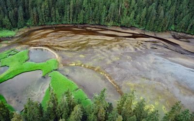
Mink Bay, Boca de Quadra
Mink Bay is an estuary that extends south for 5.4 miles (8.7 km) from Boca de Quadra an embayment on the east side of Revillagigedo Channel, about 54 miles (87 km) north-northwest of Prince Rupert and 40 miles (65 km) southeast of Ketchikan, Alaska.

Twin Hills, Togiak Bay
Twin Hills is a Yup’ik village situated on a distributary channel of the Togiak River at the head of Togiak Bay, about 130 miles (210 km) southeast of Bethel and 64 miles (103 km) west of Dillingham, Alaska.
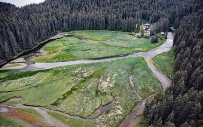
Tutka Bay Lagoon, Kachemak Bay State Park
Tutka Bay Lagoon is the site of a fish hatchery located about 4 miles (6.5 km) inside and on the southern shore of Tutka Bay in Kachemak Bay State Park, about 10 miles (16 km) east of Seldovia and 15 miles (24 km) south-southeast of Homer, Alaska.

SS Yukon, Sanak Island
The steamship Yukon, bound from Goodnews Bay on the Kuskokwim River to Seattle in 1913, ran aground in fog and became a total loss on the northwest end of Sanak Island on what is now called Yukon Reef, about 156 miles (252 km) east-northeast of Dutch Harbor and 48 miles (77 km) south-southwest of King Cove, Alaska.

Point Elrington, Elrington Island
Point Elrington is a tied island connected by a gravel isthmus to the southwestern tip of Elrington Island in the Gulf of Alaska, about 96 miles (155 km) southwest of Cordova and 43 miles (69 km) east-southeast of Seward, Alaska.
About the background graphic
This ‘warming stripe’ graphic is a visual representation of the change in global temperature from 1850 (top) to 2019 (bottom). Each stripe represents the average global temperature for one year. The average temperature from 1971-2000 is set as the boundary between blue and red. The colour scale goes from -0.7°C to +0.7°C. The data are from the UK Met Office HadCRUT4.6 dataset.
Click here for more information about the #warmingstripes.