
Alaska
Recent Articles
More Articles

Kachemak Selo, Fox River Flats
Kachemak Selo is a small community at the head of Kachemak Bay adjacent to the Fox River Flats on the Kenai Peninsula, about 27 miles (44 km) southeast of Ninilchik and 20 miles (32 km) northeast of Homer, Alaska.

Excursion Inlet, Icy Strait
Excursion Inlet is an embayment that extends 11 miles (18 km) north-northwest from the northern coast of Icy Strait to the mouth of Excursion River, about 38 miles (61 km) west-northwest of Juneau and 9.5 miles (15 km) east of Gustavus, Alaska.
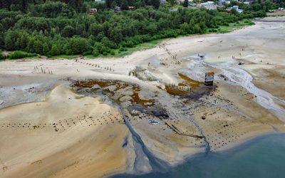
Treadwell Mine, Douglas Island
Treadwell is a historical gold mine on the eastern coast of Douglas Island on Gastineau Channel, about 1.2 miles (1.9 km) southeast of the community of Douglas and 3 miles (4.8 km) southeast of Juneau, Alaska.
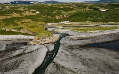
Amakdedori Creek, Kamishak Bay
Amakdedori Creek drains a watershed of 17,781 acres (7,196 ha) on the eastern flank of the Aleutian Range and flows southeast for 10 miles (16 km) to Kamishak Bay, about 26 miles (42 km) southwest of Augustine Island, and 95 miles (153 km) southwest of Homer, Alaska.
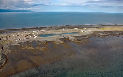
Dudiak Fishing Lagoon, Homer Spit
The Dudiak Fishing Lagoon, also known as the Fishing Hole, is located on the Homer Spit, a peninsula projecting 4 miles (6.5 km) southeast from the northern shore of Kachemak Bay, about 14 miles (23 km) northeast of Seldovia and 4 miles (6.5 km) southeast of Homer, Alaska.
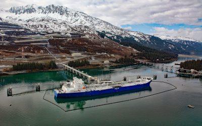
Valdez Marine Terminal, Port Valdez
Valdez Marine Terminal is located on the southern shore of Port Valdez, a fjord in northeastern Prince William Sound that is about 13 miles (21 km) long and trends west-east from Valdez Narrows at the head of Valdez Arm to the mouth of the Lowe River, about 124 miles (200 km) east of Anchorage and 3.5 miles (5.6 km) south of the community of Valdez, Alaska.
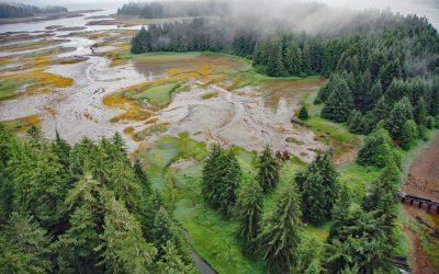
Tyee, Murder Cove
Tyee is the site of a historical cannery and shore whaling station in Murder Cove, an embayment about 0.7 miles (1.2 km) across at the southern tip of Admiralty Island, about 24 miles (39 km) west of Kake and 11 miles (18 km) southeast of Baranof, Alaska.
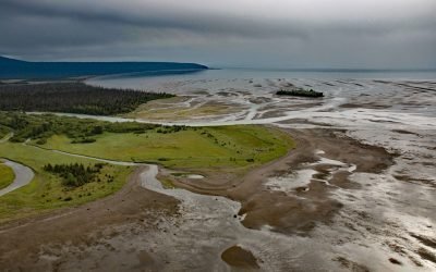
Crescent River, Lake Clark National Park and Preserve
Crescent River is formed by the junction of the North Fork and Lake Fork tributaries, that start in Lake Clark National Park and Preserve, and flows southeast for 12 miles (19 km) to the northern shore of Tuxedni Bay near the entrance on the western coast of Cook Inlet, about 55 miles (89 km) northwest of Homer and 51 miles (82 km) southwest of Kenai, Alaska.

Bradley River, Kachemak Bay
Bradley River is located on the Kenai Peninsula and flows generally northwest for 7 miles (11 km) from Bradley Lake at an elevation of 1,090 feet (332 m) to Kachemak Bay, about 31 miles (50 km) southeast of Ninilchik and 25 miles (40 km) northeast of Homer, Alaska.

Red River, Lake Clark National Park and Preserve
Red River starts from the terminus of Red Glacier on the eastern flank of Mount Iliamna and flows southeast for 7 miles (11.3 km) through Lake Clark National Park and Preserve to the western shore of Cook Inlet, about 126 miles (203 km) southwest of Anchorage and 48 miles (77 km) northwest of Homer, Alaska.
About the background graphic
This ‘warming stripe’ graphic is a visual representation of the change in global temperature from 1850 (top) to 2019 (bottom). Each stripe represents the average global temperature for one year. The average temperature from 1971-2000 is set as the boundary between blue and red. The colour scale goes from -0.7°C to +0.7°C. The data are from the UK Met Office HadCRUT4.6 dataset.
Click here for more information about the #warmingstripes.