
Alaska
Recent Articles
More Articles

Kukak Cannery, Katmai National Park and Preserve
Kukak Bay is the site of a historical razor clam cannery on the western shore of Shelikof Strait, in Katmai National Park and Preserve, about 132 miles (212 km) southwest of Homer and 77 miles (124 km) northwest of Kodiak, Alaska.
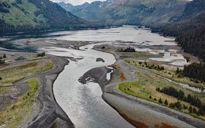
Koyuktolik Bay, Cook Inlet
Koyuktolik Bay, also known as Dogfish or Dog Salmon Bay, is about 2 miles (3.2 km) wide and located near the entrance to Kachemak Bay on the southeastern shore of Cook Inlet at the southwest tip of the Kenai Peninsula, about 30 miles (48 km) southwest of Homer and 15 miles (24 km) southwest of Seldovia, Alaska.
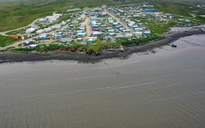
Toksook Bay, Nelson Island
Toksook Bay is a Yup’ik community on Nelson Island, in the Yukon-Kuskokwim Delta, about 112 miles (181 km) west-southwest of Bethel and 13.5 miles (22 km) west-northwest of Nightmute, Alaska.
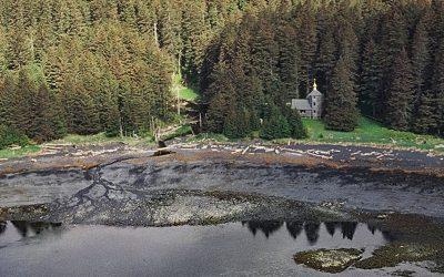
Monks Lagoon, Spruce Island
Monks Lagoon is on Icon Bay, a bight about 1 mile (1.6 km) across, on the southeastern shore of Spruce Island, about 6.6 miles (10.6 km) north of Kodiak and 5.7 miles (9 km) south-southeast of Ouzinkie, Alaska.
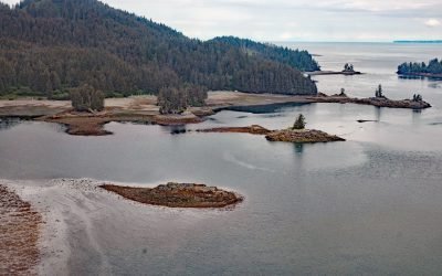
Jakolof Bay, Kachemak Bay
Jakolof Bay is on the Kenai Peninsula, on the southeastern Shore of Kachemak Bay, about 13 miles (21 km) south of Homer and 6.5 miles (10.5 km) east-northeast of Seldovia, Alaska.
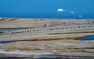
Cross Island, Beaufort Sea
Cross Island is an Arctic barrier island, about 2 miles (3.2 km) long, located between McClure Islands to the southeast and Midway Islands to the west on the Beaufort Sea coast, about 74 miles (119 km) northeast of Nuiqsut and 24 miles (40 km) north-northeast of Deadhorse, Alaska.

Bay of Pillars, Kuiu Island
Bay of Pillars is on the west coast of Kuiu Island and 1.5 miles (2.4 km) across between Point Sullivan to the north and Point Ellis to the south, about 52 miles (84 km) southeast of Sitka and 52 miles (84 km) west-southwest of Petersburg, Alaska.
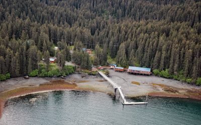
Kasitsna Bay Laboratory, Kachemak Bay
Kasitsna Bay Laboratory is a marine research facility located on a shallow embayment about 1.2 miles (1.9 km) wide, about 12 miles (19 km) south of Homer and 6.3 miles (10 km) northeast of Seldovia, Alaska.
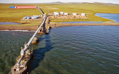
Red Dog Mine, Chukchi Sea
Red Dog is a zinc and lead mine about 46 miles (74 km) inland from the Chukchi Sea coast and connected by road to an export terminal, about 62 miles (100 km) northwest of Kotzebue and 16 miles (26 km) southeast of Kivalina, Alaska.

Harriman Glacier, Prince William Sound
Harriman Glacier is 8 miles (13 km) long, and trends northeast to its terminus at the head of Harriman Fjord, in Prince William Sound, about 74 miles (119 km) west-southwest of Valdez and 16 miles (26 km) northeast of Whittier, Alaska.
About the background graphic
This ‘warming stripe’ graphic is a visual representation of the change in global temperature from 1850 (top) to 2019 (bottom). Each stripe represents the average global temperature for one year. The average temperature from 1971-2000 is set as the boundary between blue and red. The colour scale goes from -0.7°C to +0.7°C. The data are from the UK Met Office HadCRUT4.6 dataset.
Click here for more information about the #warmingstripes.