
Alaska
Recent Articles
More Articles
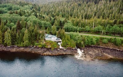
Whitman Creek, Revillagigedo Island
Whitman Creek is on the southeast coast of Revillagigedo Island, about 14 miles (23 km) north of Metlakatla and 7 miles (11 km) east-southeast of Ketchikan, Alaska.
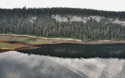
Fossil Bluffs, Kuiu Island
Fossil Bluffs is on the northeast shore of Halleck Harbor near the northern entrance of Saginaw Bay on Kuiu Island, about 42 miles (68 km) southeast of Sitka and 17 miles (27 km) southwest of Kake, Alaska.

Tiger Glacier, Icy Bay
Tiger Glacier flows east for 8 miles (13 km) to a tidewater terminus at the head of Icy Bay in Prince William Sound, approximately 98 miles (158 km) southwest of Valdez and 42 miles (68 km) east-southeast of Whittier, Alaska.
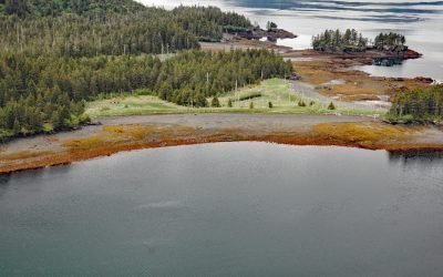
Portlock Cannery, Port Chatham
Portlock is a historical salmon cannery in Port Chatham, an embayment on the southern coast of the Kenai Peninsula, about 102 miles (164 km) north-northeast of Kodiak and 10 miles (16 km) south-southeast of Port Graham, Alaska.

McArthur River, Trading Bay
McArthur River flows southeast to Trading Bay on the west coast of Cook Inlet, approximately 65 miles (105 km) southwest of Anchorage and 29 miles (46 km) northwest of Kenai, Alaska.
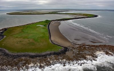
Cape Etolin, Nunivak Island
Cape Etolin is a point of land extending about 4.6 miles (7.4 km) north into the Bering Sea on the northern coast of Nunivak Island, about 50 miles (80 km) west of Nightmute on the mainland and 4 miles (6 km) north-northeast of Mekoryuk, Alaska.

Blackstone Glacier, Blackstone Bay
Blackstone Glacier flows north for 7 miles (11 km), terminating at tidewater at the head of Blackstone Bay, about 87 miles (140 km) west-southwest of Valdez and 8 miles (13 km) south of Whittier, Alaska.
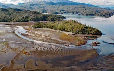
Chugachik Island, Kachemak Bay
Chugachik Island lies between Bear Cove to the south and Martin River to the north on the Kenai Peninsula, about 18 miles (29 km) northeast of Homer and 3.3 miles (5.3 km) south-southeast of Kachemak Selo, Alaska.

Cataract Glacier, Surprise Inlet
Cataract Glacier flows to the southern shore of Surprise Inlet, a fjord in Prince William Sound, about 51 miles (82 km) east-southeast of Anchorage and 20 miles (32 km) northeast of Whittier, Alaska.

Black Bear Creek, Cleveland Peninsula
Black Bear Creek is located on the southwest coast of the Cleveland Peninsula, approximately 52 miles (84 km) south of Wrangell and 35 miles (56 km) northwest of Ketchikan, Alaska.
About the background graphic
This ‘warming stripe’ graphic is a visual representation of the change in global temperature from 1850 (top) to 2019 (bottom). Each stripe represents the average global temperature for one year. The average temperature from 1971-2000 is set as the boundary between blue and red. The colour scale goes from -0.7°C to +0.7°C. The data are from the UK Met Office HadCRUT4.6 dataset.
Click here for more information about the #warmingstripes.