
Alaska
Recent Articles
More Articles
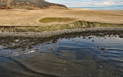
Amak Island, Bering Sea
Amak is a volcanic island situated in the Bering Sea that measures about 2 miles (3.2 km) wide and nearly 3 miles (4.8 km) longitudinally, about 172 miles (277 km) northeast of Dutch Harbor and 22 miles (35 km) northwest of Cold Bay, Alaska.

Tutka River, Kachemak Bay
The Tutka River flows generally westward to the head of Tutka Bay, a fjord on the southern coast of Kachemak Bay, approximately 18 miles (29 km) southeast of Homer and 15 miles (24 km) east of Seldovia, Alaska.
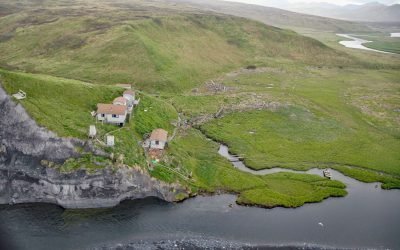
Ayakulik River, Kodiak Island
The Ayakulik River flows generally south for 30 miles (48 km) to the Shelikof Strait coast of Kodiak Island, about 89 miles (143 km) southwest of Kodiak and 22 miles (35 km) northwest of Akhiok, Alaska.

Southwestern Glacier, Northwestern Fjord
Southwestern Glacier is in Northwestern Fjord, a deep embayment in Kenai Fjords National Park and Preserve, about 50 miles (81 km) northeast of Homer and 33 miles (53 km) southwest of Seward, Alaska.
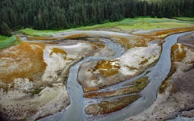
Sumdum Mine, Sanford Cove
Sumdum is a historical mine and community located at the head of Sanford Cove, an embayment on the southern shore of Endicott Arm, about 64 miles (103 km) north-northwest of Petersburg and 55 miles (89 km) southeast of Juneau, Alaska.
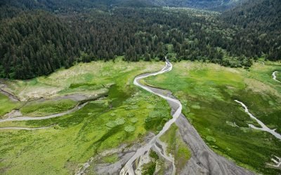
Sadie River, Kachemak Bay
Sadie River starts on the western flank of the Kenai Mountains at an elevation of about 3,200 feet (975 m) and flows generally west-northwest for 6 miles (10 km) through Kachemak Bay State Park to the head of Sadie Cove, about 14.5 miles (23 km) south-southeast of Homer and 13 miles (20 km) east-northeast of Seldovia, Alaska.
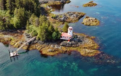
Sitka Lighthouse, Galankin Islands
Sitka Lighthouse is privately owned and located at the northwestern end of Galankin Island in Sitka Sound between the Beardslee Islands to the west and Ball Islets to the east, about 43 miles (69 km) southwest of Angoon and 1 mile (1.6 km) south-southwest of Sitka, Alaska.

Cape Elizabeth, Chugach Islands
Cape Elizabeth forms the western shore of Elizabeth Island and is located on the north side of Kennedy Entrance, about 96 miles (155 km) north-northeast of Kodiak and 36 miles (58 km) south-southwest of Homer, Alaska.
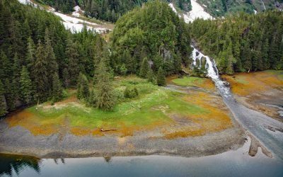
Cliff Falls, Deep Cove
Cliff Falls is the outlet for Cliff Lake, located at the head of Deep Cove, approximately 1.1 miles (1.8 km) west of Patterson Point, about 41 miles (66 km) south-southeast of Sitka, and 17.5 miles (28 km) north-northwest of Port Armstrong, Alaska.
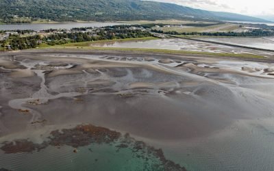
Mariner Lagoon, Kachemak Bay
Mariner Lagoon is located at the base of the Homer Spit in Kachemak Bay, approximately 1 mile (1.6 km) southeast of Homer, Alaska.
About the background graphic
This ‘warming stripe’ graphic is a visual representation of the change in global temperature from 1850 (top) to 2019 (bottom). Each stripe represents the average global temperature for one year. The average temperature from 1971-2000 is set as the boundary between blue and red. The colour scale goes from -0.7°C to +0.7°C. The data are from the UK Met Office HadCRUT4.6 dataset.
Click here for more information about the #warmingstripes.