
Alaska
Recent Articles
More Articles
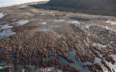
Cape Cleare, Montague Island
Cape Cleare is a headland on the southwest end of Montague Island, at the entrance to Montague Strait that leads to Prince William Sound, about 60 miles (97 km) southeast of Seward, Alaska.

Amherst Glacier, College Fjord
Amherst Glacier flows northwest for 4 miles (6.5 km) from the Chugach Mountains to a terminus lake, located 5.5 miles (9 km) northeast of Point Pakenham in College Fjord, the northwestern-most part of Prince William Sound, and 52 miles (83 km) southwest of Valdez, Alaska.
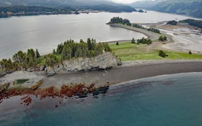
Point Naskowhak, Seldovia Bay
Point Naskowhak was once an island at the entrance to Seldovia Bay, but is now considered a tied-island, connected to the mainland by a tombolo or spit, about 15 miles (24 km) southwest of Homer and 1.5 miles (2.4 km) northwest of Seldovia, Alaska.

Beaver Falls Creek, George Inlet
Beaver Falls Creek is on Revillagigedo Island, on the western shore of George Inlet, 5.3 miles (8.5 km) northeast of Ketchikan, Alaska.
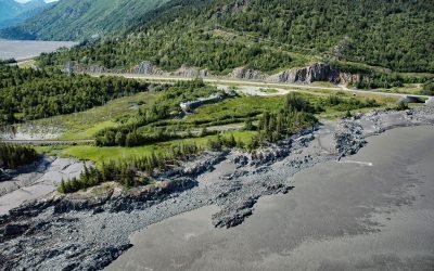
Bird Point, Turnagain Arm
Bird Point is on the north shore of Turnagain Arm in Cook Inlet, 4 miles (6.5 km) southwest of the community of Bird Creek, and 7.5 miles (13 km) west of Girdwood, Alaska.

Barry Glacier, Harriman Fjord
Barry Glacier flows southwest for 16 miles (25 km) to Barry Arm of Harriman Fjord in northwestern Prince William Sound, about 33 miles (53 km) northeast of Whittier and 58 miles (93 km) east of Anchorage, Alaska.
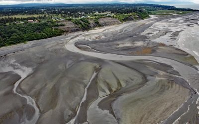
Anchor River, Anchor Point
Anchor River is on the Kenai Peninsula, flowing west for about 30 miles (48 km) from Bald Mountain to a lagoon at Anchor Point on Cook Inlet’s eastern shore, about 14 miles (23 km) northwest of Homer, Alaska.
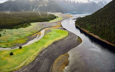
Delight Creek, McCarty Lagoon
Delight Creek flows generally southwest for 2 miles (3.2 km) from Delight Lake to the entrance of McCarty Lagoon, approximately 51 miles (82 km) southwest of Seward and 43 miles (69 km) east-southeast of Homer, Alaska.

Mount Edgecumbe, Kruzof Island
Mount Edgecumbe is a dormant volcano with an elevation of 3,201 feet (976 m) on the southern coast of Kruzof Island, about 100 miles (161 km) southwest of Juneau and 16 miles (26 km) west of Sitka, Alaska.

Chip Cove Cannery, Moser Bay
Chip Cove is an embayment between Luchek Mountain to the south and Peak 2001 to the north, and the site of a historical salmon cannery on the western shore of Moser Bay near Olga Narrows on the southwestern coast of Kodiak Island, about 83 miles (131 km) southwest of Kodiak and 6 miles (10 km) north of Akhiok, Alaska.
About the background graphic
This ‘warming stripe’ graphic is a visual representation of the change in global temperature from 1850 (top) to 2019 (bottom). Each stripe represents the average global temperature for one year. The average temperature from 1971-2000 is set as the boundary between blue and red. The colour scale goes from -0.7°C to +0.7°C. The data are from the UK Met Office HadCRUT4.6 dataset.
Click here for more information about the #warmingstripes.