
Alaska
Recent Articles
More Articles

Copper Harbor, Hetta Inlet
Copper Harbor is an embayment on Prince of Wales Island on the eastern shore of Hetta Inlet, near the historical Coppermount mine, about 38 miles (61 km) west-southwest of Ketchikan and 8.6 miles (14 km) east-northeast of Hydaburg, Alaska.

Ford Arm, Chichagof Island
Ford Arm is an embayment approximately 0.3 miles (483 m) wide and 4 miles (6.5 km) long on the west coast of Chichagof Island, about 44 miles (71 km) north-northwest of Sitka and 28 miles (44 km) south-southeast of Pelican, Alaska.
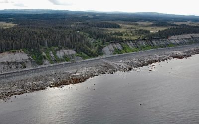
Travers Creek, Kachemak Bay
Travers Creek flows generally west-southwest to the north shore of Kachemak Bay, approximately 3.5 miles (5.5 km) south of Anchor Point and 12 miles (19 km) northwest of Homer, Alaska.
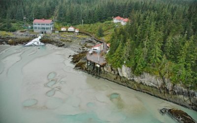
Annex Creek, Taku Inlet
Annex Creek flows southeast for 5 miles (8 km) through the Annex Lakes to Taku Inlet, about 0.35 miles (0.6 km) southwest of the Annex Creek hydroelectric power facility and 12 miles (19 km) east of Juneau, Alaska.
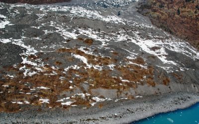
Vassar Glacier, College Fjord
Vassar Glacier flows southeast for 4.3 miles (7 km) from the eastern flank of Peak 8080 in the Chugach Mountains to the western shore of College Fjord near the confluence of Harvard Arm and Yale Arm and 2 miles (3.2 km) west of College Point, about 52 miles (83 km) west of Valdez and 42 miles (68 km) northeast of Whittier, Alaska.
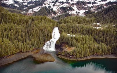
Cascade Falls, Eaglek Bay
Cascade Falls descends to Cascade Bay, an estuary extending 1.5 miles (2.4 km) northwest from Eaglek Bay in northern Prince William Sound, about 52 miles (84 km) west-southwest of Valdez and 32 miles (51.5 km) east-northeast of Whittier, Alaska.

MacDonald Spit, Kasitsna Bay
MacDonald Spit forms the northwestern shore of Kasitsna Bay on the southern coast of Kachemak Bay, approximately 11 miles (18 km) south of Homer and 5 miles (8 km) northeast of Seldovia, Alaska.
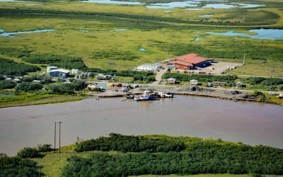
Alakanuk, Yukon River Delta
Alakanuk is a Yup’ik community located at the eastern entrance of Alakanuk Pass, a major distributary channel of the Yukon River, approximately 162 miles (261 km) northwest of Bethel and 8 miles (13 km) southwest of Emmonak, Alaska.

Lindenberger Cannery, Craig Island
The Lindenberger Packing Company is a historical salmon cannery on Craig Island, located in the present-day community of Craig, about 58 miles (93 km) west-northwest of Ketchikan and 6 miles (10 km) south-southwest of Klawock, Alaska.
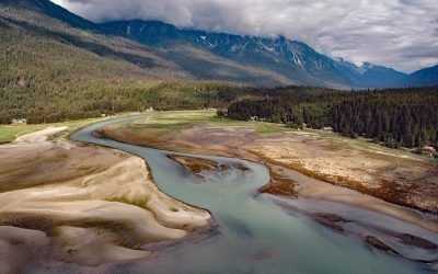
Chilkoot, Lutak Inlet
Chilkoot is a historical Tlingit village located on the Chilkoot River between Lutak Inlet to the south and Chilkoot Lake to the north, about 83 miles (134 km) north-northwest of Juneau and 12 miles (19 km) southwest of Skagway, Alaska.
About the background graphic
This ‘warming stripe’ graphic is a visual representation of the change in global temperature from 1850 (top) to 2019 (bottom). Each stripe represents the average global temperature for one year. The average temperature from 1971-2000 is set as the boundary between blue and red. The colour scale goes from -0.7°C to +0.7°C. The data are from the UK Met Office HadCRUT4.6 dataset.
Click here for more information about the #warmingstripes.