
Alaska
Recent Articles
More Articles
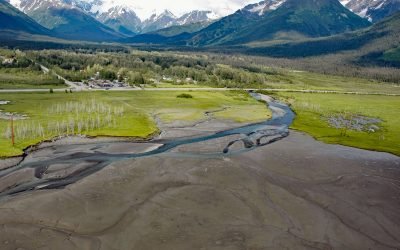
Glacier Creek, Girdwood
Glacier Creek starts from an unnamed glacier on the south flank of Goat Mountain in the Chugach Mountains and flows southwest for 10 miles (16 km) to Turnagain Arm near Girdwood, about 31 miles (50 km) southeast of Anchorage and 20 miles (32 km) northwest of Whittier, Alaska.
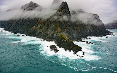
Chankliut Island, Castle Cape
Chankliut Island is 2.9 miles (4.7 km) long and 0.9 miles (1.5 km) wide, located 6 miles (10 km) south of Castle Cape in the Pacific Ocean, about 240 miles (387 km) southwest of Kodiak and 15 miles (24 km) southeast of Chignik, Alaska.
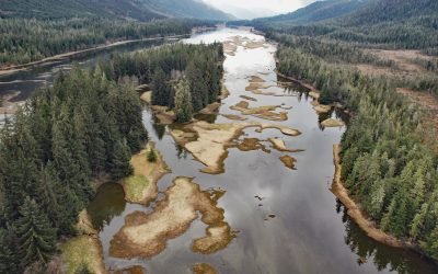
Blind Slough, Mitkof Island
Blind Slough is an estuary about 4 miles (6.5 km) long forming the lower course of the Blind River, that flows northwest on Mitkof Island to Wrangell Narrows, about 24 miles (39 km) northwest of Wrangell and 12 miles (19 km) south of Petersburg, Alaska.
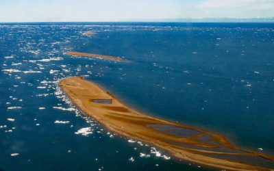
Jeannette Island, McClure Islands
Jeannette Island is a barrier island about 0.5 miles (0.8 km) long, and one of McClure Islands on the Beaufort Sea coast, about 92 miles (148 km) west-northwest of Kaktovik and 25 miles (40 km) northeast of Deadhorse, Alaska.
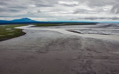
Beluga River, Cook Inlet
Beluga River starts at Beluga Lake and flows southeast for about 30 miles (48 km) to Cook Inlet, about 46 miles (74 km) north-northeast of Kenai and 35 miles (57 km) west of Anchorage, Alaska.
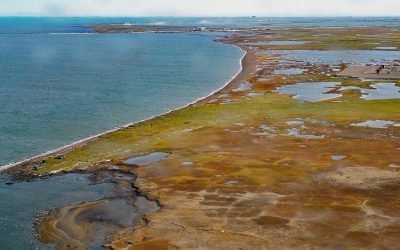
Point McIntyre, Stefansson Sound
Point McIntyre is a low point of land at the west entrance to Prudhoe Bay, in Stefansson Sound on the Beaufort Sea coast, about 196 miles (316 km) southeast of Utqiaġvik and 120 miles (194 km) west of Kaktovik, Alaska.
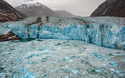
Dawes Glacier, Endicott Arm
Dawes Glacier originates from the Stikine Icefield near the Alaska-Canada boundary and flows northwest for 20 miles (32 km) to tidewater in Endicott Arm, about 100 miles (161 km) northeast of Sitka and 80 miles (129 km) southeast of Juneau, Alaska.
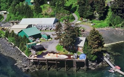
Kitoi Bay Hatchery, Afognak Island
Kitoi Bay is a cove about 0.5 miles (0.8 km) across, located on the west side of Izhut Bay on the southeast coast of Afognak Island, about 105 miles (169 km) southwest of Homer and 28 miles (45 km) north of Kodiak, Alaska.
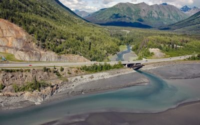
Bird Creek, Turnagain Arm
Bird Creek starts in the Chugach Mountains and flows southwest for 16 miles (26 km) to Turnagain Arm, about 22 miles (35 km) southeast of Anchorage and 12 miles (19 km) west of Girdwood, Alaska.
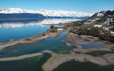
Golden Mine, Port Wells
Golden is a historical mining community on Port Wells, a fjord in northwestern Prince William Sound, about 60 miles (97 km) southwest of Valdez and 27 miles (44 km) northeast of Whittier, Alaska.
About the background graphic
This ‘warming stripe’ graphic is a visual representation of the change in global temperature from 1850 (top) to 2019 (bottom). Each stripe represents the average global temperature for one year. The average temperature from 1971-2000 is set as the boundary between blue and red. The colour scale goes from -0.7°C to +0.7°C. The data are from the UK Met Office HadCRUT4.6 dataset.
Click here for more information about the #warmingstripes.