
Alaska
Recent Articles
More Articles
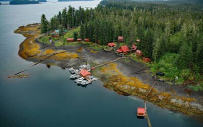
Cannery Cove, Pybus Bay
Cannery Cove is an embayment on the western shore of Pybus Bay in the Kootznoowoo Wilderness, on the southern coast of Admiralty Island, about 70 miles (113 km) south of Juneau and 24 miles (39 km) north-northwest of Kake, Alaska.
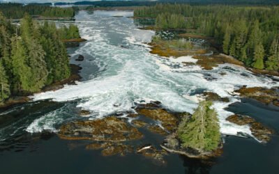
North Entrance, Big Salt Lake
North Entrance is a channel connecting Big Salt Lake to Shinaku Inlet at the head of San Alberto Bay on the west coast of Prince of Wales Island in Southeast Alaska, about 66 miles (106 km) south-southwest of Wrangell and 5 miles (8 km) north of Klawock, Alaska.
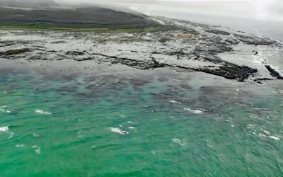
Cape Suckling, Suckling Hills
Cape Suckling is an area of wave eroded rocky reefs backed by dunes, and farther inland lie the Suckling Hills and the terminus of the Bering Glacier, about 150 miles (241 km) west-northwest of Yakutat and 73 miles (117 km) southeast of Cordova, Alaska.
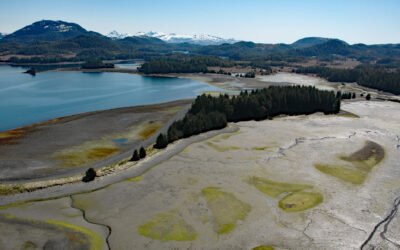
Canoe Passage, Hawkins Island
Canoe Passage is a State of Alaska Marine Park covering 2,507 acres (1,015 ha), encompassing both shores of a small-boat passage running northwest–southeast through Hawkins Island, in southeastern Prince William Sound, about 44 miles (71 km) south-southeast of Valdez and 11 miles (18 km) west of Cordova, Alaska.
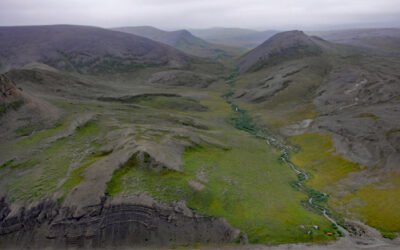
Cape Lewis, Lisburne Peninsula
Cape Lewis is a 1,222-foot (372 m) promontory with steep sea cliffs situated between Ukinyak Creek to the north and Kiliktakgot Creek to the south, 11 miles (18 km) south of Cape Lisburne on the Lisburne Peninsula, about 107 miles (172 km) southwest of Point Lay and 27 miles (44 km) north-northeast of Point Hope, Alaska.
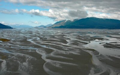
Dry Strait, Stikine River Delta
Dry Strait is a tidal channel in the Stikine Flats, part of the Stikine River delta separating Mitkof Island to the west from Dry Island to the east in the Stikine-LeConte Wilderness, about 21 miles (34 km) southeast of Petersburg and 11 miles (18 km) north-northwest of Wrangell, Alaska.
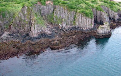
Takli Island, Amalik Bay
Takli Island is in Amalik Bay, between Cape Ilktugitak to the southwest and Cape Atushagvik to the northeast, along the Shelikof Strait coast of the Alaska Peninsula in Katmai National Park and Preserve, about 154 miles (248 kilometers) southwest of Homer and 81 miles (130 kilometers) west-northwest of Kodiak, Alaska.
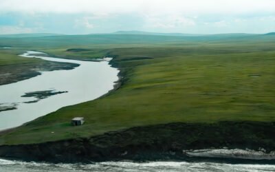
Pitmegea River, Cape Sabine
The Pitmegea River originates at an elevation of about 1,300 feet (396 meters) in the De Long Mountains of the western Brooks Range, and flows northwest for 37 miles (60 kilometers) to the Chukchi Sea at Cape Sabine, about 70 miles (113 kilometers) south-southwest of Point Lay and 66 miles (106 kilometers) northeast of Point Hope, Alaska.
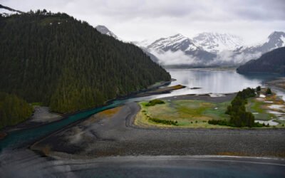
James Lagoon, McCarty Fjord
James Lagoon is a drowned cirque basin about 0.5 miles (0.8 km) wide, partially enclosed by the remains of a terminal moraine, on the western shore of McCarty Fjord in Kenai Fjords National Park, about 51 miles (82 km) southwest of Seward and 40 miles (64 km) east-southeast of Homer, Alaska.
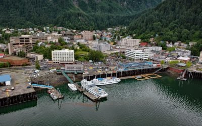
Juneau, Gastineau Channel
Juneau is the state capital, situated at the mouth of Gold Creek on Gastineau Channel, about 93 miles (150 km) northeast of Sitka and 87 miles (140 km) south-southeast of Skagway, Alaska.
About the background graphic
This ‘warming stripe’ graphic is a visual representation of the change in global temperature from 1850 (top) to 2019 (bottom). Each stripe represents the average global temperature for one year. The average temperature from 1971-2000 is set as the boundary between blue and red. The colour scale goes from -0.7°C to +0.7°C. The data are from the UK Met Office HadCRUT4.6 dataset.
Click here for more information about the #warmingstripes.