
Alaska
Recent Articles
More Articles
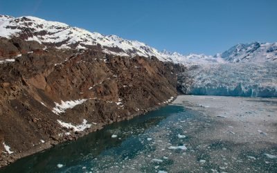
Yale Glacier, College Fjord
Yale Glacier is a massive tidewater glacier in College Fjord of Prince William Sound that starts at an elevation of 9,270 feet (2,826 m) between Mount Cardozo and Mount Einstein in the Chugach Mountains and flows generally southwest for 17 miles (27 km) to Yale Arm, about 48 miles (77 km) northeast of Whittier and 43 miles (69 km) west-northwest of Valdez, Alaska.
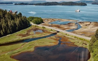
Old Sitka, Starrigavan Bay
Old Sitka is the site of a historical Russian settlement called Redoubt Saint Archangel Michael on the southern shore of Starrigavan Bay in Sitka Sound on the west coast of Baranof Island, about 232 miles (373 km) southeast of Yakutat and 5.5 miles (9 km) north of Sitka, Alaska.
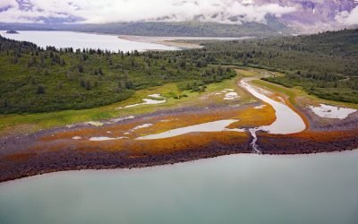
Scidmore Bay, Gilbert Peninsula
Scidmore Bay, enclosed by the Gilbert Peninsula to the east and the Fairweather Mountains to the west, lies in Glacier Bay National Park and Preserve, about 119 miles (192 km) southeast of Yakutat and 43 miles (69 km) northwest of Gustavus, Alaska.
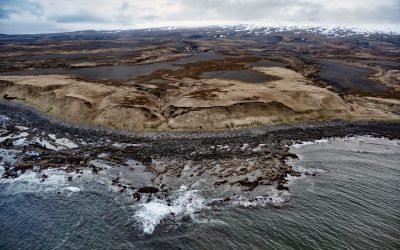
Mount Westdahl, Unimak Island
Mount Westdahl, also known as Westdahl Peak, is a relatively young, glacier-capped volcano with a summit elevation of 5,118 feet (1,560 m) situated at the southwest end of Unimak Island in the eastern Aleutian Islands, about 527 miles (848 km) southwest of Kodiak and 87 miles (140 km) northeast of Dutch Harbor, Alaska.
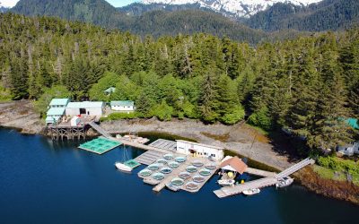
Little Port Walter, Baranof Island
Little Port Walter is an embayment and research facility on the southern shore of Port Walter, situated on the southeastern coast of Baranof Island and the western shore of Chatham Strait, about 53 miles (85 km) south-southeast of Sitka and 9 miles (14.5 km) north of Port Alexander, Alaska.
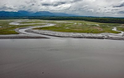
Eagle River Flats, Knik Arm
Eagle River Flats is a 2,471‐acre (1,000‐ha) tidal flat and salt marsh at the mouth of Eagle River on Eagle Bay, on the eastern shore of Knik Arm at Joint Base Elmendorf–Richardson, about 10 miles (16 km) northeast of Anchorage and 7 miles (11 km) west of Eagle River, Alaska.
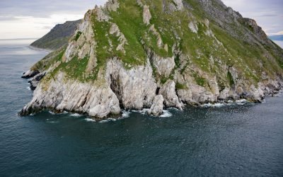
Sledge Island, Bering Sea
Sledge Island, 1.5 miles (2.4 km) across, lies in the Bering Sea, 5 miles (8 km) off the Seward Peninsula’s south coast, about 95 miles (153 km) southeast of Wales and 25 miles (40 km) west of Nome, Alaska.
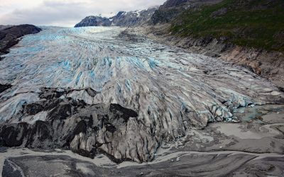
Reid Glacier, Glacier Bay National Park and Preserve
Reid Glacier flows north for 11 miles from the Brady Icefield to Reid Inlet in Glacier Bay National Park and Preserve, about 113 miles (182 km) southeast of Yakutat and 50 miles northwest of Gustavus, Alaska.
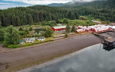
Icy Strait Point, Port Frederick
Icy Strait Point is a restored historic salmon cannery situated on Cannery Point, on the south shore of Icy Strait and on the eastern shore at the mouth of Port Frederick, a deep embayment on the northeast coast of Chichagof Island, about 22 miles (35 km) south-southeast of Gustavus and 1.6 miles (2.6 km) north-northwest of Hoonah, Alaska.
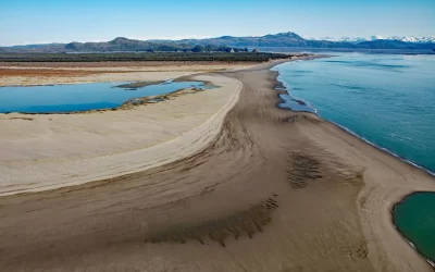
Strawberry Hill, Point Bentinck
Strawberry Hill is a series of uplifted beach ridges on Point Bentinck, at the eastern tip of Hinchinbrook Island and the southern entrance to Strawberry Channel, which separates the island from the mainland, about 53 miles (85 km) south of Valdez and 17 miles (27 km) southwest of Cordova, Alaska.
About the background graphic
This ‘warming stripe’ graphic is a visual representation of the change in global temperature from 1850 (top) to 2019 (bottom). Each stripe represents the average global temperature for one year. The average temperature from 1971-2000 is set as the boundary between blue and red. The colour scale goes from -0.7°C to +0.7°C. The data are from the UK Met Office HadCRUT4.6 dataset.
Click here for more information about the #warmingstripes.