
Alaska
Recent Articles
More Articles
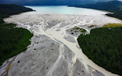
Geikie Inlet, Glacier Bay
Geikie Inlet is a fjord about 8 miles (13 km) long that trends generally northeast from the mouth of the Geikie River to the western coast of Glacier Bay, in Glacier Bay National Park and Preserve, about 130 miles (209 km) southeast of Yakutat and 32 miles (51 km) northwest of Gustavus, Alaska.
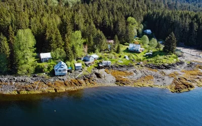
Loring, Naha Bay
Loring is a small community at the site of a historical salmon cannery on the west coast of Revillagigedo Island, at the head of Naha Bay and near the mouth of the Naha River, about 66 miles (106 km) south-southeast of Wrangell and 17 miles (27 km) north of Ketchikan, Alaska.
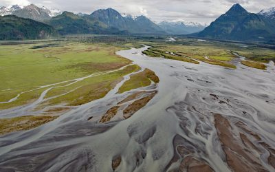
West Glacier Creek, Chinitna Bay
West Glacier Creek flows generally south-southeast for about 7 miles (11 km) to the north shore of Chinitna Bay, draining a watershed between the Chigmit Mountains and Mount Iliamna, about 83 miles (134 km) southwest of Kenai and 60 miles (97 km) west-northwest of Homer, Alaska.
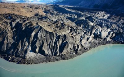
Grand Pacific Glacier, Tarr Inlet
Grand Pacific Glacier flows from elevations between 4,925-9,845 feet (1500–3000 m) on the British Columbia-Alaska boundary to Tarr Inlet in Glacier Bay National Park and Preserve, about 100 miles (161 km) southeast of Yakutat and 66 miles (106 km) north-northwest of Gustavus, Alaska.
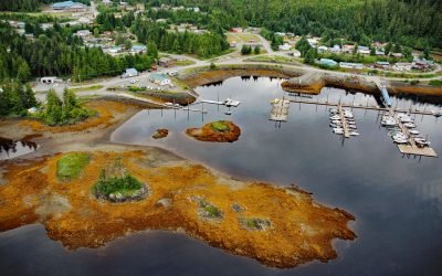
Thorne Bay, Prince of Wales Island
Thorne Bay is a small community, and an estuary of the Thorne River on the eastern coast of Prince of Wales Island, the largest of approximately 1,100 islands interspersed by marine channels in the Alexander Archipelago of Southeast Alaska, about 55 miles (89 km) southwest of Wrangell and 42 miles (68 km) northwest of Ketchikan, Alaska.
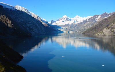
Johns Hopkins Inlet, Glacier Bay National Park and Preserve
Johns Hopkins Inlet is a fjord in Glacier Bay National Park and Preserve that starts at the terminus of the Johns Hopkins Glacier and extends for about 10 miles (16 km) to the head of Glacier Bay, about 106 miles (171 km) southeast of Yakutat and 58 miles (93 km) northwest of Gustavus, Alaska.
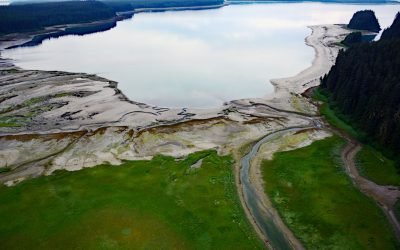
Beartrack Cove, Glacier Bay National Park and Preserve
Beartrack Cove is an estuary about 3 miles (4.8 km) long and 1.6 miles (2.6 km) wide situated at the mouth of the Beartrack River in Glacier Bay National Park and Preserve, about 46 miles (74 km) south-southwest of Haines and 14 miles (23 km) north-northwest of Gustavus, Alaska.
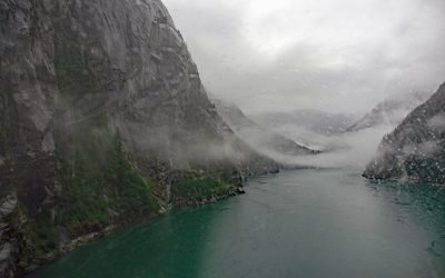
Fords Terror, Endicott Arm
Fords Terror is a fjord in the Coast Mountains of Southeast Alaska that trends generally south for 8 miles (13 km) to Endicott Arm, about 64 miles (103 km) southeast of Juneau and 57 miles (92 km) north-northwest of Petersburg, Alaska.

Ultramarine Glacier, Blue Fjord
Ultramarine Glacier is located at the head of Blue Fjord, a glacial estuary that trends generally north for 4.5 miles (7.3 km) to Port Nellie Juan in western Prince William Sound on the east coast of the Kenai Peninsula, about 87 miles (140 km) west of Cordova and 26 miles (42 km) southeast of Whittier, Alaska.
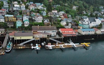
Ketchikan, Revillagigedo Island
Ketchikan is a coastal community and U.S. port of entry on the north shore of Tongass Narrows, on the southern coast of Revillagigedo Island, about 88 miles (142 km) northwest of Prince Rupert and 84 miles (135 km) south-southeast of Wrangell, Alaska.
About the background graphic
This ‘warming stripe’ graphic is a visual representation of the change in global temperature from 1850 (top) to 2019 (bottom). Each stripe represents the average global temperature for one year. The average temperature from 1971-2000 is set as the boundary between blue and red. The colour scale goes from -0.7°C to +0.7°C. The data are from the UK Met Office HadCRUT4.6 dataset.
Click here for more information about the #warmingstripes.