
Alaska
Recent Articles
More Articles
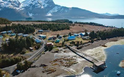
Tatitlek, Prince William Sound
Tatitlek is a small Chugach Alutiiq community located on the northeastern shore of Tatitlek Narrows across from Bligh Island and at the mouth of Boulder Bay on the eastern shore of Prince William Sound, about 24 miles (38 km) southwest of Valdez and 39 miles (63 km) northwest of Cordova, Alaska.
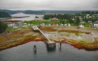
Angoon, Kootznahoo Inlet
Angoon is a historic Tlingit village located on an isthmus at the mouth of Kootznahoo Inlet on the eastern shore of Chatham Strait and the west coast of Admiralty Island, about 77 miles (124 km) northwest of Petersburg and 60 miles (97 km) southwest of Juneau, Alaska.
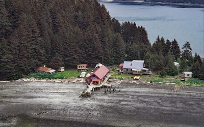
Hogg Island, Bluefox Bay
Hogg Island is the site of a historical fox farm and herring reduction plant situated in Bluefox Bay on Shelikof Strait and the northwest coast of Afognak Island, about 91 miles (147 km) southwest of Homer and 47 miles (76 km) north-northwest of Kodiak, Alaska.
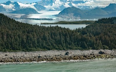
Grand Plateau Glacier, Fairweather Range
Grand Plateau Glacier starts on the north flank of Mount Fairweather in the Fairweather Range of the Saint Elias Mountains and flows generally northwest for 19 miles (31 km) where it splits into two terminal lobes, with the southern lobe flowing 6 miles (10 km) to Grand Plateau Lake, about 142 miles (229 km) northwest of Juneau and 70 miles (113 km) southeast of Yakutat, Alaska.
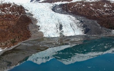
Wellesley Glacier, College Fjord
Wellesley Glacier flows for about 4.5 miles (7 km) from the Chugach Mountains and terminates at a lagoon on the west side of College Fjord, about 55 miles (89 km) west of Valdez and 40 miles (64 km) northeast of Whittier, Alaska.
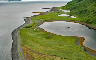
Three Saints Harbor, Kodiak Island
Three Saints Harbor is the location of a historical Russian settlement established in 1784 on Three Saints Bay on the east coast of Kodiak Island, about 63 miles (101 km) southwest of Kodiak and 29 miles (47 km) northeast of Akhiok, Alaska.
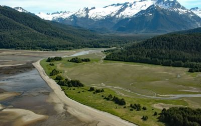
Eagle River Beach, Favorite Channel
Eagle Beach is at the mouth of Eagle River on the eastern shore of Favorite Channel, about 68 miles (109 km) south-southeast of Skagway and 22 miles (35 km) northwest of Juneau, Alaska.
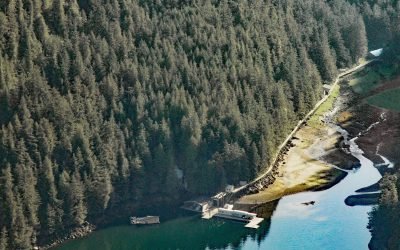
Bell Island, Behm Canal
Bell Island is the site of a historic hot spring on Behm Canal, in the Alexander Archipelago of Southeast Alaska, about 49 miles (79 km) southeast of Wrangell and 40 miles (64 km) north-northeast of Ketchikan, Alaska.
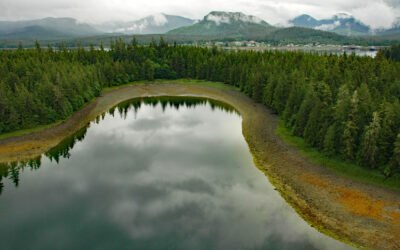
Spook Island, Hydaburg
Spook Island is in Cordova Bay, on the west coast of Prince of Wales Island, about 23 miles (37 km) southeast of Craig and across Sukkwan Strait from and 0.75 miles (1.2 km) west of Hydaburg, Alaska.
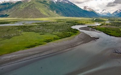
Portage, Turnagain Arm
Portage is a historical community and railroad siding at milepost 64.2 on the Alaska Railroad at the head of Turnagain Arm in the Chugach National Forest, about 41 miles (66 km) south of Anchorage and 11 miles (18 km) northwest of Whittier, Alaska.
About the background graphic
This ‘warming stripe’ graphic is a visual representation of the change in global temperature from 1850 (top) to 2019 (bottom). Each stripe represents the average global temperature for one year. The average temperature from 1971-2000 is set as the boundary between blue and red. The colour scale goes from -0.7°C to +0.7°C. The data are from the UK Met Office HadCRUT4.6 dataset.
Click here for more information about the #warmingstripes.