
Alaska
Recent Articles
More Articles
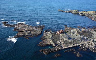
McIver Bight, Unalaska Island
McIver Bight is a cove on the southwestern coast of Unalaska Island, 825 miles (1,330 km) southwest of Anchorage and 38 miles (62 km) southwest of Dutch Harbor, Alaska.
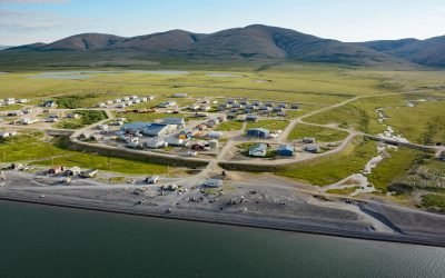
Brevig Mission, Port Clarence
Brevig Mission is an Iñupiat village located on Brevig Lagoon, on the north shore of Port Clarence, about 151 miles (244 km) southwest of Kotzebue and 81 miles (130 km) northwest of Nome, Alaska.
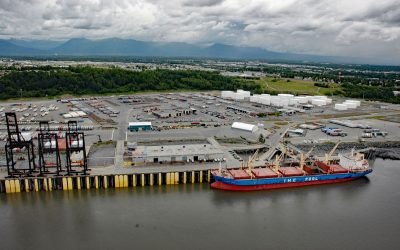
Port of Anchorage, Cook Inlet
Port of Anchorage is on the southeastern shore of Knik Arm at the head of Cook Inlet, about 75 miles (121 km) north of Seward and 1.5 miles (2.4 km) north of downtown Anchorage, Alaska.
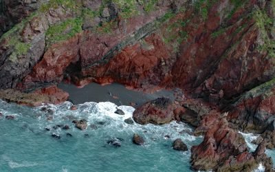
Red River, Kodiak Island
Red River is a stream on Kodiak Island that flows south for about 4.5 miles (7 km) to Shelikof Strait, 2 miles (3.2 km) east of Bumble Bay, and about 80 miles (129 km) southwest of Kodiak and 6 miles (10 km) northwest of Ayakulik, Alaska.
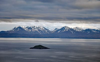
Jude Island, Alaska Peninsula
Jude Island is about 0.2 miles (0.3 km) across and located off the Alaska Peninsula between Unga and Wosnesenski islands, about 48 miles (77 km) northeast of King Cove and 24 miles (39 km) west-southwest of Sand Point, Alaska.
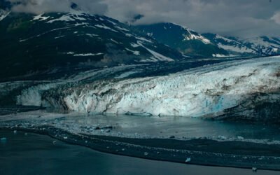
Turner Glacier, Disenchantment Bay
Turner Glacier starts at an elevation of roughly 11,000 feet (3,353 m) on the eastern flank of Mount Cook in the Saint Elias Mountains and flows generally southeast for 21 miles (34 km) to Disenchantment Bay at the head of Yakutat Bay, about 214 miles (344 km) east-southeast of Cordova and 33 miles (53 km) north of Yakutat, Alaska.

Mary Island, Revillagigedo Channel
Mary Island is the site of a historic lighthouse located between Felice Strait to the west and Revillagigedo Channel to the east, about 64 miles (103 km) north-northwest of Prince Rupert, British Columbia and 25 miles (40 km) southeast of Ketchikan, Alaska.

Kipnuk, Kuguklik River
Kipnuk is a Central Yup’ik village situated on a sharp bend of the Kuguklik River, 5 miles (8 km) upstream from the estuary in Kinak Bay on the Bering Sea, about 98 miles (158 km) southwest of Bethel and 18 miles (29 km) south-southeast of Chefornak, Alaska.

Stardust Bay, Sedanka Island
Stardust Bay is situated on the southeast coast of Sedanka Island, which is separated from Unalaska Island by Udagak Strait to the west and Beaver Inlet to the north, about 780 miles (1258 km) southwest of Anchorage and 16 miles (26 km) southeast of Dutch Harbor, Alaska.

Will Rogers-Wiley Post Memorial, Walakpa Bay
Will Rogers-Wiley Post Memorial is at Walakpa Bay, a coastal inlet that extends 6 miles (10 km) east from the Chukchi Sea and is fed by a watershed of 56,487 acres (22,860 ha), about 76 miles (123 km) northeast of Wainwright and 11 miles (18 km) southwest of Utqiaġvik, Alaska.
About the background graphic
This ‘warming stripe’ graphic is a visual representation of the change in global temperature from 1850 (top) to 2019 (bottom). Each stripe represents the average global temperature for one year. The average temperature from 1971-2000 is set as the boundary between blue and red. The colour scale goes from -0.7°C to +0.7°C. The data are from the UK Met Office HadCRUT4.6 dataset.
Click here for more information about the #warmingstripes.