
Alaska
Recent Articles
More Articles
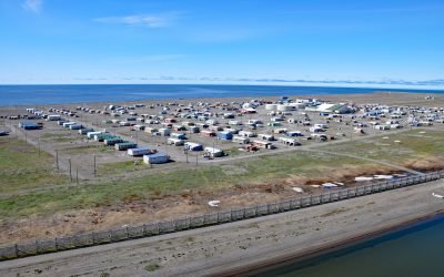
Point Hope, Marryat Inlet
Point Hope is an Iñupiaq whaling community also known as Tikiġaq or Tigara, situated on a barrier spit that extends northwest from Cape Thompson and joins another spit that extends southwest from the Lisburne Peninsula to enclose several lagoons including Marryat Inlet and forms the Tigara Peninsula, about 228 miles (367 km) southwest of Wainwright and 73 miles (118 km) northwest of Kivalina, Alaska.

Valdez, Mineral Creek
Valdez is a community situated on the outwash fan of Mineral Creek on the north shore and near the head of Port Valdez in northeastern Prince William Sound, about 82 miles (132 km) east-northeast of Whittier and 46 miles (74 km) north-northwest of Cordova, Alaska.

Kotzebue, Baldwin Peninsula
Kotzebue is a community situated between Cape Blossom to the south and Pipe Spit to the east near the tip of the Baldwin Peninsula that separates Kotzebue Sound from Hotham Inlet, about 149 miles (240 km) southeast of Point Hope and 73 miles (117 km) west-northwest of Selawik, Alaska.
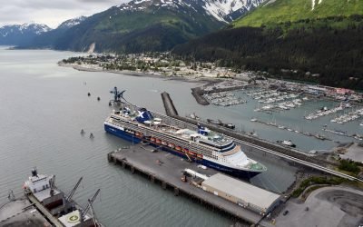
Seward, Resurrection Bay
Seward is a historic community at the base of Mount Marathon on the western shore of Resurrection Bay on the Kenai Peninsula and near the mouth of the Resurrection River, about 80 miles (129 km) west-northwest of Homer and 79 miles (127 km) south of Anchorage, Alaska.
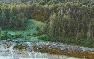
Goddard, Hot Springs Bay
Goddard is a historic settlement situated in Hot Springs Bay on the west coast of Baranof Island, about 92 miles (148 km) west of Petersburg and 15 miles (24 km) south of Sitka, Alaska.

Hunter Bay, Prince of Wales Island
Hunter Bay is the estuary for several watersheds that support important sockeyes salmon populations and the site of a historical salmon cannery on the west coast of Prince of Wales Island near the abandoned village of Klinkwan, about 89 miles (143 km) northwest of Prince Rupert, British Columbia, and 42 miles (68 km) southwest of Ketchikan, Alaska.

Campbell Creek, Turnagain Arm
Campbell Creek starts at the confluence of the North and South forks in Campbell Park on the western flank of the Chugach Mountains and flows generally southwest for 10 miles (16 km) through the city of Anchorage to Campbell Lake, and the lake outflow then enters Turnagain Arm about 8 miles (13 km) northwest of Potter and 6.5 miles (10.5 km) south-southwest of downtown Anchorage, Alaska.
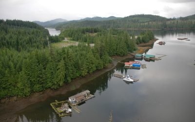
Naukati Bay, Prince of Wales Island
Naukati Bay is a community at the site of a former logging camp and log transfer facility situated on a peninsula on the western coast of Prince of Wales Island between Little Naukati Bay to the northwest, Kaikli Cove to the northeast, Naukati Bay to the east, and across Tuxekan Passage from Tuxekan Island to the west, about 71 miles (114 km) northwest of Ketchikan and 18 miles (29 km) southwest of Coffman Cove, Alaska.

Calder, Shakan Strait
Calder is a mining camp for a historic marble quarry and present-day limestone mine situated at the mouth of Marble Creek on Shakan Strait near the entrance to El Capitan Passage on Prince of Wales Island, about 92 miles (148 km) northwest of Ketchikan and 12 miles (19 km) south-southeast of Port Protection, Alaska.

Deering, Kotzebue Sound
Deering is a community situated on a barrier spit at the mouth of the Inmachuk River on Kotzebue Sound on the northern coast of the Seward Peninsula between Cape Deceit to the west and Ninemile Point to the east, about 155 miles (250 km) east-northeast of Point Hope and 57 miles (92 km) south of Kotzebue, Alaska.
About the background graphic
This ‘warming stripe’ graphic is a visual representation of the change in global temperature from 1850 (top) to 2019 (bottom). Each stripe represents the average global temperature for one year. The average temperature from 1971-2000 is set as the boundary between blue and red. The colour scale goes from -0.7°C to +0.7°C. The data are from the UK Met Office HadCRUT4.6 dataset.
Click here for more information about the #warmingstripes.