
Alaska
Recent Articles
More Articles

Hubbard Glacier, Disenchantment Bay
Hubbard Glacier originates from icefields at an elevation of around 11,000 feet (3,400 m) in the Centennial Range of the Saint Elias Mountains in Kluane National Park and Reserve and flows about 48 miles (77 km) to the Alaska border and then continues for another 28 miles (45 km) through Wrangell-Saint Elias National Park to its terminus in Disenchantment Bay, about 220 miles (355 km) east-southeast of Cordova and 32 miles (52 km) north-northeast of Yakutat, Alaska.
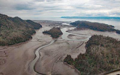
China Poot Creek, Kachemak Bay
China Poot Creek starts at an elevation of about 3,500 feet (1,067 m) on the western flank of the Kenai Mountains and flows for 5.6 miles (9 km) to China Poot Lake, also called Leisure Lake, at an elevation of 168 feet (51 m), and then for another 0.9 miles (1.5 km) to China Poot Bay on the southeastern shore of Kachemak Bay, about 19 miles (31 km) northeast of Seldovia and 13 miles (21 km) southeast of Homer, Alaska.
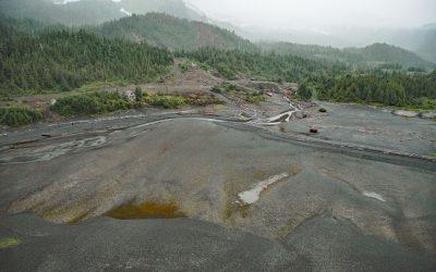
Beatson Copper Mine, Latouche Island
Beatson Copper Mine and the abandoned mining community of Latouche are situated at the base of Mount Beatson and adjacent to Powder Point near the northwest tip of Latouche Island in Prince William Sound, about 82 miles (132 km) southwest of Cordova and 57 miles (92 km) southeast of Whittier, Alaska.
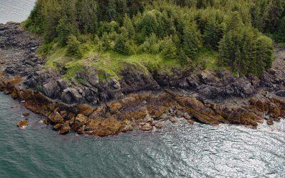
Point Lena, Favorite Channel
Point Lena is located on Favorite Channel, between Point Stephens to the north and Point Louisa to the south, and is the site of an infamous historical shipwreck and the present-day Ted Stevens Marine Research Institute, about 63 miles (102 km) south-southeast of Haines and 14 miles (23 km) northwest of Juneau, Alaska.
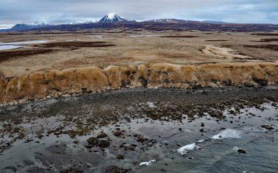
Unga Island Petrified Forest, Shumagin Islands
Unga Island is part of the Shumagin Islands situated south of the Alaska Peninsula in the Gulf of Alaska, and the site of a petrified forest exposed along the eroding northern shore, about 64 miles (103 km) northeast of King Cove and 11 miles (18 km) northwest of Sand Point, Alaska.
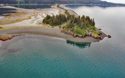
Nubble Point, Kasitsna Bay
Nubble Point is a bedrock outcrop connected to the Kenai Peninsula mainland by MacDonald Spit which forms and separates Kasitsna Bay from Kachemak Bay, about 11 miles (18 km) south of Homer and 6.5 miles (10.5 km) northeast of Seldovia, Alaska.
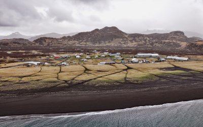
Perryville, Alaska Peninsula
Perryville is an Alutiiq Sugpiaq community established on the south coast of the Alaska Peninsula between Three Star Point to the west and Coal Cape to the east, about 66 miles (106 km) northeast of Sand Point and 41 miles (66 km) southwest of Chignik, Alaska.
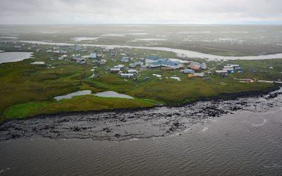
Newtok, Yukon-Kuskokwim Delta
Newtok is a Central Yup’ik community located between the Ningaluk River to the south and a tidal slough to the north, 19 miles (31 km) upstream from the Bering Sea in the Yukon-Kuskokwim Delta, about 125 miles (202 km) south of Emmonak and 96 miles (155 km) west of Bethel, Alaska.

Tyndall Glacier, Taan Fjord
Tyndall Glacier starts at an elevation of about 10,000 feet (3,050 m) in the Saint Elias Mountains near the Canadian border, between Mount Huxley to the west and Mount Saint Elias to the east, and flows generally south-southwest for 13 miles (21 km) to the head of Taan Fjord in Icy Bay, about 160 miles (258 km) east-southeast of Cordova and 68 miles (110 km) northwest of Yakutat, Alaska.
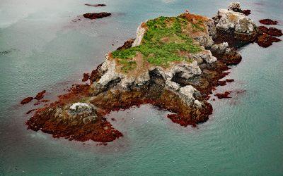
Gull Island, Kachemak Bay
Gull Island is about 633 feet (193 m) long and 93 feet (28 m) high and is situated about 0.6 miles (1 km) northwest of Moosehead Point near the entrance to Peterson Bay on the southeast shore of Kachemak Bay, and about 17 miles (27 km) northeast of Seldovia and 8 miles (13 km) southeast of Homer, Alaska.
About the background graphic
This ‘warming stripe’ graphic is a visual representation of the change in global temperature from 1850 (top) to 2019 (bottom). Each stripe represents the average global temperature for one year. The average temperature from 1971-2000 is set as the boundary between blue and red. The colour scale goes from -0.7°C to +0.7°C. The data are from the UK Met Office HadCRUT4.6 dataset.
Click here for more information about the #warmingstripes.