
British Columbia
Recent Articles
More Articles
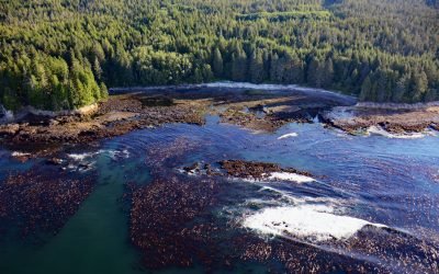
Botanical Beach, Juan de Fuca Provincial Park
Botanical Beach is located on San Juan Point in Botany Bay at the northern end of Juan de Fuca Provincial Park on the south coast of Vancouver Island, about 50 miles (80 km) west-northwest of Victoria and 2 miles (3 km) south-southwest of Port Renfrew, British Columbia.
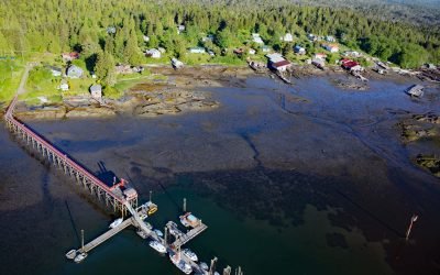
Dodge Cove, Digby Island
Dodge Cove is a small community located on Digby Island, across from Kaien Island on the west side of Prince Rupert Harbour, about 88 miles (142 km) southeast of Ketchikan and 3 miles (5 km) southwest of Prince Rupert, British Columbia.
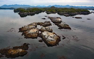
Prager Islands, Hecate Strait
Prager Islands is a group of islands, islets, and tidal reefs in Hecate Strait, situated between Dolphin Island to the east and Goschen Island to the northwest, which are part of the Gitxaala Nii Luutiksm Conservancy within the Great Bear Rainforest, about 39 miles (63 km) south-southwest of Prince Rupert and 4 miles (6.4 km) west-southwest of Kitkatla, British Columbia.
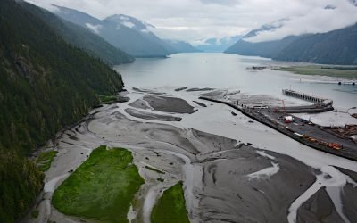
Portland Canal, International Boundary
Portland Canal is a deglaciated fjord that extends south-southwest for 65 miles (105 km) from the community of Stewart in the north to the head of Portland Inlet in the south, forming part of the international boundary between Southeast Alaska and British Columbia, Canada.
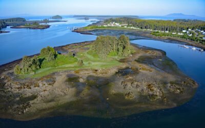
Metlakatla, Venn Passage
Metlakatla is a small Tsimshian community located on the northern shore of Venn Passage, about 87 miles (140 km) southeast of Ketchikan and 5 miles (8 km) west-northwest of Prince Rupert, British Columbia.
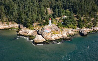
Point Atkinson Lighthouse, Burrard Inlet
Lighthouse Park was historically called Point Atkinson, a headland that together with Point Grey to the south, defines the entrance to Burrard Inlet, a fjord incising the lower mainland of British Columbia, about 33 miles (53 km) northeast of Nanaimo and 8 miles (13 km) northwest of downtown Vancouver, British Columbia.
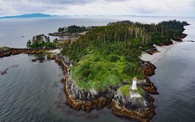
Lucy Islands, Chatham Sound
Lucy Islands is a small group of islets and reefs situated 26 miles (42 km) south of the Alaska border at the intersection of Brown Passage and Chatham Sound, about 83 miles (134 km) southeast of Ketchikan and 12 miles (19 km) west of Prince Rupert, British Columbia.
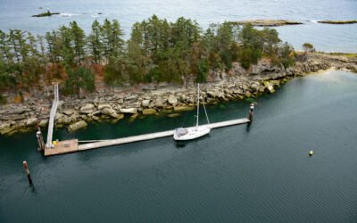
Kendrick Island, Wakes Cove Provincial Park
Kendrick Island is surrounded by Wakes Cove Provincial Park near the eastern entrance to Gabriola Passage, 0.1 miles (0.2 km) off the northeast coast of Valdes Island, about 28 miles (45 km) southwest of Vancouver and 12 miles (19 km) east-southeast of Nanaimo, British Columbia.
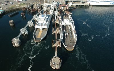
Swartz Bay, North Saanich
Swartz Bay is at the north end of the Saanich Peninsula on Vancouver Island and is the location of a BC Ferries terminal that provides the marine link connecting Highway 17 with the mainland, about 25 miles (40 km) southwest of Tsawwassen and 2.7 miles (4.3 km) north of Sidney, British Columbia.
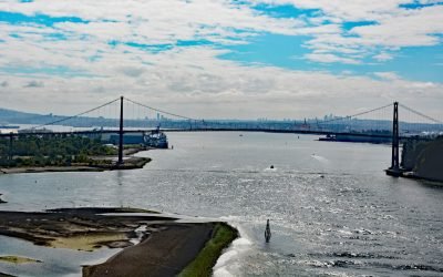
Lions Gate Bridge, Burrard Inlet
Lions Gate Bridge spans Burrard Inlet at the First Narrows, a strait about 1,312 feet (400 m) wide between Prospect Point in Stanley Park to the south and the sandy shoals of the Capilano River mouth to the north, about 2 miles (3.2 km) southeast of West Vancouver and 2 miles (3.2 km) northwest of downtown Vancouver, British Columbia.
About the background graphic
This ‘warming stripe’ graphic is a visual representation of the change in global temperature from 1850 (top) to 2019 (bottom). Each stripe represents the average global temperature for one year. The average temperature from 1971-2000 is set as the boundary between blue and red. The colour scale goes from -0.7°C to +0.7°C. The data are from the UK Met Office HadCRUT4.6 dataset.
Click here for more information about the #warmingstripes.