
British Columbia
Recent Articles
More Articles
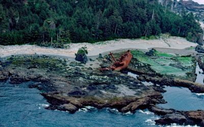
SS Clarksdale Victory, Hippa Island
SS Clarksdale Victory is a shipwreck on the west coast of Hippa Island, 1.5 miles (2.4 km) west of Graham Island in the Haida Gwaii Archipelago, about 49 miles (79 km) southwest of Masset and 42 miles (68 km) northwest of Queen Charlotte, British Columbia.
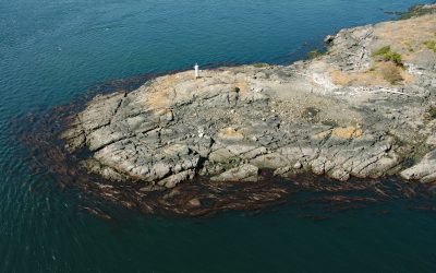
Fairfax Point, Moresby Island
Fairfax Point is a point of land at the southern tip of Moresby Island, one of the Southern Gulf Islands, about 41 miles (66 km) south-southwest of Vancouver and 6 miles (10 km) northeast of Sidney, British Columbia.
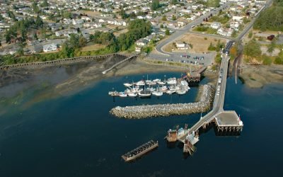
Crofton, Vancouver Island
Crofton is a small coastal community at Osborne Bay on the southeast coast of Vancouver Island, about 34 miles (55 km) north-northwest of Victoria and 26 miles (42 km) southeast of Nanaimo, British Columbia.
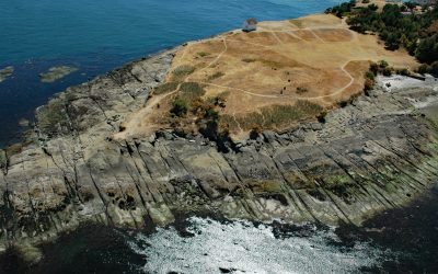
East Point, Saturna Island
East Point is the end of a long peninsula at the easternmost tip of Saturna Island in the Gulf Islands National Park Reserve, about 35 miles (56 km) south of Vancouver and 18 miles (29 km) northeast of Sidney, British Columbia.
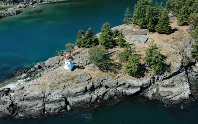
Portlock Point, Prevost Island
Portlock Point is part of a larger peninsula that forms the eastern extremity of Prevost Island and is part of the Gulf Islands National Park Reserve, about 33 miles (53 km) south-southwest of Vancouver and 13 miles (21 km) north-northeast of Sidney, British Columbia.
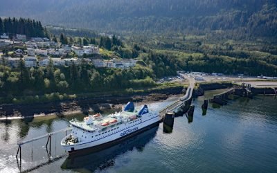
Prince Rupert, Kaien Island
Prince Rupert is a port community on Kaien Island, just north of the mouth of the Skeena River, and linked by a short bridge to the British Columbia mainland, about 465 miles (748 km) northwest of Vancouver and 90 miles (145 km) southeast of Ketchikan, Alaska.
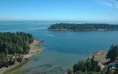
Whaler Bay, Galiano Island
Whaler Bay is located on the southeast end of Galiano Island adjacent to Sturdies Bay and across the island from Montague Harbour, about 28 miles (45 km) south-southwest of Vancouver and 18 miles (29 km) north of Sidney, British Columbia.
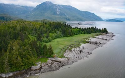
Port Essington, Skeena River
Port Essington is an abandoned cannery town on the south bank of the Skeena River estuary at the confluence of the Ecstall River, about 61 miles (98 km) southwest of Terrace and 18 miles (29 km) southeast of Prince Rupert, British Columbia.
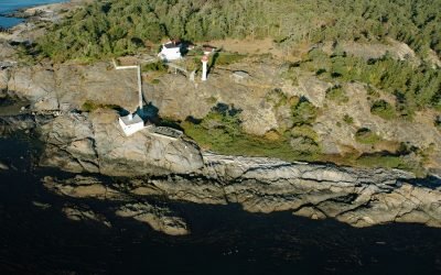
Discovery Island, Sea Bird Point
Discovery Island is part of a group of islands in Oak Bay off the southeastern tip of Vancouver Island at Sea Bird Point, about 17 miles (27 km) southeast of Sidney and 6.5 miles (10.5 km) east of downtown Victoria, British Columbia.
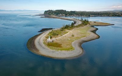
Whiffin Spit, Sooke Harbour
Whiffin Spit is a narrow sandspit that almost landlocks Sooke Harbour and Sooke Basin, about 17 miles (27 km) southwest of Victoria and 1.5 miles (2.4 km) southeast of Sooke, British Columbia.
About the background graphic
This ‘warming stripe’ graphic is a visual representation of the change in global temperature from 1850 (top) to 2019 (bottom). Each stripe represents the average global temperature for one year. The average temperature from 1971-2000 is set as the boundary between blue and red. The colour scale goes from -0.7°C to +0.7°C. The data are from the UK Met Office HadCRUT4.6 dataset.
Click here for more information about the #warmingstripes.