
British Columbia
Recent Articles
More Articles
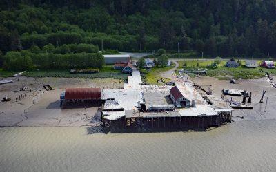
Cassiar Cannery, Skeena River
Cassiar is a historic salmon cannery situated on the northern shoreline of Inverness Passage at the mouth of the Skeena River, about 67 miles (18 km) southwest of Terrace and 11 miles (18 km) southeast of Prince Rupert, British Columbia.
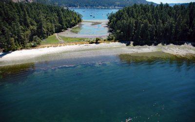
Montague Harbour, Galiano Island
Montague Harbour is a provincial marine park located on Trincomali Channel on the southern coast of Galiano Island, one of the Gulf Islands in the Strait of Georgia, about 32 miles (52 km) north of Victoria and 30 miles (48 km) south-southwest of Vancouver, British Columbia.
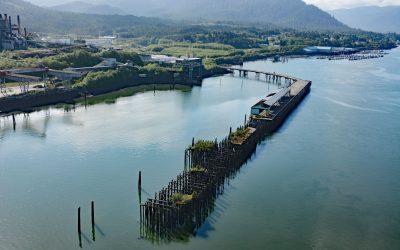
Port Edward, Porpoise Harbour
Port Edward is a community located on the eastern shore of Porpoise Harbour on the Tsimshian Peninsula near the mouth of the Skeena River, about 98 miles (158 km) southeast of Ketchikan and 9 miles (15 km) south of Prince Rupert, British Columbia.
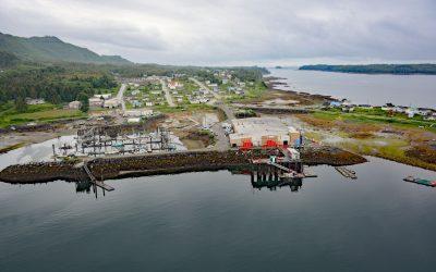
Lax Kw’alaams, Port Simpson
Lax Kw’alaams is a Tsimshian community on Port Simpson, an embayment on the eastern coast of Chatham Sound between Flewin Point to the north and Finlayson Island to the south, about 76 miles (123 km) southeast of Ketchikan, and 18 miles (29 km) north-northwest of Prince Rupert, British Columbia.
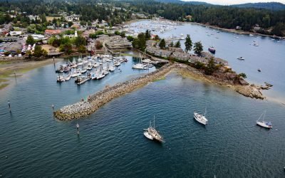
Ganges Harbour, Salt Spring Island
Ganges Harbour is an embayment on the eastern coast of Salt Spring Island that extends 5 miles northwest from Captain Passage, about 35 miles (57 km) southwest of Vancouver, and 15 miles (24 km) north-northwest of Sidney, British Columbia.
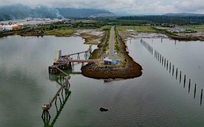
Kitimat, Douglas Channel
Kitimat is a designed community for employees of an aluminum smelter situated on the alluvial fan of the Kitimat River at the head of Douglas Channel, about 71 miles (115 km) east-southeast of Prince Rupert and 32 miles (52 km) south of Terrace, British Columbia.
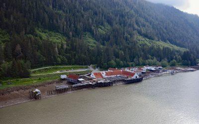
North Pacific Cannery, Inverness Passage
North Pacific Cannery was built in 1889 on 183 acres (74 ha) of Crown land on the north shore of Inverness Passage across from Smith Island and near the mouth of the Skeena River, about 70 miles (113 km) southwest of Terrace and 9 miles (14.5 km) south-southeast of Prince Rupert, British Columbia.

Sheringham Point, Strait of Juan de Fuca
Sheringham Point is the site of a historic lighthouse located on the southern shore of Vancouver Island and on the Strait of Juan de Fuca, between Otter Point to the east and Point No Point to the west, about 26 miles (42 km) west-southwest of Victoria and 7 miles (11 km) southeast of Jordon River, British Columbia.

Lawyer Island, Malacca Passage
Lawyer Islands are located in Malacca Passage, part of the Canadian Inside Passage between Porcher Island to the south and the Tsimpsean Peninsula to the north and just off the mouth of the Skeena River, about 102 miles (165 km) southeast of Ketchikan and 13 miles (20 km) south of Prince Rupert, British Columbia.
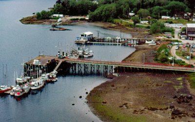
Coal Harbour, Holberg Inlet
Coal Harbour is a community located on the north side of Holberg Inlet in Quatsino Sound, about 220 miles (355 km) northwest of the city of Vancouver and 11 miles (18 km) southwest of Port Hardy, British Columbia.
About the background graphic
This ‘warming stripe’ graphic is a visual representation of the change in global temperature from 1850 (top) to 2019 (bottom). Each stripe represents the average global temperature for one year. The average temperature from 1971-2000 is set as the boundary between blue and red. The colour scale goes from -0.7°C to +0.7°C. The data are from the UK Met Office HadCRUT4.6 dataset.
Click here for more information about the #warmingstripes.