
British Columbia
Recent Articles
More Articles

Humpback Bay, Porcher Island
Humpback Bay is an embayment on the north coast of Porcher Island off Malacca Passage, about 15 miles (24 km) south of Prince Rupert, British Columbia.
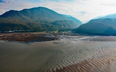
Gingolx, Kincolith River
Gingolx is one of four Nisga’a villages that make up the Nisga’a First Nation and is situated at the confluence of the Kincolith River and the Nass River on the northern shore of Nass Bay, about 70 miles (113 km) east-southeast of Ketchikan and 50 miles (80 km) north-northeast of Prince Rupert, British Columbia.
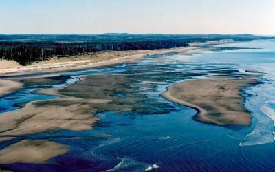
SS Pezuta, Tlell River
The Tlell River flows generally north-northeast for 28 miles (45 km) to Hecate Strait, near the wreck of the steamship SS Pezuta, about 29 miles (47 km) south-southeast of Masset and 4.5 miles (7 km) north of Tlell, British Columbia.

Beaver Point, Salt Spring Island
Beaver Point is a prominent headland in Ruckle Provincial Park on the southeastern shore of Salt Spring Island in the Southern Gulf Islands and at the northwestern end of Swanson Channel, about 8 miles (13 km) north-northeast of Sidney and 4 miles (6 km) east of Fulford Harbour, British Columbia.
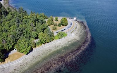
Brockton Point, Stanley Park
Brockton Point is a prominent peninsula in Stanley Park, located on the southern coast of Burrard Inlet, about 19 miles (30 km) north of Tsawwassen and 2.6 miles (4 km) southeast of West Vancouver, British Columbia.
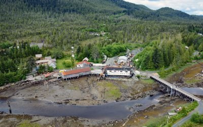
Oona River, Porcher Island
Oona River is a community situated at the mouth of the namesake river that drains a watershed on the southeastern shore of Porcher Island, approximately 25 miles (40 km) south of Prince Rupert and 13 miles (21 km) north-northeast of Kitkatla, British Columbia.
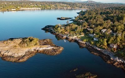
Flower Island, Ten Mile Point
Flower Island is a small, uninhabited islet located about 250 feet (80 m) offshore from the southern end of Ten Mile Point, roughly 15 miles (24 km) south-southeast of Sidney and 4 miles (6 km) east-northeast of Victoria, British Columbia.
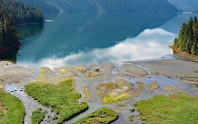
Foch Lagoon, Foch-Gilttoyees Provincial Park
Foch Lagoon is about 1 mile (1.6 km) wide and extends for 5 miles (8 km) northwest from the western shore of Douglas Channel in Foch-Gilttoyees Provincial Park and Protected Area, about 60 miles (97 km) southeast of Prince Rupert and 25 miles (40 km) southwest of Kitimat, British Columbia.
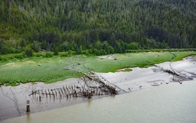
Haysport, Skeena River
Haysport is the site of a historical community and salmon cannery on the north shore of the Skeena River adjacent to the Grand Trunk Railroad, about 61 miles (100 km) southwest of Terrace and 16 miles (26 km) southeast of Prince Rupert, British Columbia.

Brentwood Bay, Saanich Inlet
Brentwood Bay is a community within the municipality of Central Saanich on the eastern shore of Saanich Inlet, about 11 miles (18 km) north-northwest of the city of Victoria and 6 miles (10 km) south-southwest of Sidney, British Columbia.
About the background graphic
This ‘warming stripe’ graphic is a visual representation of the change in global temperature from 1850 (top) to 2019 (bottom). Each stripe represents the average global temperature for one year. The average temperature from 1971-2000 is set as the boundary between blue and red. The colour scale goes from -0.7°C to +0.7°C. The data are from the UK Met Office HadCRUT4.6 dataset.
Click here for more information about the #warmingstripes.