
British Columbia
Recent Articles
More Articles
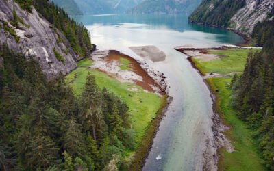
Brim River Hot Springs, Gardner Canal
Brim River Hot Springs and adjoining Owyacumish River Park protect 2,488 acres (1,007 ha) at the head of Owyacumish Bay on the north shore of Gardner Canal, about 96 miles (155 km) southwest of Prince Rupert and 40 miles (64 km) south-southwest of Kitimat, British Columbia.
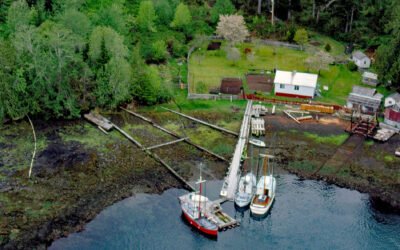
Quatsino, Quatsino Sound
Quatsino is a small community located on Quatsino Sound on the northwestern coast of Vancouver Island, about 14 miles (23 km) south-southwest of Port Hardy and 10 miles (16 km) northwest of Port Alice, British Columbia.
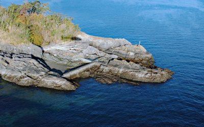
Cormorant Point, Gordon Head
Cormorant Point is a headland between Cordova Bay and Margaret Bay in Saanich’s Gordon Head neighborhood, about 11 miles (18 km) south-southeast of Sidney and 5.5 miles (8.9 km) north-northeast of Victoria, British Columbia.
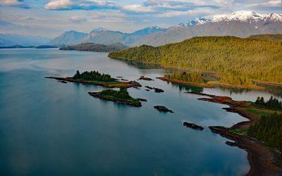
Hastings Arm, Observatory Inlet
Hastings Arm extends 14 miles (23 km) north from Observatory Inlet into the Coast Mountains and terminates at the mouth of the Kshwan River, about 23 miles (37 km) south‐southeast of Stewart and 17 miles (27 km) northwest of Kitsault, British Columbia.
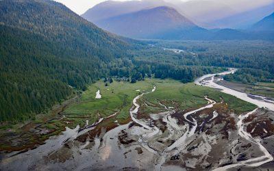
Kitsault River, Alice Arm
Kitsault River drains a watershed area of about 113,668 acres (46,000 ha), including the Kitsault Glacier that flows out of the Cambria Icefield and several smaller glaciers, and flows generally south for 23 miles (37 km) through the Coast Mountains to the head of Alice Arm, about 37 miles (60 km) south-southeast of Stewart and 1.7 miles (2.7 km) north-northwest of Kitsault, British Columbia.
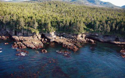
Valencia Bluffs, West Coast Trail
Valencia Bluffs are sea cliffs along the West Coast Trail in Pacific Rim National Park Reserve on Vancouver Island’s southwest shore, about 29 miles (47 km) northwest of Port Renfrew and 11 miles (18 km) southeast of Bamfield, British Columbia.
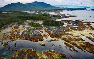
Randall Island, Dundas Archipelago
Randall Island is part of the Dundas Archipelago, a group of islands in Hecate Strait on the west side of Chatham Sound between Brown and Caamaño Passages, about 74 miles (119 km) southeast of Ketchikan and 22 miles (35 km) west-northwest of Prince Rupert, British Columbia.
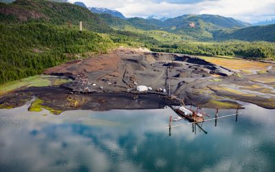
Anyox, Observatory Inlet
Anyox, an abandoned mining community in the Coast Mountains, lies at the mouth of Anyox Creek on Granby Bay in Observatory Inlet, about 79 miles (127 km) north-northeast of Prince Rupert and 37 miles (60 km) south of Stewart, British Columbia.
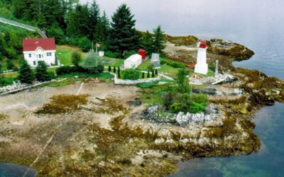
Dryad Point, Campbell Island
Dryad Point is on the northeastern point of Campbell Island and is the site of a historic lighthouse that marks the intersection of Lama Passage to the east and Seaforth Channel to the north on the Inside Passage, about 173 miles (278 km) southeast of Prince Rupert and 2 miles (3.2 km) northeast of Bella Bella, British Columbia.
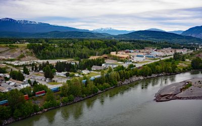
Terrace, Skeena River
Terrace, a community at the confluence of the Skeena and Kitsumkalum Rivers, lies about 71 miles (114 km) east-northeast of Prince Rupert and 64 miles (103 km) southwest of Hazelton, British Columbia.
About the background graphic
This ‘warming stripe’ graphic is a visual representation of the change in global temperature from 1850 (top) to 2019 (bottom). Each stripe represents the average global temperature for one year. The average temperature from 1971-2000 is set as the boundary between blue and red. The colour scale goes from -0.7°C to +0.7°C. The data are from the UK Met Office HadCRUT4.6 dataset.
Click here for more information about the #warmingstripes.