
California
Recent Articles
More Articles

Soquel Creek, Capitola
Soquel Creek runs through Capitola, a community adjacent to Santa Cruz on the north coast of Monterey Bay, about 75 miles (120 km) south of San Francisco and 26 miles (42 km) north of Monterey, California.
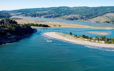
Bolinas Lagoon, Bolinas Bay
Bolinas Lagoon is a tidal estuary situated between the communities of Bolinas to the west and Stinson Beach to the east, about 35 miles (56 km) south-southeast of Bodega Bay and 17 miles (27 km) northwest of San Francisco, California.
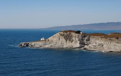
Point Conception, Gaviota Coast
Point Conception is located on the Gaviota Coast, at the western end of the Santa Barbara Channel, about 45 miles (72 km) west of Santa Barbara and 13 miles (21 km) south of Lompoc, California.
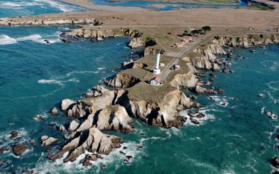
Point Arena, Mendocino Coast
Point Arena is a narrow headland about 0.5 miles (0.8 km) long with a historical lighthouse that marks a significant change in the orientation of the Mendocino Coast, about 34 miles (55 km) south of Fort Bragg and 4 miles (6.4 km) northwest of the community of Point Arena, California.
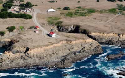
Point Cabrillo, Mendocino Coast
Point Cabrillo is a sandstone headland marked with a lighthouse on the Mendocino Coast between Point Arena and Cape Mendocino, about 6.7 miles (11 km) south of Fort Bragg and 1.3 miles (2 km) southwest of Caspar, California.
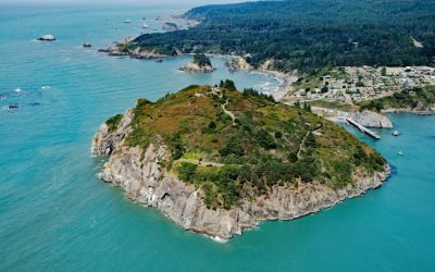
Trinidad Head, Trinidad Bay
Trinidad Head is a prominent headland joined to the mainland by a narrow isthmus adjacent to the town of Trinidad and protecting Trinidad Bay, about 48 miles (77 km) south of Crescent City and 18 miles (29 km) north of Eureka, California.

Bodega Head, Bodega Bay
Bodega Head is a granitic promontory at the north end of Bodega Bay in Sonoma County, approximately 40 miles (64 km) northwest of San Francisco and 20 miles (32 km) west of Santa Rosa, California.

Malibu Lagoon, Santa Monica Bay
Malibu Lagoon is an estuary formed by a spit on the north shore of Santa Monica Bay that partially encloses the mouth of Malibu Creek, about 26 miles (42 km) west of downtown Los Angeles and in the community of Malibu, California.

Cowell Ranch Beach, Half Moon Bay
Cowell Ranch Beach is at the southern end of Half Moon Bay near the ghost town of Purissima, and the northern boundary of the historical Cowell Ranch, about 38 miles (61 km) northwest of Santa Cruz and 2.8 miles (4.5 km) south of the community of Half Moon Bay, California.

Kirby Cove, Marin Headlands
Kirby Cove is an embayment in the Marin Headlands on the northern shore of the Golden Gate in the Golden Gate National Recreation Area, and the site of a historic military installation, about 5.5 miles (9 km) northwest of downtown San Francisco and 2.3 miles (4 km) south of Sausalito, California.
About the background graphic
This ‘warming stripe’ graphic is a visual representation of the change in global temperature from 1850 (top) to 2019 (bottom). Each stripe represents the average global temperature for one year. The average temperature from 1971-2000 is set as the boundary between blue and red. The colour scale goes from -0.7°C to +0.7°C. The data are from the UK Met Office HadCRUT4.6 dataset.
Click here for more information about the #warmingstripes.