
California
Recent Articles
More Articles
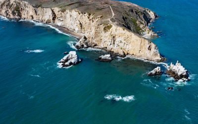
Chimney Rock, Point Reyes
Chimney Rock is an islet that lies off the eastern headland of the Point Reyes Peninsula, connected only at low tide, about 3 miles (4.8 km) east of the Point Reyes Light and 10 miles (16 km) southwest of Inverness, California.
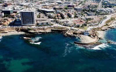
Childrens Pool, La Jolla
Children’s Pool was one of the many gifts that philanthropist Ellen Browning Scripps gave to the community of La Jolla, about 13 miles (21 km) south of Encinitas and 11.4 miles (18 km) northwest of San Diego, California.
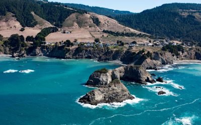
Casket Rock, Elk
Casket Rock is the outermost of three large rocks west of the community of Elk, about 22 miles (35 km) south-southeast of Fort Brag and 13 miles (21 km) north of Point Arena, California.

Salmon Creek, Sonoma Coast State Park
Salmon Creek starts at an elevation of 570 feet (174 m) and flows generally southwest for 19 miles (31 km) draining a watershed of 22,487 acres (9,100 ha) between the Northern Coast Ranges and the Pacific Ocean at Salmon Creek Beach in Sonoma Coast State Park, about 20 miles (32 km) southwest of Santa Rosa and 2 miles (3.2 km) northwest of Bodega Bay, California.
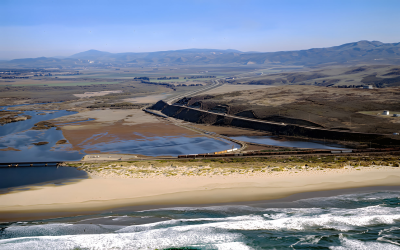
Surf Beach, Santa Ynez River
Surf Beach is within Vandenberg Space Force Base and extends south-southwest for about 4.5 miles (7.3 km) from the mouth of the Santa Ynez River estuary to Spring Canyon, about 31 miles (50 km) south of Pismo Beach and 9 miles (14.5 km) west-northwest of Lompoc, California.
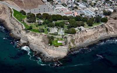
Point Fermin, San Pedro
Point Fermin is the site of a historic lighthouse at the southernmost tip of the Palos Verdes Peninsula in the city of San Pedro, about 25 miles (40 km) southeast of Santa Monica and 7 miles (11 km) southwest of Long Beach, California.
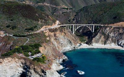
Bixby Creek, Big Sur
Bixby Creek starts at the confluence of Mill Creek and Turner Creek that flow from an elevation of 2,500 feet (762 m) on the west flank of Skinner Ridge for a total run of about 7 miles (11 km) through the Santa Lucia Mountains to the Big Sur coast, between Hurricane Point to the south and Division Knoll to the north, about 16 miles (26 km) south of Monterey and 9 miles (15 km) northwest of the community of Big Sur, California.
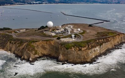
Pillar Point, Half Moon Bay
Pillar Point is a prominent headland forming the northwestern shore of Half Moon Bay and providing partial protection for Pillar Point Harbor, and the site of Pillar Point Air Force Station and a famous surf location called Mavericks, about 20 miles (32 km) south-southwest of San Francisco and 4 miles (6.5 km) northwest of the community of Half Moon Bay, California.
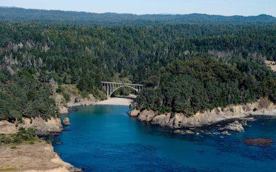
Russian Gulch, Mendocino Coast
Russian Gulch is a river that starts at an elevation of about 800 feet (244 m) on the northwestern flank of Hi Chute Ridge in the California Coast Ranges and flows generally northwest for 5 miles (8 km) to the Pacific Ocean, draining a watershed of 2,456 acres (994 ha) in Russian Gulch State Park, about 2 miles (3.3 km) north of Mendocino and 7 miles (11 km) south of Fort Bragg, California.
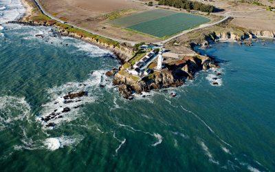
Pigeon Point Lighthouse, Pigeon Point
Pigeon Point is a prominent headland and the site of a historic lighthouse, situated between Bolsa Point to the north and Franklin Point to the south, about 25 miles (40 km) northwest of Santa Cruz and 5 miles (8 km) south of Pescadero, California.
About the background graphic
This ‘warming stripe’ graphic is a visual representation of the change in global temperature from 1850 (top) to 2019 (bottom). Each stripe represents the average global temperature for one year. The average temperature from 1971-2000 is set as the boundary between blue and red. The colour scale goes from -0.7°C to +0.7°C. The data are from the UK Met Office HadCRUT4.6 dataset.
Click here for more information about the #warmingstripes.