
California
Recent Articles
More Articles
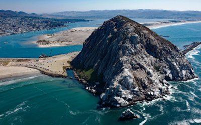
Morro Rock, Morro Bay
Morro Rock is a volcanic plug with an elevation of 576 feet (176 m), connected to the mainland by a causeway that forms the entrance channel to Morro Bay, about 102 miles (164 km) southeast of Monterey and 21 miles (34 km) northwest of Pismo Beach, California.
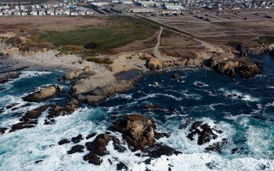
Glass Beach, Noyo Headlands Park
Glass Beach is situated in the northern section of Noyo Headlands Park in the community of Fort Bragg, which is between Pudding Creek to the north and Noyo River to the south, about 95 miles (153 km) south-southeast of Eureka and 10 miles (16 km) north of Mendocino, California.
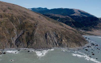
Cape Mendocino, Lost Coast
Cape Mendocino is a major headland on the Lost Coast and the westernmost point in California, situated between Bear River to the north and Mattole River to south, about 210 miles (338 km) northwest of San Francisco, and 28 miles (45 km) southwest of Eureka, California.

Año Nuevo Island, Año Nuevo State Park
Año Nuevo Island is the site of a historic light tower and fog signal on about 9 acres (3.6 ha) and separated from Point Año Nuevo by a shallow channel encompassed by Año Nuevo State Park, about 21 miles (34 km) northwest of Santa Cruz and 11 miles (18 km) south-southeast of Pescadero, California.

Point Bonita, Marin Headlands
Point Bonita is the site of a historic lighthouse situated on the Marin Headlands at the northern entrance to the Golden Gate, about 7 miles (11 km) west-northwest of San Francisco, and 4 miles (7 km) southwest of Sausalito, California.

Point Reyes, Point Reyes National Seashore
Point Reyes is a prominent headland with a historic lighthouse located in Point Reyes National Seashore, a park and nature preserve of 71,028 acres (28,744 ha), about 35 miles (56 km) northwest of San Francisco and 12 miles (19 km) southwest of Inverness, California.
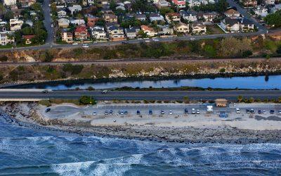
San Elijo Lagoon, Cardiff
San Elijo Lagoon is 915 acres (370 ha) of tidal wetlands formed by Escondido Creek that drains a watershed of 54,000 acres (22,000 ha) and flows generally southwest for 26 miles (42 km) to the Pacific Ocean at Cardiff, or Cardiff-by-the-Sea, a beach community in Encinitas, about 89 miles (144 km) southeast of Los Angeles and 21 miles (34 km) north-northwest of San Diego, California.
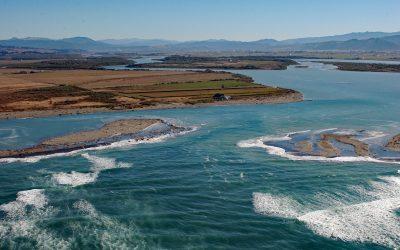
Eel River Delta, Eel River
A delta of 33,000 acres (13,355 ha) is formed by the Eel River, which starts at an elevation of 6,245 feet (1,903 m) on the southern flank of Bald Mountain in Mendocino National Forest and flows generally northwest for 196 miles (315 km) draining a watershed of 2,357,761 acres (954,152 ha) in the California Coast Ranges, about 13 miles (21 km) south-southwest of Eureka and 5 miles (8 km) northwest of Ferndale, California.
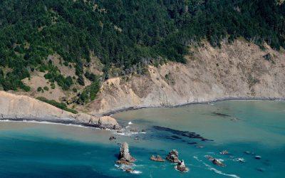
Cluster Cone Rocks, Bear Harbor
Cluster Cone Rocks are at Bear Harbor, the site of a historical lumber wharf built over the rocky point that protects a small south-facing embayment with a sandy beach in Sinkyone Wilderness State Park on the Mendocino coast, about 21 miles (34 km) north-northwest of Westport and 12 miles (19 km) west-northwest of Leggett, California.
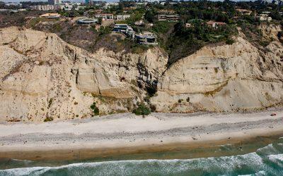
Black’s Beach, Torrey Pines
Black’s Beach is the secluded southern section of Torrey Pines State Beach, which starts at the mouth of Los Peñasquitos Lagoon to the north and extends south for about 4.5 miles (7.2 km) to Scripps Beach, about 10 miles (16 km) south of Encinitas and 4 miles (6.5 km) north-northeast of La Jolla, California.
About the background graphic
This ‘warming stripe’ graphic is a visual representation of the change in global temperature from 1850 (top) to 2019 (bottom). Each stripe represents the average global temperature for one year. The average temperature from 1971-2000 is set as the boundary between blue and red. The colour scale goes from -0.7°C to +0.7°C. The data are from the UK Met Office HadCRUT4.6 dataset.
Click here for more information about the #warmingstripes.