
California
Recent Articles
More Articles
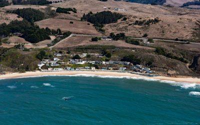
Martins Beach, Half Moon Bay
Martins Beach is a public beach adjacent to a private gated community protected from erosion by a seawall, about 6 miles (10 km) south of the community of Half Moon Bay and 0.7 miles (1.1 km) southwest of Lobitos, California.
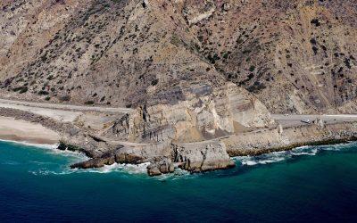
Mugu Rock, Point Mugu State Park
Mugu Rock is a distinctive feature at Point Mugu, a headland in Point Mugu State Park, situated between Thornhill Broome Beach to the east and Mugu Beach to the west in Santa Monica National Recreation Area, about 17 miles (27 km) west-northwest of Malibu, and 9 miles (14.5 km) southeast of Port Hueneme, California.

Tennessee Cove, Golden Gate National Recreation Area
Tennessee Cove is an embayment with a sandy beach about 600 feet (180 m) long on the Pacific Ocean between Pirates Cove to the north and Rodeo Cove to the south in Golden Gate National Recreation Area about 10 miles (16 km) northwest of San Francisco and 3.6 miles (5.8 km) southwest of Mill Valley, California.

King Philip, Ocean Beach
King Philip was a clipper ship that wrecked in 1878 on Ocean Beach, on the west coast of the San Francisco Peninsula in the Sunset District, about 1 mile (1.6 km) south of Golden Gate Park and 7 miles (11 km) west-southwest of downtown San Francisco, California.

La Jenelle, Silver Strand
La Jenelle was a passenger ship that went aground and wrecked in 1970 on Silver Strand at Port Hueneme, a sandy beach created partly from dredged harbor sand about 1 mile (1.6 km) long and 450 feet(140 m) wide, about 33 miles (53 km) southeast of Santa Barbara and 3.3 miles (5.3 km) south of Oxnard, California.

SS Palo Alto, Seacliff Beach
SS Palo Alto is a shipwreck that now serves as an artificial reef for marine life at Seacliff State Beach on the northern coast of Monterey Bay, about 6.4 miles (10.3 km) east of Santa Cruz and 0.9 miles (1.5 km) southwest of Aptos, California.

SS Dominator, Palos Verdes
SS Dominator is a shipwrecked freighter that ran aground in 1961 on the Palos Verdes Peninsula, about 13 miles (21 km) west of Long Beach and 5.6 miles (9 km) south-southwest of Redondo Beach, California.

USS Milwaukee, Samoa Beach
The USS Milwaukee was a U.S. Navy cruiser that in 1917 was overcome by wind and waves close to shore and was beached at the community of Samoa on the northern peninsula of Humboldt Bay, about 7 miles (11 km) southwest of Arcata and 1.5 miles (2.4 km) west of Eureka, California.
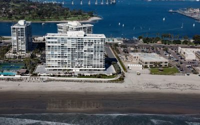
SS Monte Carlo, Coronado Shores
The shipwreck of the SS Monte Carlo is occasionally exposed by shifting sands during the winter on Coronado Shores, a wide sandy beach also known as South Beach, on Coronado Island about 4.5 miles (7.3 km) east of Point Loma and 3.4 miles (5.5 km) south of San Diego, California.
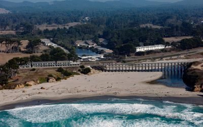
Pudding Creek, Fort Bragg
Pudding Creek is a small coastal watershed in Mendocino County that drains 18 square miles (4,662 ha) before entering the Pacific Ocean about 2.4 miles (3.9 km) southwest of Cleone and 1 mile (1.6 km) north of Fort Bragg, California.
About the background graphic
This ‘warming stripe’ graphic is a visual representation of the change in global temperature from 1850 (top) to 2019 (bottom). Each stripe represents the average global temperature for one year. The average temperature from 1971-2000 is set as the boundary between blue and red. The colour scale goes from -0.7°C to +0.7°C. The data are from the UK Met Office HadCRUT4.6 dataset.
Click here for more information about the #warmingstripes.