
California
Recent Articles
More Articles
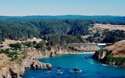
Albion River, Mendocino Coast
Albion River flows generally west-southwest for 18 miles (29 km) to the Mendocino Coast, about 22 miles (35 km) north of Point Arena and 6 miles (10 km) south-southeast of Mendocino, California.
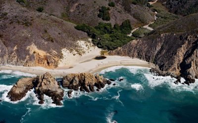
Sycamore Creek, Pfeiffer Beach
Sycamore Creek flows to Pfeiffer Beach on the Big Sur coast, about 26 miles (42 km) south of Monterey and 21 miles (34 km) northwest of Lucia, California.
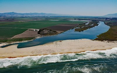
Salinas River, Castroville
The Salinas River begins in the central California Coast Ranges and flows 175 miles (282 km) generally northwest to Monterey Bay, approximately 12 miles (19 km) north-northeast of Monterey and 3 miles (5 km) west-southwest of Castroville, California.
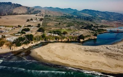
Ten Mile River, MacKerricher State Park
The Ten Mile River flows southwest for 7 miles (11 km) to the Pacific Ocean at the northern border of MacKerricher State Park, about 9 miles (15 km) north-northeast of the Noyo River at Fort Bragg and 5.7 miles (9.2 km) south of Westport, California.
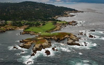
Cypress Point, Monterey Peninsula
Cypress Point is the westernmost headland on the Monterey Peninsula, about 4.5 miles (7.3 km) southwest of Monterey and 3.5 miles (5.5 km) northwest of Carmel, California.
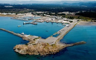
Whaler Island, Crescent City
Whaler Island, about 700 feet (215m) across, lies 0.4 miles (0.65km) offshore and is now connected to the mainland by a paved road on an artificial breakwater, about 16 miles (26km) north-northwest of Klamath and 1.4 miles (2.3km) southeast of Crescent City, California.
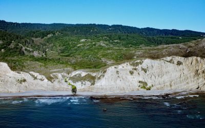
Alamere Falls, Point Reyes National Seashore
Alamere Falls is located in the Phillip Burton Wilderness of Point Reyes National Seashore, about 6 miles (10 km) south of Olema and 6.4 miles (10.3 km) northwest of Bolinas, California.
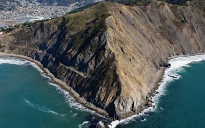
Point San Pedro, Pacifica
Point San Pedro forms the northwestern extent of Pedro Point Headland on San Pedro Mountain which reaches an elevation of about 624 feet (190 m) and has steep cliffs on both the northern and southern flanks, and forms the southern slope of the San Pedro Creek watershed, about 3.6 miles (5.8 km) north of Montara and the southern municipal boundary of Pacifica, California.
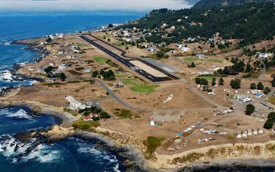
Shelter Cove, Point Delgada
Shelter Cove is an isolated community on Point Delgada on the Lost Coast between Deadman Gulch to the south and Telegraph Creek to the north, about 54 miles (87 km) south of Eureka and 43 miles (69 km) north-northwest of Fort Bragg, California.
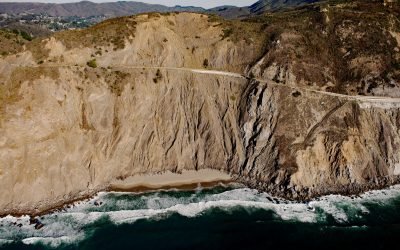
Devil’s Slide, San Pedro Headlands
Devil’s Slide is on the western flank of San Pedro and Montara Mountains in the San Pedro Headlands, about 3 miles (5 km) north of Montara and 1 mile (1.6 km) southwest of the Linda Mar District of Pacifica, California.
About the background graphic
This ‘warming stripe’ graphic is a visual representation of the change in global temperature from 1850 (top) to 2019 (bottom). Each stripe represents the average global temperature for one year. The average temperature from 1971-2000 is set as the boundary between blue and red. The colour scale goes from -0.7°C to +0.7°C. The data are from the UK Met Office HadCRUT4.6 dataset.
Click here for more information about the #warmingstripes.