
California
Recent Articles
More Articles
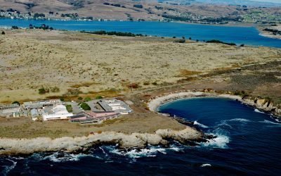
Bodega Marine Laboratory, Bodega Head
Bodega Marine Laboratory is located on Bodega Head, a prominent peninsula that partially encloses Bodega Harbor on the northwestern shore of Bodega Bay, about 10 miles (16 km) south-southeast of Jenner and 1.7 miles (2.7 km) southwest of the community of Bodega Bay, California.
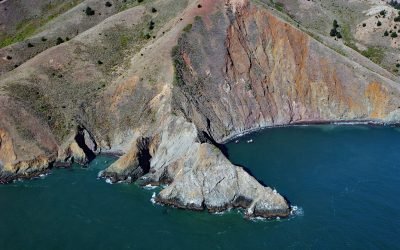
Point Diablo, Marin Headlands
Point Diablo extends about 600 feet (183 m) south from the Marin Headlands roughly midway between Point Bonita to the west and Lime Point to the east, about 6 miles (10 km) northwest of San Francisco and 2.7 miles (4 km) south-southwest of Sausalito, California.
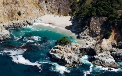
McWay Creek, Julia Pfeiffer Burns State Park
McWay Creek drains a watershed of approximately 1,730 acres (700 ha) and flows southwest for 2.5 miles (4 km) through Julia Pfeiffer Burns State Park and McWay Canyon one Big Sur coast, about 30 miles (48 km) south-southeast of Carmel and 12 miles (19 km) northwest of Lucia, California.
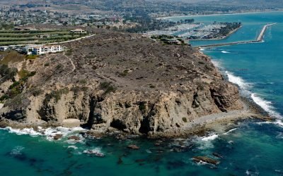
Dana Point Headlands, San Juan Capistrano
Dana Point is a prominent headland situated between Dana Point Harbor to the south and Strand Beach to the north, about 50 miles (80 km) southeast of Los Angeles and 4 miles (6 km) southwest of San Juan Capistrano, California.
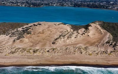
Morro Dunes, Los Osos
Morro Dunes form a barrier spit separating Morro Bay to the east from the Pacific Ocean to the west, about 6 miles (10 km) south-southwest of the community of Morro Bay and 2 miles (3.2 km) west of Los Osos, California.
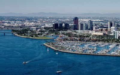
Los Angeles River, Long Beach
Los Angeles River starts at the confluence of Bell Creek and Arroyo Calabasas that drain from the Simi Hills and Santa Monica Mountains respectively, and flows generally southeast for 30 miles (48 km) through the San Fernando Valley and downtown Los Angeles and then south for 20 miles (32 km) to San Pedro Bay at Long Beach, California.
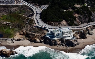
Cliff House, Point Lobos
Cliff House is a former restaurant perched on the Point Lobos headland of the San Francisco Peninsula just north of Ocean Beach, overlooking Seal Rocks offshore and the site of the former Sutro Baths onshore, about 6.5 miles (10.5 km) west of downtown San Francisco and at the west end of the Richmond District of San Francisco, California.
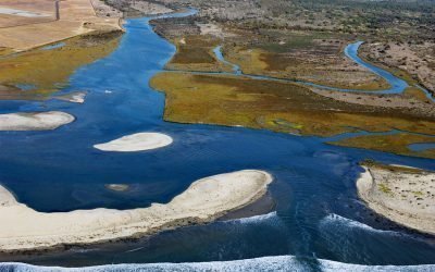
Tijuana River, Imperial Beach
Tijuana River drains a 1.1‑million‑acre (450,000 ha) watershed that originates in the Sierra de Juárez in northern Baja California and flows west‑northwest for 120 miles to the Pacific at the southern edge of Imperial Beach, about 11 miles south of San Diego and 5 miles northwest of Tijuana, Mexico.
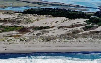
Ma-le’l Dunes, Humboldt Bay
Ma-le’l Dunes, a National Natural Landmark, lie between the Mad River Slough and the Pacific Ocean at the base of the Samoa Peninsula, which partially encloses the northern part of Humboldt Bay, about 1 mile (1.6 km) north of Manila and 3.5 miles (5.6 km) west of Arcata, California.
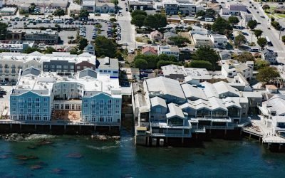
Pacific Biological Laboratories, Cannery Row
Pacific Biological Laboratories is a small, unpainted, two-story wood-frame building toward the northwest end of Cannery Row that served as a biological supply company operated by Edward F. Ricketts from 1937 to 1948, on a small property on Monterey Bay now sandwiched between the Monterey Bay Aquarium and the Intercontinental Hotel in Monterey, California.
About the background graphic
This ‘warming stripe’ graphic is a visual representation of the change in global temperature from 1850 (top) to 2019 (bottom). Each stripe represents the average global temperature for one year. The average temperature from 1971-2000 is set as the boundary between blue and red. The colour scale goes from -0.7°C to +0.7°C. The data are from the UK Met Office HadCRUT4.6 dataset.
Click here for more information about the #warmingstripes.